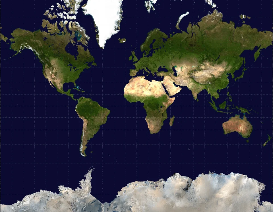



A journey through Greenland’s glaciers takes you to the edge of the largest body of ice in the Northern Hemisphere. The Greenland Ice Sheet covers about 80 percent of the island, and where it meets the sea it breaks into icebergs the size of city blocks.
The easiest places to experience it are in West Greenland: the UNESCO-listed Ilulissat Icefjord, the calving front of Eqi Glacier and the ice sheet itself near Kangerlussuaq, which you can reach by road. This guide covers what to see, how to get there, when to go and how to travel responsibly in a landscape that is changing fast.
The Greenland Ice Sheet at a Glance
According to Visit Greenland, the ice sheet covers about 1.8 million square kilometers, roughly 14 times the size of England. It is only a few meters thick at its edges but more than 3,200 meters thick in the interior. If it all melted, global sea levels would rise by around 6 to 7 meters.
Hundreds of outlet glaciers drain this ice toward the coast. Some end on land in towering walls of ice; others, called tidewater or calving glaciers, flow straight into fjords and shed icebergs. Both kinds can be seen on a single trip to West Greenland.
Ilulissat Icefjord: Greenland’s Iceberg Factory
The Ilulissat Icefjord was inscribed as a UNESCO World Heritage Site in 2004. At its head, the glacier Sermeq Kujalleq, also known as Jakobshavn Isbræ, is one of the fastest-moving glaciers in the world. It calves more than 35 cubic kilometers of ice a year, around 10 percent of all of Greenland’s calved ice, and more than any other glacier outside Antarctica.
The icebergs drift slowly down the roughly 55-kilometer fjord and often jam at its mouth, where they sit grounded on a shallow moraine before breaking free into Disko Bay. The town of Ilulissat sits right beside this frozen traffic jam, so you can walk from your hotel to the edge of the ice.
Hiking to Sermermiut
A boardwalk trail leads from the edge of town to Sermermiut, a valley on the shore of the icefjord where archaeologists have found remains of several Arctic cultures spanning thousands of years. From the rocks above the valley you look straight out over the ice. Longer marked routes continue along the fjord for those with more time and proper boots.
Ilulissat Icefjord Centre
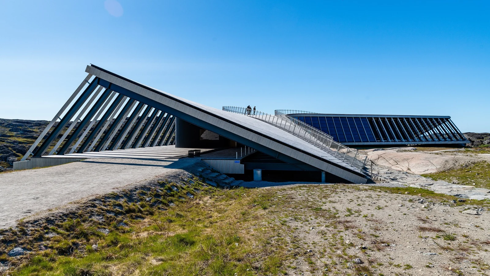
Opened in July 2021 and designed by the Danish architect Dorte Mandrup, the Icefjord Centre (Kangiata Illorsua) stands at the start of the trails. Its exhibition explains how the ice forms and moves, the life of people in the region and the effects of climate change. Its roof also works as a viewpoint over the fjord. Many flights to Greenland connect through Copenhagen, and our Copenhagen travel guide can help you plan a stopover in the Danish capital.
Boat trips and flightseeing
From the harbor, small boats sail among the icebergs at the mouth of the fjord. In summer, evening and midnight cruises take advantage of the long light. Helicopter and small-plane flights give a view of the whole fjord and the calving front, which you cannot reach by boat because of the ice.
Eqi Glacier: Watching a Glacier Calve
About 70 kilometers north of Ilulissat, Eqi Glacier (Eqip Sermia) is one of the most accessible calving glacier fronts in Greenland. Full-day boat trips from Ilulissat sail north along the coast, then wait at a safe distance in front of the ice wall while chunks break off and crash into the water.
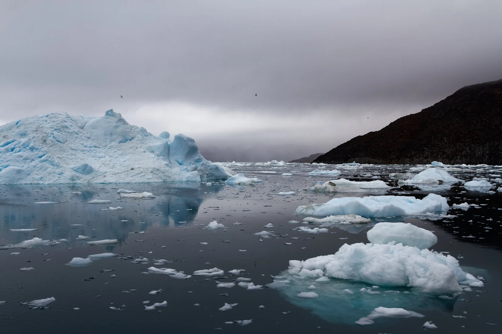
The boat trip itself is part of the experience, with icebergs along the way and a chance of seeing whales and seals in summer. Bring warm layers even on a sunny day, as the air near the ice is cold.
Kangerlussuaq: Walk on the Ice Sheet
Near Kangerlussuaq, a dirt road of about 25 kilometers runs from the settlement to the edge of the ice sheet, the only road in Greenland that reaches it. Guided tours drive to a spot known as Point 660, then walk up through the moraine onto the ice itself. Along the way, many tours also stop at Russell Glacier, where a wall of ice ends on land above a roaring meltwater river.
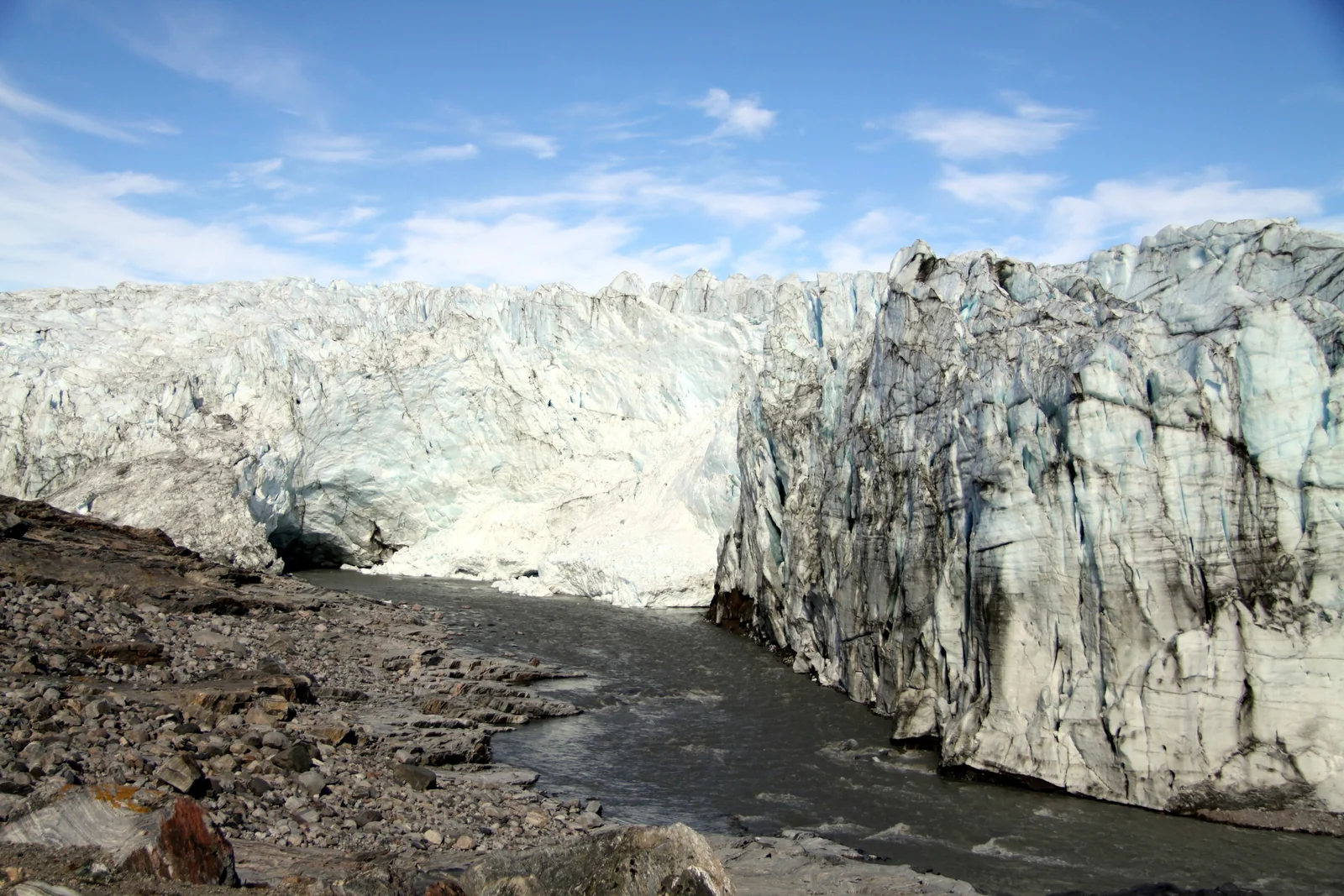
Never go onto the ice without an authorized guide. Crevasses can be hidden under snow, and weather on the ice sheet can change quickly. Glacier fronts like Russell also shed ice without warning, so keep well back from the wall.
Best Time to Visit Greenland’s Glaciers
| Season | What to expect |
|---|---|
| June to August | Peak season: boat trips, hiking, midnight sun around Ilulissat and whales in Disko Bay |
| September | Fewer visitors, autumn colors on the tundra and darker nights for the northern lights |
| October to March | Dark, cold and quiet; northern lights, dog sledding in the north and sea ice |
| April to May | Bright, cold days with snow still on the ground; good for winter activities |
Summer is the best time for glacier boat trips and hiking. If the aurora is your goal, autumn and winter are better; see our guide to aurora hunting in Canada’s Arctic for comparable destinations.
How to Get to Greenland’s Glacier Regions
- By air: Greenland has no roads between towns, so you fly or sail. Nuuk’s new international airport opened in November 2024, and Ilulissat’s expanded airport is scheduled to receive direct flights from Copenhagen from late October 2026. Check current routes with the airlines.
- Domestic connections: Air Greenland links Nuuk, Kangerlussuaq, Ilulissat and other towns.
- By sea: expedition cruises and a coastal ferry along the west coast visit Disko Bay and Ilulissat in summer.
- Where to stay: Ilulissat has the widest choice of hotels, guesthouses and tour operators; book early for July and August.
Climate Change and Responsible Travel
Greenland’s glaciers are among the most closely studied in the world because they are losing ice. Many outlet glaciers, including Sermeq Kujalleq, have retreated over recent decades, and the Icefjord Centre is a good place to learn how scientists measure these changes.
- Book with local operators and guides, so more of your spending stays in Greenlandic communities.
- Keep a safe distance from wildlife and follow your guide’s instructions on boats and on the ice.
- Stay on marked trails around Ilulissat to protect fragile tundra and archaeological sites.
- Ask before photographing people and respect private property, including sled dogs, which are working animals.
For more ice landscapes, read our guides to Patagonia’s glaciers, Antarctica and Iceland’s hot springs and underground rivers, or browse all our world destinations.
Greenland Glaciers FAQ
What is the most famous glacier in Greenland?
Sermeq Kujalleq, also called Jakobshavn Isbræ, is the best known. It feeds the Ilulissat Icefjord, a UNESCO World Heritage Site, and is one of the fastest-moving and most productive glaciers in the world, calving more than 35 cubic kilometers of ice a year.
Can you walk on the Greenland Ice Sheet?
Yes, with a guide. The easiest access is from Kangerlussuaq, where a road leads to the ice edge at Point 660 and guided tours walk onto the ice. Never go onto a glacier or the ice sheet alone, as crevasses can be hidden under snow.
When is the best time to see Greenland’s glaciers?
June to August is best for boat trips to the icefjord and Eqi Glacier, hiking and the midnight sun. September is quieter, with the first dark nights for the northern lights. Winter trips are possible but focus on the aurora and snow activities rather than glacier cruises.
How do you get to Ilulissat?
Most visitors fly with Air Greenland via Nuuk or Kangerlussuaq. Ilulissat’s airport has been expanded with a longer runway, and direct flights from Copenhagen are scheduled to start in late October 2026. In summer you can also arrive by coastal ferry or cruise ship.
How much of Greenland is covered by ice?
About 80 percent of Greenland is covered by the ice sheet and glaciers. The ice sheet spans around 1.8 million square kilometers and is more than 3,200 meters thick at its deepest point, making it the second-largest ice mass on Earth after Antarctica.
Is Greenland’s ice melting?
Yes. The ice sheet has been losing mass for decades, and many outlet glaciers, including Sermeq Kujalleq, have retreated. Meltwater and iceberg calving from Greenland contribute to global sea level rise, which is why its glaciers are closely monitored by scientists.