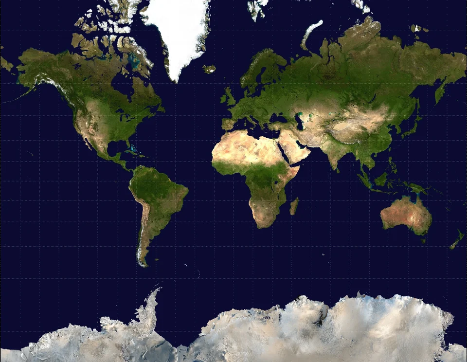



Most visitors to Patagonia see two icons: the Perito Moreno Glacier in Argentina and the granite towers of Torres del Paine in Chile. Yet the region at the southern tip of South America holds hundreds of other glaciers and mountains that see only a fraction of the crowds, from calving tidewater glaciers you can only reach by boat to jagged peaks with near-empty trails.
None of these places is truly undiscovered, but many are genuinely remote and quiet. This guide covers the lesser-known glaciers and peaks worth the extra effort, how to reach them, when to go and how to travel safely in one of the windiest, wildest corners of the Americas.
Patagonia’s Ice Fields Explained
Most of Patagonia’s big glaciers flow from two huge ice fields in the southern Andes. The Southern Patagonian Ice Field covers about 16,800 square kilometers, stretches roughly 350 kilometers north to south and is shared by Chile and Argentina. It is described as the world’s second-largest contiguous ice field outside the polar regions.
Farther north, the smaller Northern Patagonian Ice Field covers about 4,200 square kilometers and lies entirely within Chile’s Laguna San Rafael National Park. Together they feed dozens of outlet glaciers, including Pío XI, the largest glacier in the Southern Hemisphere outside Antarctica. Like glaciers worldwide, most of them are retreating, so what you see today may look different in a decade.
| Ice field | Approximate area | Country | Glaciers to know |
|---|---|---|---|
| Southern Patagonian Ice Field | 16,800 km² | Chile and Argentina | Pío XI, Viedma, Upsala, Perito Moreno, Grey, Spegazzini |
| Northern Patagonian Ice Field | 4,200 km² | Chile | San Rafael, San Quintín, Exploradores |
Lesser-Known Glaciers in Chilean Patagonia
Chile’s Aysén Region, crossed by the gravel-and-asphalt Carretera Austral highway, is the best place to find glaciers without the crowds. Distances are long and services are limited, but the rewards are huge.
San Rafael Glacier
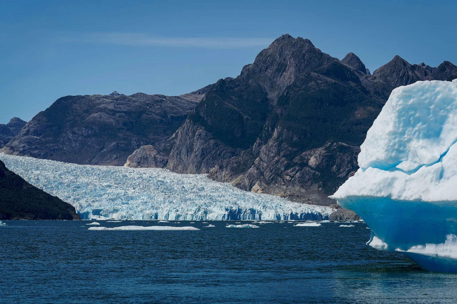
The San Rafael Glacier descends from the Northern Patagonian Ice Field into the lagoon of the same name, calving icebergs into the water. It can only be reached by water. Full-day boat trips run from Bahía Exploradores, reached by road from Puerto Río Tranquilo, and longer cruises leave from Puerto Chacabuco near Coyhaique. Laguna San Rafael National Park was declared a UNESCO biosphere reserve in 1979.
Exploradores Glacier
About 52 kilometers west of Puerto Río Tranquilo along a gravel road, the Exploradores Glacier flows down from the flanks of Monte San Valentín. Guided ice hikes cross the rocky moraine and then continue on the glacier with crampons among crevasses and meltwater channels. Trekking reopened in 2024 on a new route with stricter requirements, so always go with a licensed local guide.
Queulat Hanging Glacier
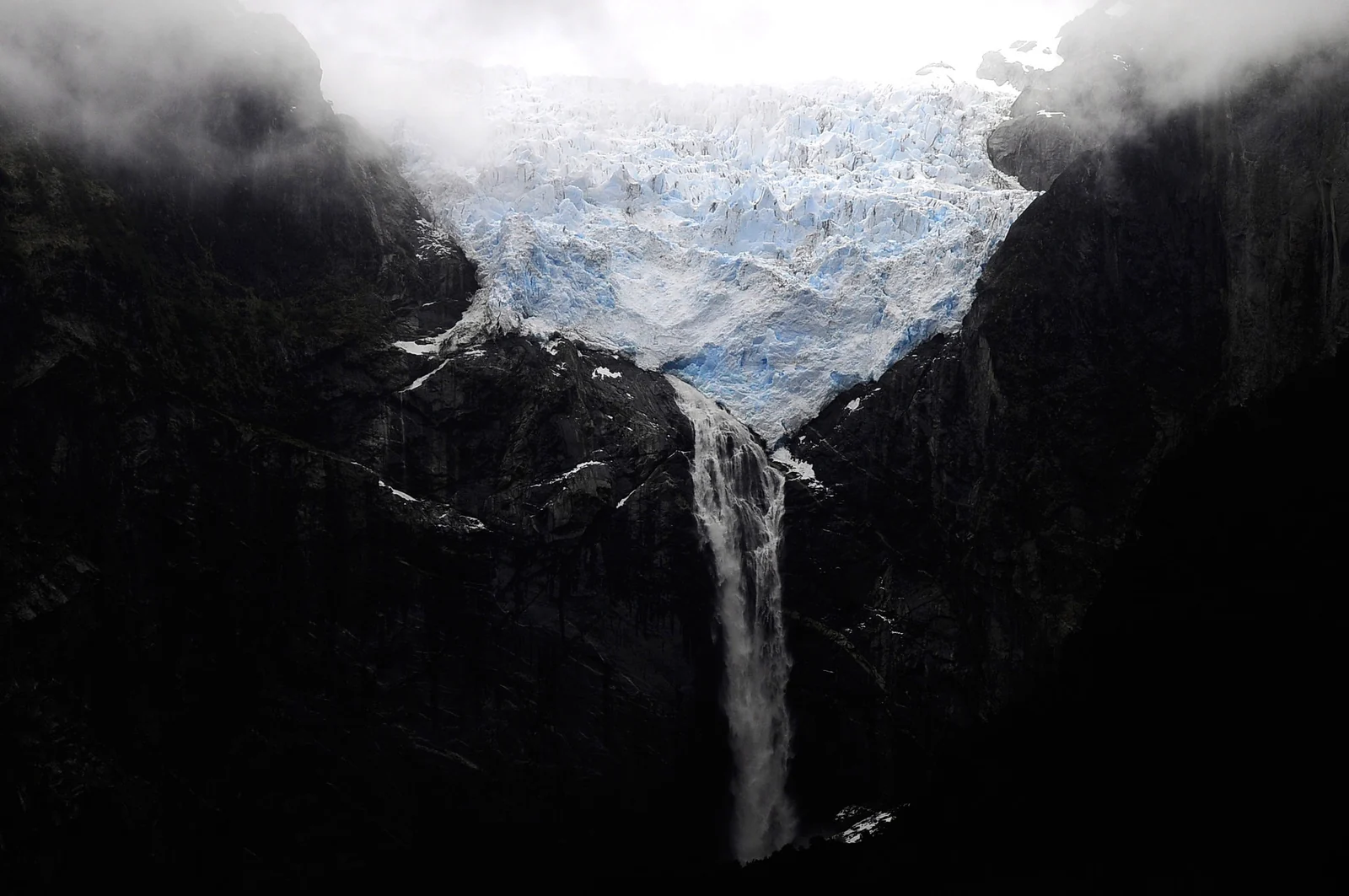
In Queulat National Park, north of Coyhaique, the Ventisquero Colgante clings to the top of a sheer rock wall, feeding waterfalls that drop toward a lagoon below. A short trail and a longer hike through temperate rainforest lead to viewpoints. It is one of the easiest glaciers to see from the Carretera Austral.
Quieter Glaciers in Argentine Patagonia
Argentina’s Los Glaciares National Park, a UNESCO World Heritage Site since 1981, is best known for Perito Moreno. Yet the ice field sends 47 large glaciers into the park, and several of them are seen by far fewer people.
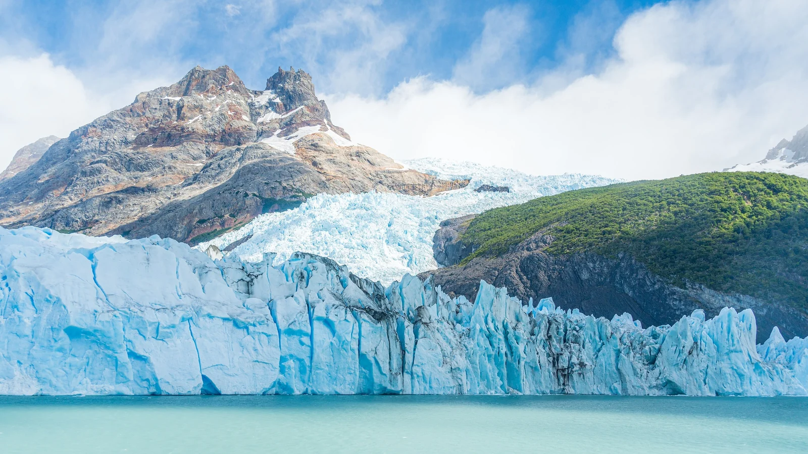
- Upsala and Spegazzini: these glaciers flow into remote arms of Lago Argentino and can only be seen on boat trips that leave from Puerto Bandera, west of El Calafate. Spegazzini has one of the tallest ice fronts in the park.
- Viedma: one of the largest glaciers in the Southern Patagonian Ice Field, it ends in Lago Viedma near El Chaltén. Boat trips and guided ice walks run in season.
Mountains Beyond Fitz Roy and Torres del Paine
Mount Fitz Roy (3,405 m) and Cerro Torre (3,128 m) are famous for good reason. If you want high peaks with fewer people, look a little farther afield.
Cerro Castillo
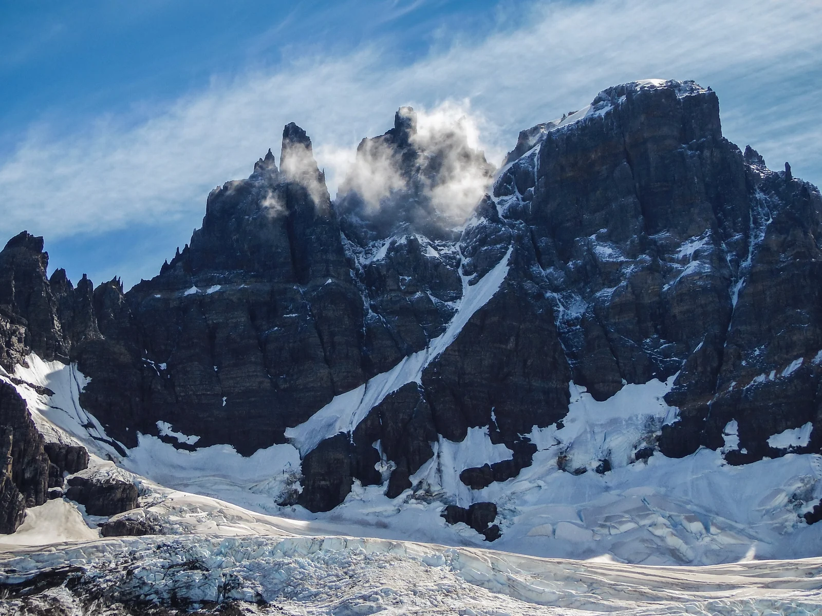
South of Coyhaique, the castle-like spires of Cerro Castillo rise to about 2,670 meters above glaciers and turquoise lakes. The multi-day trek through Cerro Castillo National Park is often compared with the Torres del Paine circuits but is far quieter. A steep day hike from Villa Cerro Castillo reaches the lagoon beneath the main peak.
Monte San Valentín
At the northern end of the Northern Patagonian Ice Field, Monte San Valentín is the highest mountain in Patagonia, measured at roughly 4,060 meters. It is a serious expedition peak surrounded by ice, but you can admire it from the Exploradores Valley on a clear day.
Monte San Lorenzo
On the Chile–Argentina border, Monte San Lorenzo reaches about 3,706 meters and is the second-highest summit in Patagonia. It is remote from both sides, reached via long gravel roads from Cochrane in Chile or through the steppe of Argentina’s Santa Cruz Province.
Following the Route of Parks and the Carretera Austral
The easiest way to link these places is the Route of Parks of Patagonia, a 2,800-kilometer scenic route connecting 17 national parks in Chilean Patagonia from Puerto Montt to Cape Horn. Ten of them sit along the Carretera Austral, including Queulat, Cerro Castillo and Patagonia National Park.
Self-drive is the most flexible option, but plan carefully: long stretches are unpaved, fuel stations are far apart and some sections require ferry crossings. Buses connect the main towns, though less frequently than in the Torres del Paine or El Calafate areas. A classic scenic drive elsewhere in the world is covered in our list of 10 breathtaking routes.
Best Time to Visit Patagonia’s Glaciers and Mountains
The best time to visit is the southern summer, roughly November to March, when days are long, boats and guided ice hikes run regularly and trails are mostly free of snow. December to February is the peak season. Shoulder months such as November and March bring fewer visitors and autumn colors in March and April, though some services close early.
Whatever the month, expect strong wind, rapid weather changes and rain, especially on the Chilean side. Winter (June to August) brings short days and snow, and many remote boat trips and lodges close for the season.
Safety and Responsible Travel in Remote Patagonia
- Never walk on a glacier without a guide. Crevasses, moulins and calving fronts are deadly, and conditions change quickly.
- Stay well back from ice fronts. Calving blocks can create waves that sweep over lake shores.
- Check park rules and permits. Some trails require registration, have fixed opening hours or close in strong winds.
- Carry layers and waterproofs in every season, plus cash, as card payment and ATMs can be scarce in small towns.
- Follow Leave No Trace. Pack out waste, use only designated campsites and never light fires outside permitted areas.
Drawn to cold, icy landscapes? Our guides to Greenland’s glaciers and Antarctica make natural next adventures, and many Antarctic cruises leave from Ushuaia at the southern end of Patagonia. For more of the continent, browse our South America guides.
Patagonia Glaciers and Mountains FAQ
What is the least crowded glacier to visit in Patagonia?
Glaciers in Chile’s Aysén Region, such as San Rafael, Exploradores and the Queulat Hanging Glacier, see far fewer visitors than Perito Moreno or Grey. They take more time to reach, usually along the Carretera Austral, but reward you with quieter viewpoints and small-group tours.
Can you visit the San Rafael Glacier?
Yes, but only by boat. Full-day trips leave from Bahía Exploradores, reached by road from Puerto Río Tranquilo, and longer cruises depart from Puerto Chacabuco. Trips depend on the weather and should be booked in advance, especially in the December to February peak season.
When is the best time to see glaciers in Patagonia?
November to March, the southern summer, is best. Boats and guided ice hikes operate regularly, days are long and trails are mostly clear. December to February is busiest. Weather is unpredictable year-round, so build spare days into your plans for canceled boat trips.
What is the highest mountain in Patagonia?
Monte San Valentín in Chile, at the northern end of the Northern Patagonian Ice Field, is the highest mountain in Patagonia at roughly 4,060 meters. Monte San Lorenzo on the Chile–Argentina border, at about 3,706 meters, is second. Mount Fitz Roy, at 3,405 meters, is lower but far better known.
Is it safe to hike on Patagonian glaciers?
Only with a licensed guide and proper equipment. Guided ice hikes on glaciers such as Exploradores, Viedma and Perito Moreno provide crampons, helmets and briefings. Walking on a glacier alone risks falling into crevasses, and approaching calving fronts on foot or by kayak is extremely dangerous.
Are Patagonia’s glaciers melting?
Most of them are retreating. Scientific studies show that the Patagonian ice fields have lost significant mass in recent decades as temperatures rise. A few glaciers, such as Perito Moreno, have been relatively stable, but overall the trend is clear, and viewpoints and routes on the ice change over time.