


For centuries, the ancient lost cities of the Amazon rainforest belonged to legend: El Dorado, Percy Fawcett’s “City Z” and tales of gold hidden in the jungle. The real story is stranger and better documented. Over the last two decades, archaeologists using laser scanning (LiDAR), satellite images and patient fieldwork have mapped towns, plazas, causeways and farmland that Indigenous peoples built across the Amazon long before Europeans arrived.
These were not stone cities like Machu Picchu. They were built of earth and wood, spread out among gardens and forest, and designed for a tropical environment. Below are the best-documented discoveries, what they tell us about Amazonian history, and why researchers believe thousands more sites are still hidden under the canopy.
From El Dorado to Real Amazon Archaeology
The El Dorado legend began not in the Amazon but in the Colombian highlands, with accounts of a Muisca ritual in which a ruler covered in gold dust made offerings at Lake Guatavita. Spanish expeditions chasing that story pushed east into the lowlands. In 1541–42, Francisco de Orellana’s party became the first Europeans to travel down the Amazon, and the expedition’s chronicler, Gaspar de Carvajal, described long stretches of riverbank crowded with settlements. Colombia’s Caribbean port of Cartagena, fortified to protect the Spanish treasure fleets, shows the colonial side of that story; see our Cartagena travel guide.
Later explorers found far fewer people and dismissed Carvajal as an exaggerator. For much of the 20th century, many scholars assumed the Amazon’s poor soils could only ever have supported small, mobile groups. What they missed was catastrophe: European diseases spread through trade networks and killed a large share of the population, often before outsiders even saw the communities affected. The forest then grew back over abandoned towns.
How LiDAR Finds Settlements Under the Forest
LiDAR works by firing millions of laser pulses from an aircraft or drone. Most bounce off leaves, but a small fraction slips through gaps in the canopy and reflects off the ground. Software filters out the vegetation and builds a detailed model of the bare earth, revealing mounds, ditches, embankments and roads that are almost invisible to someone standing a few meters away.
The method does not replace excavation. Archaeologists still dig to date sites, study pottery and confirm that features are human-made. But LiDAR has changed the scale of what is known, turning a handful of scattered sites into connected landscapes.
Upano Valley, Ecuador: The Oldest Known Amazonian Urban Network
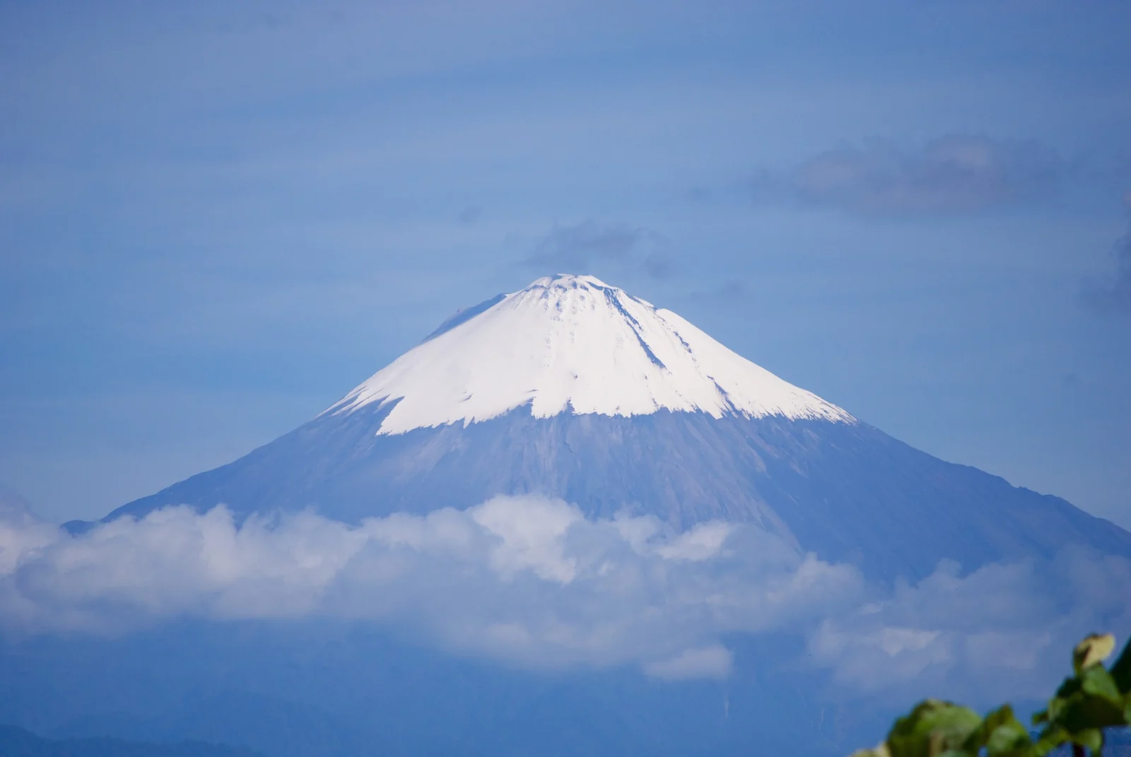
In January 2024, a team led by French archaeologist Stéphen Rostain published a study in Science describing a network of settlements in the Upano Valley, on the eastern slopes of the Ecuadorian Andes below Sangay volcano. Fieldwork had already located some mounds, but LiDAR revealed more than 6,000 rectangular earthen platforms grouped around low plazas, along with farming terraces and drainage channels.
The most striking features are wide, straight roads, dug into the ground and running for kilometers between settlement centers. The researchers date the main occupation to roughly 500 BCE through the first centuries CE, which makes the Upano Valley the oldest large-scale urban landscape yet documented in the Amazon. The authors describe it as “garden urbanism”: dense clusters of homes and ceremonial spaces surrounded by cultivated land rather than packed city blocks.
The Casarabe Culture of the Bolivian Amazon
In the Llanos de Mojos, a seasonally flooded savanna and forest region in northern Bolivia, a team led by Heiko Prümers of the German Archaeological Institute used LiDAR to map settlements of the Casarabe culture. Their 2022 paper in Nature documented 26 sites, including two large centers, Cotoca and Landívar, covering about 147 and 315 hectares.
The Casarabe people, active from roughly 500 to 1400 CE, built stepped platforms and conical mounds, ringed their main centers with defensive banks, and linked them to smaller sites with raised causeways several kilometers long. Canals and reservoirs managed water through wet and dry seasons. The authors call it “low-density urbanism”: spread-out cities woven into an engineered landscape.
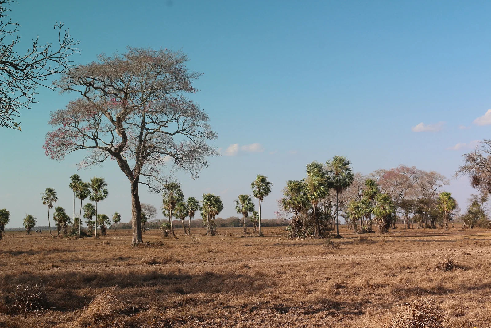
Kuhikugu and the Garden Cities of the Upper Xingu
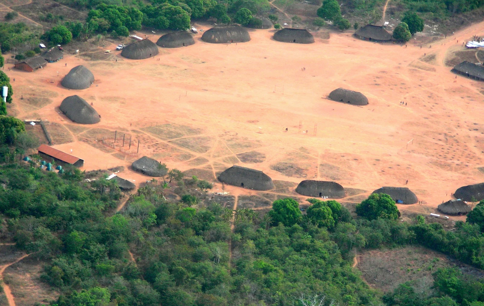
Kuhikugu is an archaeological complex near the headwaters of the Xingu River in Mato Grosso, Brazil. It was studied by anthropologist Michael Heckenberger working with the Kuikuro people, who live in the region today and are regarded as descendants of the builders. The research, published in Science in 2003 and 2008, described clusters of towns and villages linked by roads, with large circular plazas, defensive ditches, bridges and managed wetlands.
The settlements were occupied over many centuries and declined after European contact, largely through introduced diseases. You will often read that up to 50,000 people lived in the wider region; treat that as an estimate rather than a census. Kuhikugu is also sometimes linked to Percy Fawcett, the British explorer who vanished in 1925 while searching for a lost city he called “Z,” but that connection is speculation.
Acre Geoglyphs, Marajó Island and Other Key Sites
The Acre geoglyphs, Brazil
When forest in the western Brazilian state of Acre was cleared for cattle ranching, huge geometric ditches appeared: perfect circles, squares and combinations of both, some hundreds of meters across. A 2017 study in PNAS counted more than 450 of these enclosures across about 13,000 square kilometers. They appear to have been ceremonial and gathering places rather than towns, and the study found that their builders modified the forest without clearing it on anything like today’s scale.
Marajoara culture, Marajó Island
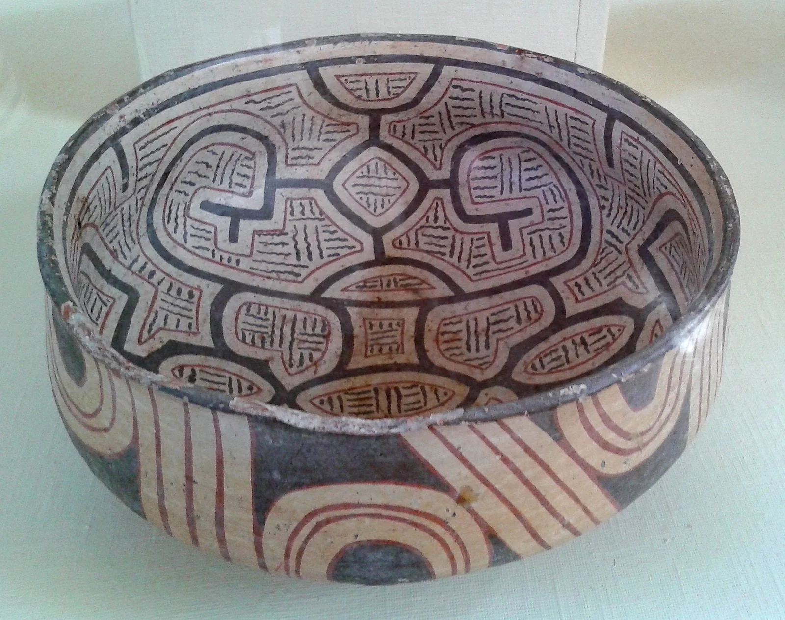
On Marajó Island at the mouth of the Amazon, the Marajoara culture built large artificial mounds that raised homes and cemeteries above seasonal floods. Most estimates place its height between about 400 and 1400 CE. It is best known for elaborate painted and incised pottery, including large funerary urns, which are displayed in museums in Brazil and abroad.
Terra preta: the soil that people made
Across the basin, archaeologists find patches of terra preta (“black earth”), dark and fertile soil created over generations from charcoal, food waste, bone and broken pottery. It marks where people lived and farmed, and it is still valued by farmers today. Terra preta is one of the strongest pieces of evidence that the Amazon supported large, settled populations.
| Site or culture | Country | Approximate period | Known for |
|---|---|---|---|
| Upano Valley | Ecuador | c. 500 BCE to first centuries CE | 6,000+ platforms, long straight roads |
| Casarabe culture | Bolivia | c. 500–1400 CE | Large centers, causeways, reservoirs |
| Kuhikugu (Upper Xingu) | Brazil | Centuries before and after 1500 CE | Plaza towns, roads, defensive ditches |
| Acre geoglyphs | Brazil | Mostly the last 2,000 years | 450+ geometric ditched enclosures |
| Marajoara culture | Brazil | c. 400–1400 CE | Flood-proof mounds, painted pottery |
How Many Lost Settlements Are Still Hidden?
A 2023 study in Science, led by Vinicius Peripato and drawing on a large international team, analyzed LiDAR transects across the basin and reported 24 previously unknown earthworks. Combining those results with models of soil, climate and tree species associated with past human activity, the team estimated that between 10,000 and 24,000 pre-Columbian earthworks may still be hidden in Amazonia.
That is why “lost cities waiting to be discovered” is a fair description, with an important caveat. Most of what remains is earthworks, soils and pottery, not temples full of treasure. Claims of Amazonian “pyramids” or gold-filled cities that you may see online are not supported by published research. The real discoveries are about how many people lived here and how skillfully they shaped the forest.
Indigenous Knowledge and the Threats to These Sites
Many discoveries depend on Indigenous communities, who know the land, hold oral histories about old settlements and increasingly co-lead research. The Kuikuro partnership in the Upper Xingu is a well-known example. Researchers also stress that the forest many people call “pristine” is in part a cultural landscape, shaped by the ancestors of people living there now.
The biggest threat is deforestation. The same clearing that exposed the Acre geoglyphs can destroy other sites before anyone records them, and mining, road building and farming continue to cut into archaeological landscapes. LiDAR helps document sites quickly, but protecting them depends on land rights and conservation.
Can You Visit Ancient Amazon Sites?
Most of the sites above are not tourist attractions. Many are on private land, in remote areas without infrastructure, or inside Indigenous territories where access requires permission from the communities and the relevant authorities. Unlike stone ruins such as Machu Picchu, earthworks are often hard to read at ground level. If you simply want to walk through tropical forest and look for wildlife, Costa Rica’s national parks are far easier to visit, as our Costa Rica travel guide explains.
- Museums first: regional museums in Brazil, including those in Belém at the mouth of the Amazon, hold major collections of Amazonian archaeology such as Marajoara pottery.
- Marajó Island: reachable by boat from Belém; ask locally about museums and guided visits focused on Marajoara heritage.
- Go with local guides: in Ecuador’s Morona Santiago province or Bolivia’s Beni, use licensed local operators and ask specifically about archaeological sites that are open to visitors.
- Respect the sites: never dig, collect pottery or fly drones over Indigenous land without permission.
For more of the continent, browse our South America destination guides, or compare these earthen cities with the Aztec foundations under modern Mexico City.
Amazon Lost Cities FAQ
Were there really ancient cities in the Amazon rainforest?
Yes, though not stone cities. Research in Ecuador’s Upano Valley, Bolivia’s Llanos de Mojos and Brazil’s Upper Xingu has documented large, planned settlements with platforms, plazas, roads, causeways and water management. Archaeologists often describe them as garden or low-density urbanism, spread out among farmland and forest.
What is the oldest known lost city in the Amazon?
The Upano Valley settlements in Ecuador are the oldest large urban network documented so far. A 2024 study in Science dated their main occupation to roughly 500 BCE through the first centuries CE, and LiDAR revealed more than 6,000 earthen platforms connected by long, straight roads.
What is Kuhikugu?
Kuhikugu is an archaeological complex near the headwaters of the Xingu River in Brazil, studied by Michael Heckenberger together with the Kuikuro people. It consists of towns and villages with large plazas, roads and defensive ditches, occupied for centuries and largely abandoned after European diseases spread.
How does LiDAR find ruins under the rainforest?
An aircraft or drone fires millions of laser pulses at the ground. A small share passes through gaps in the canopy and bounces back from the soil. Software removes the vegetation from the data, producing a bare-earth map that shows mounds, ditches, causeways and roads hidden by trees.
Was El Dorado a real city?
No city of gold has ever been found. The legend grew from accounts of a Muisca ritual at Lake Guatavita in Colombia, where a ruler covered in gold dust made offerings. Spanish expeditions searching for it helped spread the myth into the Amazon lowlands.
How many ancient sites are still undiscovered in the Amazon?
A 2023 study in Science estimated that more than 10,000 pre-Columbian earthworks may still be hidden across Amazonia, based on LiDAR data and predictive modeling. Most would be earthworks such as mounds, ditches and enclosures rather than monumental stone buildings.
Can tourists visit the lost cities of the Amazon?
Mostly not yet. Many sites are remote, on private land or within Indigenous territories that require permission to enter. Museums are the easiest way to see Amazonian archaeology, and local guides in regions such as Marajó Island can advise on places that are open to visitors.