


Madeira levada walks follow narrow irrigation channels cut into mountainsides, so the paths are mostly level, shaded and lined with ferns, with waterfalls and laurel forest along the way. Levadas suit first-timers because the gradient is gentle and the route is obvious: you simply walk beside the water. The exceptions are the high ridge paths and a few exposed sections, and this guide flags them.
A sensible first plan is one or two easy channel walks such as Caldeirão Verde or the 25 Fontes, the coastal Ponta de São Lourenço for contrast, and the Pico do Arieiro to Pico Ruivo ridge as a separate, harder day. If you are still choosing between Portuguese islands, our Azores travel guide covers the other great hiking archipelago.
What Are Madeira's Levadas?
A levada is a man-made water channel. The first ones were built in the 16th century to carry water from the rainy north and west of the island to the drier south, where sugar cane and later other crops needed irrigation. The work was dangerous: channels were cut into near-vertical cliffs and through solid rock, and enslaved people did much of the labor in the early centuries.
The network now runs to well over 2,000 kilometers, and some channels also feed hydroelectric plants. Beside many of them runs a service path built for the caretakers who keep the water flowing. Those paths are what hikers use today, and they are why a levada walk feels so different from a mountain trail: it contours the slope instead of climbing it.
Much of the wet forest above the channels is the Laurisilva, a relic laurel forest that UNESCO inscribed as a World Heritage Site in 1999. You can read the listing on the UNESCO World Heritage Centre site.
The Best Levada Walks for First-Timers at a Glance
Distances and times are approximate and one-way unless noted. Always check the official listing for the route you plan to walk, because lengths, status and rules are updated.
| Walk | Distance | Difficulty | Tunnels | Best for |
|---|---|---|---|---|
| PR9 Caldeirão Verde | 8.7 km one way (official) | Moderate | Four, headlamp needed | Waterfall, forest, classic levada |
| PR6 Levada das 25 Fontes | About 4 km one way | Moderate | None to speak of | Springs and cascades, short side trip to Risco |
| PR8 Ponta de São Lourenço | About 3 km one way | Moderate | None | Sea cliffs and views, no shade |
| PR11 Vereda dos Balcões | About 1.5 km one way | Easy | None | Quick viewpoint near Ribeiro Frio |
| PR13 Fanal | About 10 km point to point | Moderate | None | Ancient laurel trees, fog and mood |
| PR1 Pico do Arieiro to Pico Ruivo | About 8 km one way | Hard | Several | Highest ridge, big drops and steps |
Pico do Arieiro to Pico Ruivo (PR1)
This is the headline hike for Pico do Arieiro to Pico Ruivo searches, and it is not a levada walk at all. The route runs along the spine of the island between two of its highest summits, Arieiro at about 1,818 meters and Ruivo, the island's highest point, at about 1,862 meters, using stone steps, rock-cut tunnels and railings above deep valleys.
It is demanding for a first trip. Expect hundreds of steps, a lot of ascent and descent, strong wind, and cloud that can arrive within minutes. Start early so you are not racing the light, and sort out the ending in advance: you finish far from where you began, so you need a transfer, a second driver or a guided tour that handles the return.
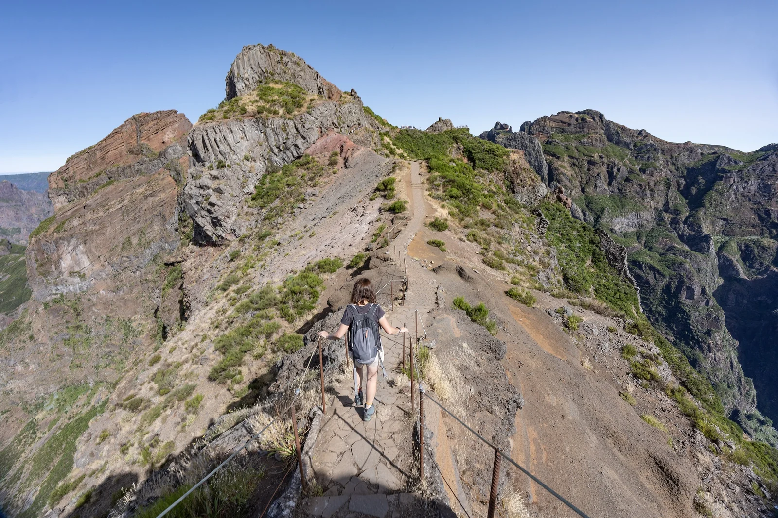
This route has been closed or restricted several times after fires and landslides, and rules such as walking direction have changed. Treat any guide, this one included, as background and confirm the situation on the official Madeira tourism site before you plan a day around PR1. If it is closed, the short walk from the Arieiro car park to the first viewpoints still gives a fair taste of the scenery above the clouds.
Caldeirão Verde and 25 Fontes: The Classic Levada Walks
Levada do Caldeirão Verde (PR9)
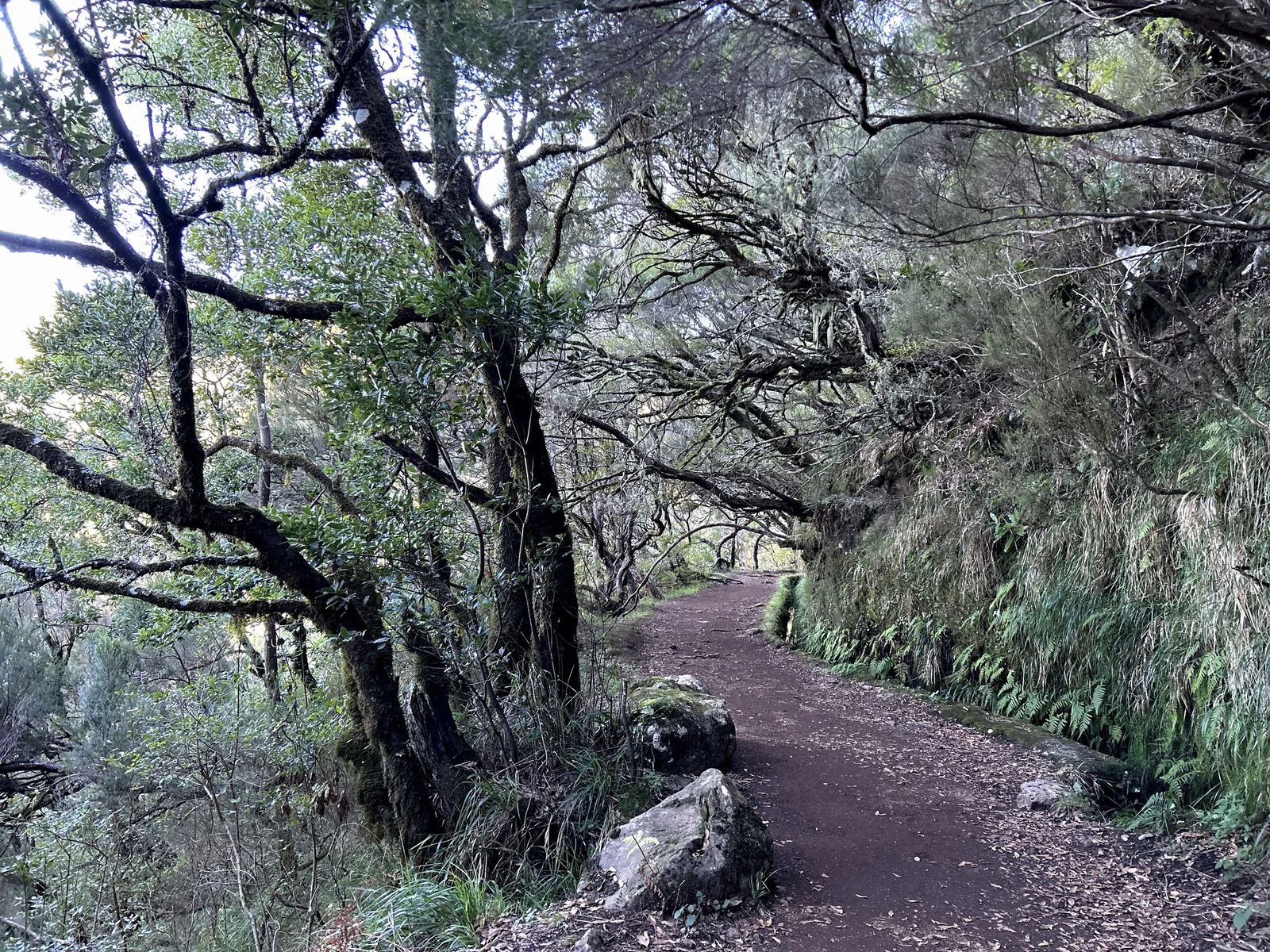
The Caldeirão Verde levada starts at Queimadas Forest Park above Santana and follows the channel through dense laurel forest to a waterfall of roughly 100 meters. The official PR9 page lists 8.7 kilometers each way, about 6.5 hours for the full out-and-back, and four rock-cut tunnels.
Many first-timers walk as far as the waterfall and turn around rather than pushing on. The path is wide for most of the way, but some stretches have a drop on one side, and the tunnels are low and dark. A real headlamp is far better than a phone torch. Sections beyond the main waterfall have been closed at times, so check before you go.
Levada das 25 Fontes (PR6)
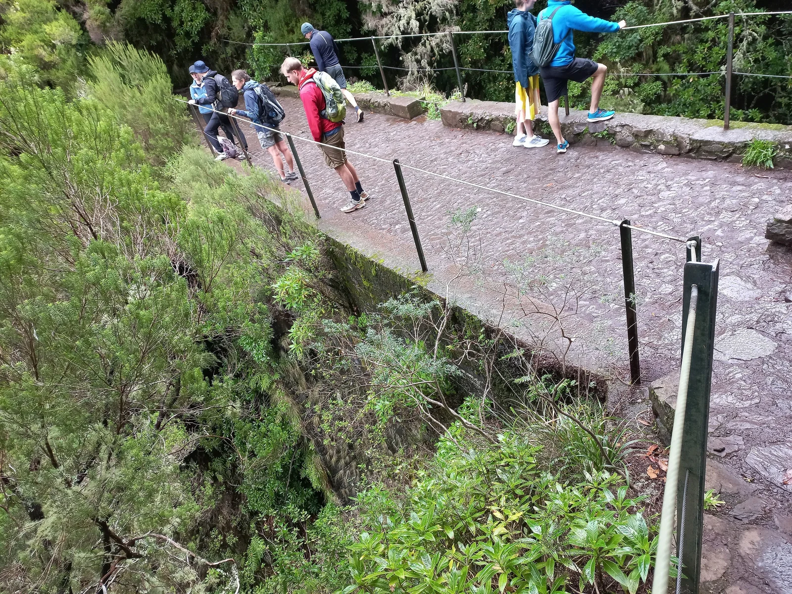
Starting from Rabaçal in the west, this walk descends by stairs and path to a levada that leads to a pool fed by many small streams, which gives the walk its name. Plan on roughly three to four hours for the return, and remember that the finish is a climb.
A short side route, the Levada do Risco, leads to the Risco waterfall and is easy enough to combine with 25 Fontes on the same day. Rabaçal gets busy in the middle of the day, so arrive early. Both paths can be slippery when wet, and the narrow sections have railings that you will want to use.
Ponta de São Lourenço, Balcões and Fanal: Easier Add-Ons
Ponta de São Lourenço (PR8)
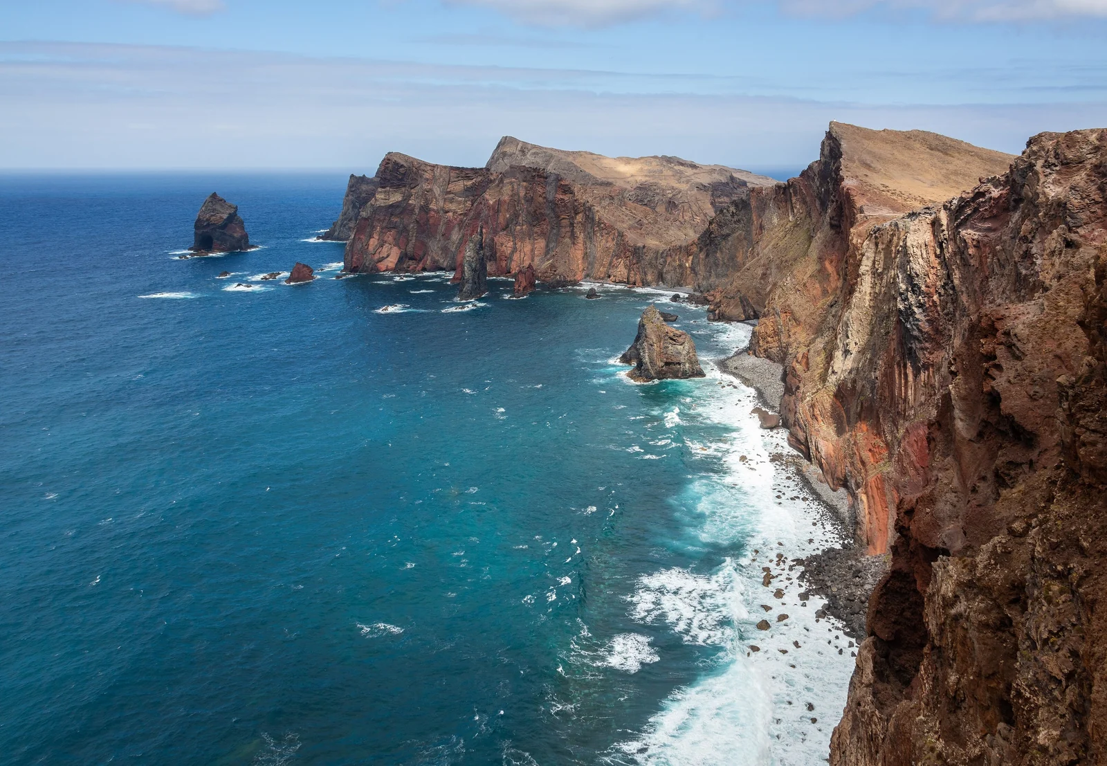
The long peninsula at Madeira's eastern tip is dry, windy and almost treeless, a complete contrast to the green interior. The path out to the far viewpoints is about 3 kilometers each way with some ups and downs. There is little shade and no real shelter, so bring sun protection and go on a calm, clear day.
Vereda dos Balcões (PR11) and Levada do Rei (PR18)
The route to the Balcões viewpoint near Ribeiro Frio is short, about 1.5 kilometers each way, and easy, which makes it a good first walk or a fallback when the weather is unsettled. Its official number is PR11. The Levada do Rei (PR18) near São Jorge is a longer, wetter levada walk with tunnels and water falling across the path, and it has had closures, so confirm it before planning a day around it.
Fanal laurel forest (PR13)
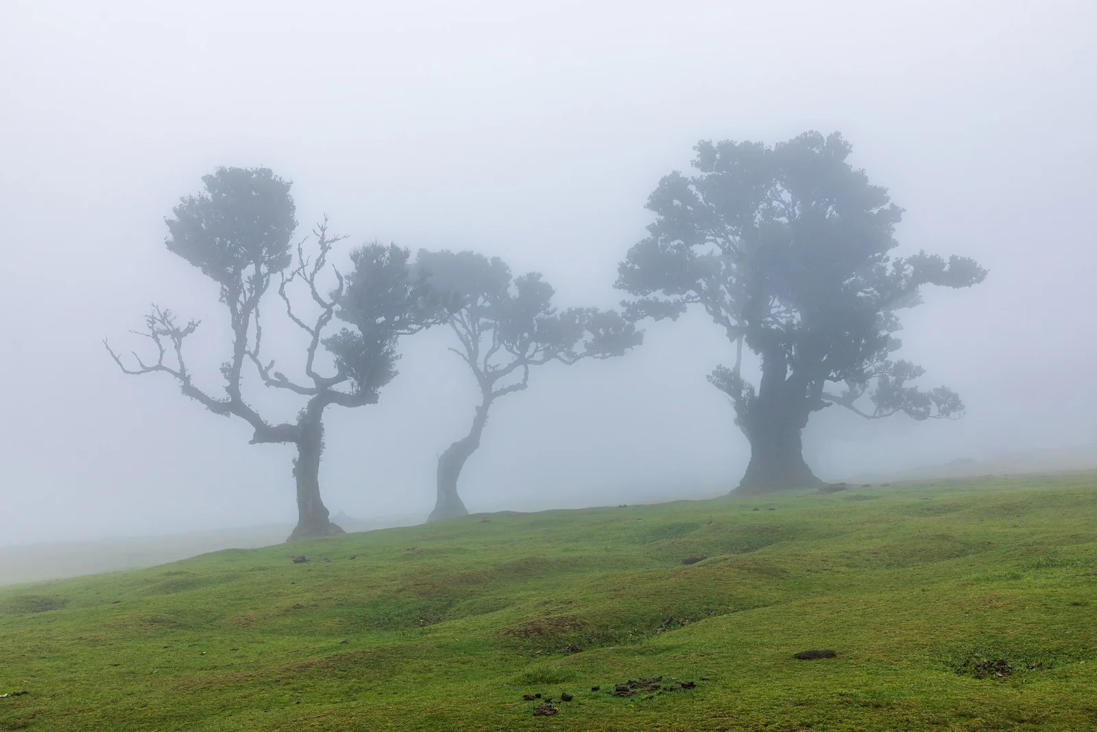
Fanal is a high clearing with ancient laurel trees that look dramatic in fog. You can visit by road without a long hike, or walk the PR13 route of roughly 10 kilometers from the Paul da Serra plateau. It is often cloudy and windy, so the light is unpredictable, which is part of the appeal.
Tunnels, Headlamps, Vertigo and What to Pack
Tunnels on levadas are cut just wide enough for the channel and a path, and many are low. Bring a headlamp for each hiker, keep a hand free for the wall, and watch your head. In a long tunnel you may need to step aside for walkers coming the other way.
If you are prone to vertigo, avoid the exposed parts of PR1 and be cautious on routes such as Levada do Rei, where the path sits beside a drop. Many levada paths are wide with a wall or railing, but some have an open edge. Balcões, Fanal or the first part of Caldeirão Verde are better choices if you are unsure.
Pack for changing conditions:
- Shoes with real grip, since wet stone and mud are normal
- A light waterproof jacket, even on a sunny coast day
- A headlamp with fresh batteries for each person
- Sun protection, a hat and plenty of water
- A charged phone with offline maps and a paper copy of your route
- A warm layer for summit and forest sections
Tell someone your plan and carry your phone. In an emergency, call 112, the European emergency number.
Trail Status, Fees and Closures
Madeira manages its classified PR routes, and conditions change after storms, fires and landslides. Closures can be short or last for long periods. The rule is simple: check the official trail list on Visit Madeira for the day you walk, and follow any notice on site.
Many popular PR routes now charge a small fee, usually bought online in advance, and some routes also use a reservation or time window. Children are exempt on at least some routes, and PR1 has been priced higher than the others. Amounts and rules change, so we do not quote a price here. Parking at some trailheads is also paid.
Best Season and Weather Microclimates
You can walk levadas year-round, because Madeira's climate is mild. Spring and autumn are the easiest seasons for most people, with comfortable temperatures and good water in the channels. Summer is the driest and busiest period, and winter brings more rain and cloud.
The island has sharp microclimates. The south coast around Funchal is usually sunnier, the north and the mountains get more cloud and rain, and the highest peaks are cooler and windier than the shore. It is common to leave sunshine in Funchal and arrive in fog at a trailhead. Check a mountain forecast and be ready to switch plans, for example from PR1 to the east coast, when the weather turns.
Getting Around and Where to Base Yourself
A rental car gives the most freedom, but roads are steep and narrow and parking at popular trailheads can be tight. Guided tours and transfers cost more per day yet handle one-way routes like PR1 and remove the driving. Public buses connect the main towns, but few go to trailheads, so they work best for town-based days.
Good bases include:
- Funchal: the capital, with the widest choice of tours, buses and restaurants, and close to the central mountains.
- Santana: in the north, near Queimadas and the Caldeirão Verde start.
- Machico: on the east side, near Ponta de São Lourenço and the airport.
- Porto Moniz: in the northwest, convenient for Rabaçal and Fanal.
Madeira also combines well with a mainland trip. Our Lisbon travel guide and Porto travel guide cover the mainland side. For another volcanic island with strong hiking, read our Tenerife travel guide.
Madeira Levada Walks FAQ
What is a levada in Madeira?
A levada is an irrigation channel built from the 16th century to carry water from the wet north and west to the drier south. Most have a maintenance path beside them, and many of those paths are now popular hiking routes.
What are the best levada walks for beginners?
The usual picks for first-timers are Caldeirão Verde (PR9) to the waterfall, the Levada das 25 Fontes (PR6) and the short Balcões walk (PR11). Choose the one that fits the weather and your base town.
Is Pico do Arieiro to Pico Ruivo hard?
Yes. It is a high ridge route with many steps, tunnels, exposed sections and changeable weather, so it suits fit, confident walkers. Check the official status first, and plan your transport back because it is a one-way walk.
Do I need a headlamp on levada walks?
For walks with tunnels, such as Caldeirão Verde, yes. A phone light is weak and leaves one hand busy, while a headlamp is safer in low, dark tunnels. Carry spare batteries.
Do you have to pay to hike in Madeira?
Many classified routes now charge a small fee, normally paid online in advance, and some have set time windows. Rules and amounts change, so check the official Madeira tourism site before you go.
When is the best time for levada walks?
Spring and autumn are comfortable for most people, though you can walk year-round. Expect more rain in winter and more crowds in summer. Weather differs a lot between the south coast and the mountains.
Can you do levada walks without a car?
Yes, with guided tours or transfers. Buses reach some towns but few trailheads. Tours are also handy for one-way routes such as PR1, where you finish far from the start.