


The Choquequirao trek is a multi-day hike to an Inca site high above the Apurímac River in southern Peru. Choquequirao (often spelled Choquequirau) sits on a ridge in the Vilcabamba range, roughly 98 km west of Cusco as the crow flies, at around 3,000 m. It is a big, partly excavated complex of plazas, terraces and stone houses, and you reach it on foot, which is why it still sees only a fraction of the visitors who crowd Machu Picchu.
Most people take the classic four-day round trip from Cusco. A longer route continues over high passes to Machu Picchu in a week or more. Either way it is a hard walk with a lot of up and down, not a sightseeing stroll. This guide covers the history, the route options, how difficult the trek really is, the best season, what to pack and how Choquequirao compares with Machu Picchu. For the famous neighbor, see our guides to Machu Picchu and the story behind Machu Picchu.
What Is Choquequirao and Where Is It?
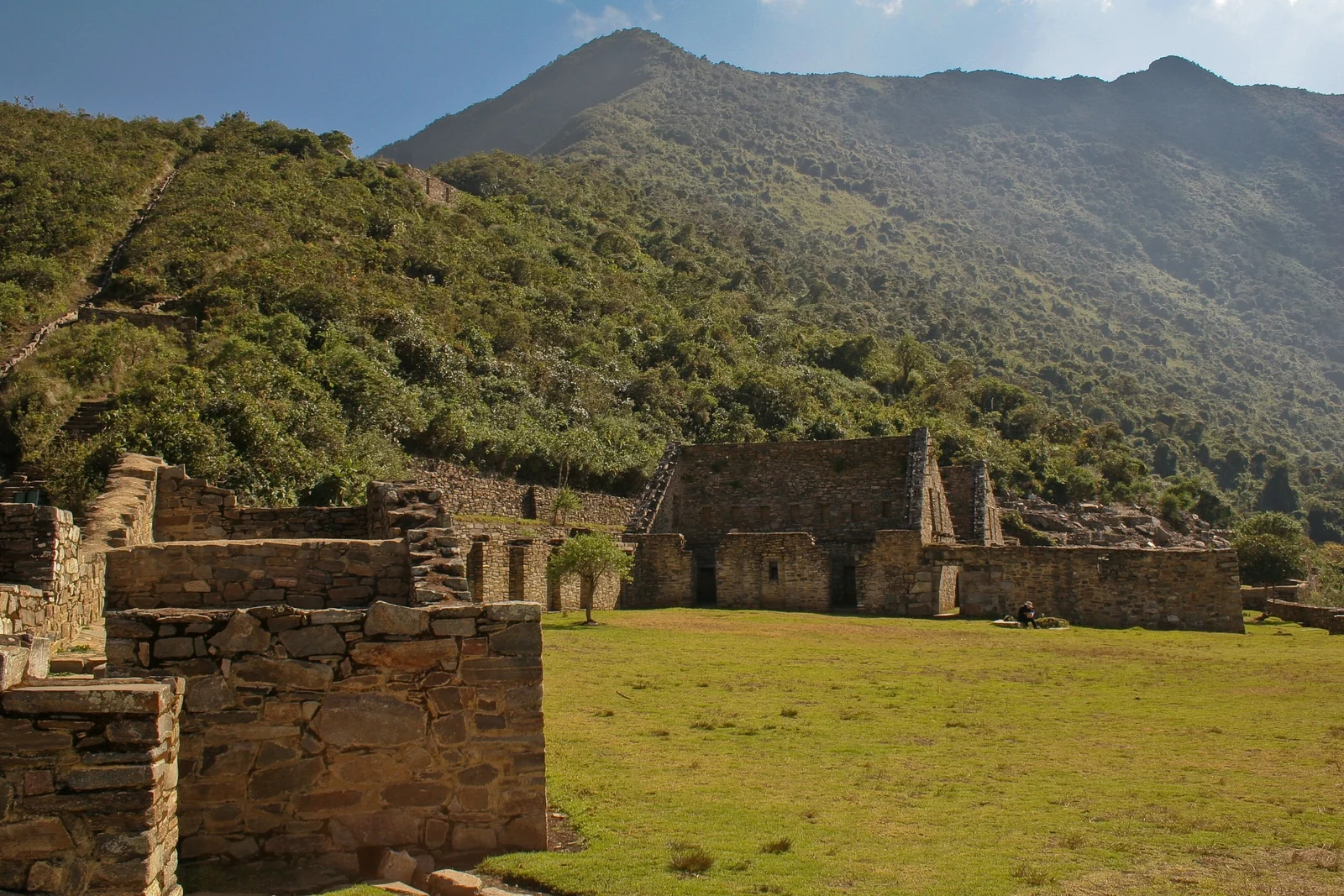
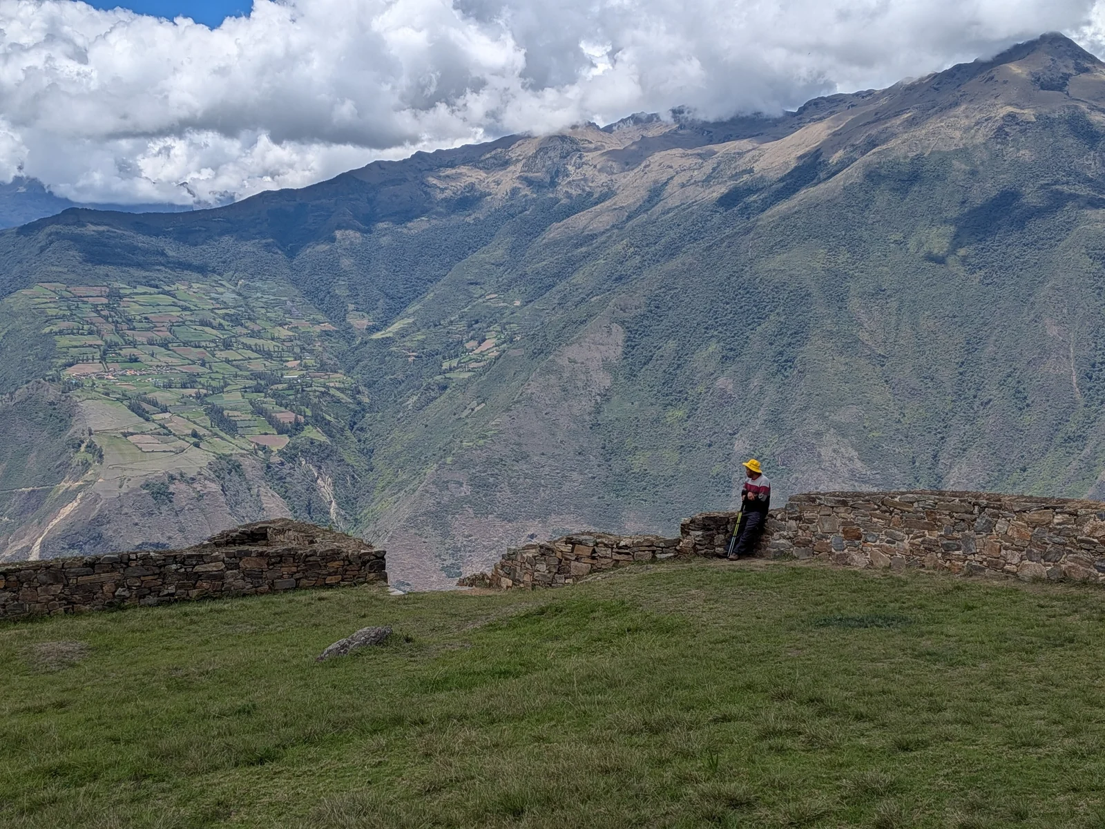
Choquequirao lies in the Santa Teresa district of La Convención province, in the Cusco Region. The usual starting point is the village of San Pedro de Cachora in neighboring Apurímac, about three to four hours by road from Cusco. From there the trail drops into the Apurímac canyon and climbs the other side to the ruins.
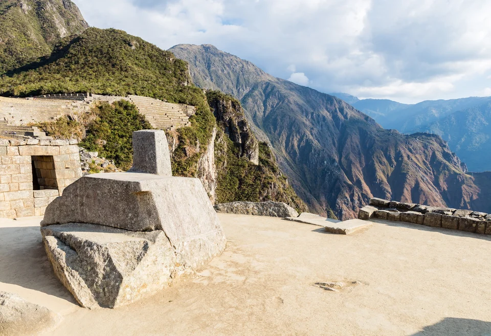
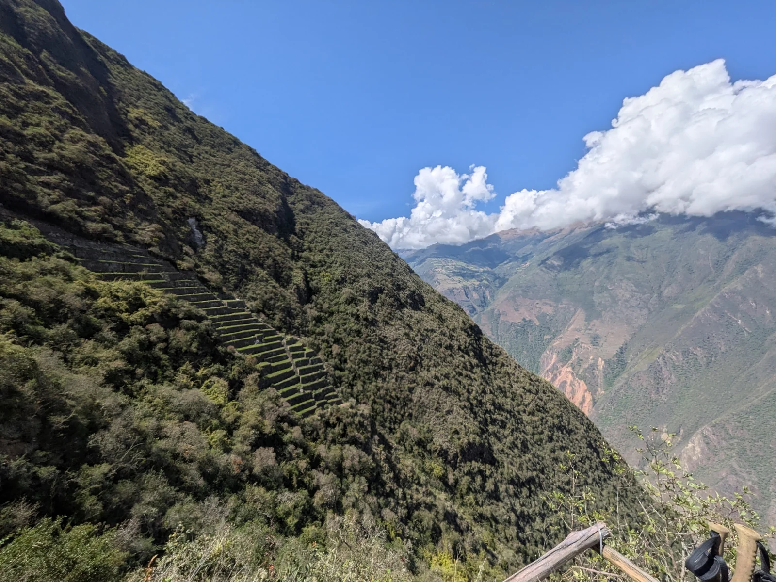
The name is commonly translated as "Cradle of Gold," from Aymara and Quechua roots, though translations vary. The complex spreads over a large area, and only part of it has been excavated. Researchers describe about a dozen sectors, including a main plaza, a ceremonial platform known as an usnu, a great staircase of terraces and agricultural slopes that fall away toward the valley.
Why It Is Called Machu Picchu's Sister
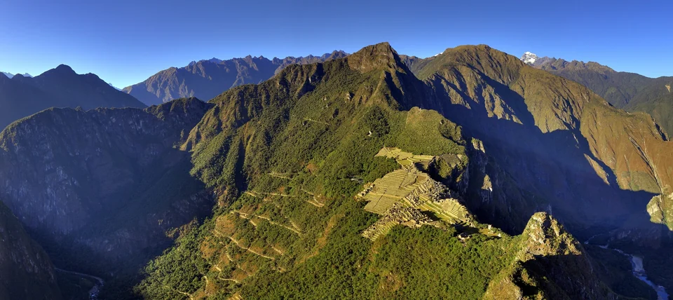
The nickname comes from similar architecture, a similar mountain-top setting and a similar sense of drama. Both sites look out over deep canyons, and both are made of finely fitted stone. The difference is access. Machu Picchu has trains, buses and timed tickets. Choquequirao has a trail, and the walk filters out most casual visitors.
A Short History of Choquequirao
Choquequirao is generally dated to the 15th and 16th centuries, when it is thought to have served as a ceremonial and administrative center and a checkpoint on the way into the Vilcabamba region. Some scholars link it to the emperor Pachacuti and his successor Tupac Inca Yupanqui, though details of its founding are still debated.
Its best-documented moment came after the Spanish conquest. When Manco Inca Yupanqui failed to retake Cusco in the siege of 1535, he withdrew into Vilcabamba, and Choquequirao is thought to have been part of the territory of that resistance. The site was abandoned around the end of the 16th century.
A colonial document from 1710 is among the earliest mentions of the ruins. European and Peruvian explorers visited in the 19th century, and the American explorer Hiram Bingham reached the site in 1909, two years before his Machu Picchu expedition. He judged Choquequirao to be a frontier fortress. Systematic excavation and restoration, which is still incomplete, started much later.
The Llama Terraces
The best-known feature is Sector VIII, where terraces are decorated with white stone figures of llamas set into the dark walls. Archaeologists have documented around two dozen of them. Zigzag patterns in the stonework are one reason some researchers suspect craftsmen from other regions were involved. They are the highlight of the visit, so give them time and good light.
Choquequirao Trek Options: Four Days or Longer
Two broad options cover nearly every itinerary. The right one depends on how many days you have and how much altitude you want to handle.
| Option | Typical length | Highest point | Best for |
|---|---|---|---|
| Classic round trip from Cachora | 4 days, 3 nights | Around 3,000 m at the ruins | Seeing the site as a stand-alone trek |
| Extended trek via the Yanama Pass to Machu Picchu | About 7 to 11 days | Yanama Pass, roughly 4,670 m | Fit, acclimatized hikers who want a longer Andean crossing |
| Fast guided variations | 2 to 3 days | Around 3,000 m | Experienced hikers with strong legs; less time at the ruins |
The Classic 4-Day Round Trip
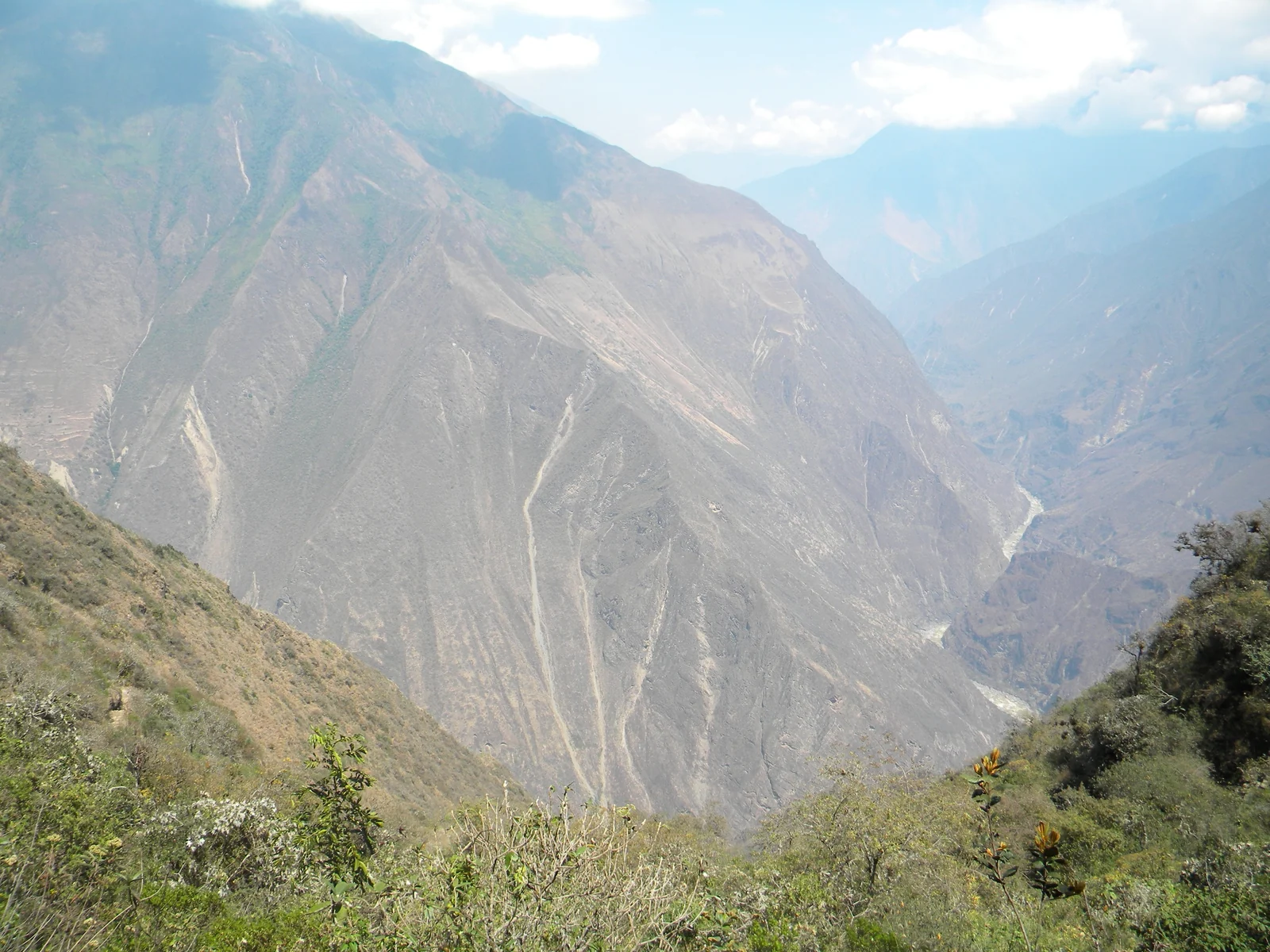
Operators run this itinerary in slightly different ways, but the outline is consistent. On day one you drive from Cusco to the trailhead near Cachora and walk downhill to a campsite on the canyon slope. Day two takes you down to the Apurímac River at around 1,450 m, over a bridge, and then up a steep, hot climb to a camp near the village of Marampata or close to the ruins.
Day three is for Choquequirao itself, usually a full morning or day among the terraces, the plaza and the llama sector. Day four is the walk out, back down to the river and up the Cachora side, then the road to Cusco. The two climbs out of the canyon are the main physical challenge. The ruins are the reward at the end, not the easy part.
The Choquequirao to Machu Picchu Route
The long route continues beyond Choquequirao over very high passes, with the Yanama Pass at about 4,670 m as the most cited high point. It then runs through remote valleys and joins the lower trails toward Santa Teresa and Machu Picchu. Typical itineraries last about a week to 11 days, depending on the pace and the extensions you add.
It is one of the most demanding trekking routes in the region. You will camp for many nights, cross cold high ground and face weather changes. Plan it only if you are in good shape, have time to acclimatize, and go with a reputable operator who handles camps, food and guides.
How Hard Is the Choquequirao Trek?
Operators rate the classic route from moderate to challenging, and the honest answer is that it is hard for anyone who does not walk uphill regularly. The elevation profile is the problem. You lose well over a thousand meters going down to the Apurímac, then climb most of it back on the other side, in warm, exposed terrain. Then you do both again on the way out.
Altitude itself is more manageable than on the Machu Picchu long route, because the ruins sit around 3,000 m and the lowest point is much lower. Still, Cusco is above 3,300 m, so spend at least a couple of days there before you start. Knees and quads take the most punishment on the descents.
- Training: do long hikes with stairs or hills in the weeks before, carrying the pack you plan to use.
- Pace: start early on the climb days, because the canyon heats up fast.
- Poles: trekking poles protect your knees on the steep sections.
- Fitness honesty: if you struggle with a full day of uphill walking at home, choose a shorter hike or a mule-supported plan.
Best Time to Go
As in most of the Andes, the dry season is the safest bet. That generally means roughly May to September, with clearer skies, firmer trails and cold, frosty nights at higher camps. The rainy season, typically from about November to March, brings mud, landslide risk on exposed sections and more cloud over the ruins.
The shoulder months can work, but trail conditions vary. Daytime temperatures inside the Apurímac canyon are warm in any season, while nights at camp are cool, so you need layers either way. Ask your operator about current trail conditions before you book.
Guides, Permits and Planning
Most visitors book a package with a Cusco-based operator that covers transport, camping gear, meals, muleteers and a guide. That is the easy way to manage logistics, especially if you are short on time. Independent hiking is possible on the classic route, but you must carry everything yourself and arrange transport and camping.
The site has its own entrance ticket, and regional authorities manage the archaeological park. Rules for tickets, guides and camping can change, so confirm them with your operator or with the cultural authority in Cusco before you travel. The official Peru tourism page gives the basics on access and the trek.
Pick operators carefully. Ask how many people are in a group, who carries the gear, what the cancellation terms are and whether guides are licensed. Beware of prices that look too low, since cheap packages often cut food quality, pack animal welfare or safety.
What to Pack for Choquequirao
- Broken-in hiking boots with good grip, plus camp shoes.
- Layers: a warm jacket and hat for night and morning, light clothing for the canyon.
- Rain shell and a pack cover, even in the dry season.
- Sun protection: a wide-brim hat, sunscreen and sunglasses, since the climbs are exposed.
- Insect repellent for the lower valley, where biting insects are common.
- Water treatment and a large bottle or bladder, plus electrolyte tablets.
- Headlamp, trekking poles and a basic first-aid kit with blister care.
- Cash in small bills for snacks and tips where there is no card reader.
Choquequirao vs Machu Picchu
The comparison is the main reason people search for this hike, so here it is plainly. Machu Picchu is the better-preserved, more compact and more widely documented site. It is unmissable and easy to reach. Choquequirao is more rugged, less restored and far quieter, and the effort of getting there is part of the experience.
| Feature | Choquequirao | Machu Picchu |
|---|---|---|
| Access | Multi-day trek from Cachora | Train or trek, then bus or walk to the gate |
| Visitor numbers | Small, spread out | Very high, with timed entry |
| Condition | Partly excavated, more overgrown | Extensively restored |
| Effort | Demanding, canyon descents and climbs | Low to moderate, depending on route |
| Highlight | Llama terraces, remote setting | Iconic citadel view |
If your time in Peru is short, see Machu Picchu first. If you have a week, are fit and want an Inca site almost to yourself, Choquequirao is the better trek. To check Machu Picchu entry rules and circuits, use the official Machu Picchu site.
Getting There and Where to Stay
Fly into Cusco, spend a couple of days acclimatizing, then take a road transfer toward Cachora, which usually takes three to four hours. Most operators include this transfer in the package. Public transport to the trailhead is possible but slower and less predictable.
In Cusco, the historic center near the Plaza de Armas is the easiest base for evenings, and San Blas is a quieter neighborhood with steep streets and small guesthouses. On the trail you will camp or use basic lodges near the larger stopping points. Expect simple facilities and bring what you need.
For more Inca ruins and Andean planning, see our Peru travel guides and the wider South America destinations.
Choquequirao Trek FAQ
How long is the Choquequirao trek?
The classic round trip takes four days and three nights from Cusco. Faster guided versions run two to three days, and longer routes continuing to Machu Picchu take about a week to 11 days. Choose the length that suits your fitness.
How hard is the Choquequirao trek?
It is challenging. The route drops into the Apurímac canyon and climbs out the other side, then repeats the effort on the return. Altitude is lower than the Machu Picchu long route, but the steep climbs and heat make it hard for casual walkers.
Is Choquequirao better than Machu Picchu?
They offer different experiences. Machu Picchu is more complete and easier to visit. Choquequirao is wilder, quieter and requires a multi-day hike. Many travelers see Machu Picchu first and choose Choquequirao if they want solitude and a real trek.
What is the best time of year for Choquequirao?
The dry season, roughly May to September, is usually best, with clearer skies and firmer trails. Nights are cold at higher camps. The rainy season, from about November to March, brings mud and more cloud, so check trail conditions with your operator.
Do you need a guide for Choquequirao?
Most visitors go with a licensed operator that handles transport, camping, food and a guide. Independent hiking is possible on the classic route, but rules can change. Confirm current requirements with local authorities or your operator before you go.
How high is Choquequirao?
The ruins sit at about 3,000 m above sea level, while the Apurímac canyon floor is around 1,450 m. Sources give slightly different figures for the site, so treat the number as approximate. Cusco itself is over 3,300 m.
Can you hike from Choquequirao to Machu Picchu?
Yes. A longer route links the two sites over high passes, including the Yanama Pass at roughly 4,670 m, and usually takes about a week to 11 days. It is demanding, so it suits fit, acclimatized hikers who travel with an experienced operator.