


The Upano Valley in Ecuador is where archaeologists found one of the oldest and best-documented urban landscapes in the Amazon basin. A laser survey of a river valley at the foot of the Andes showed about 6,000 earthen platforms, plazas and straight roads under the forest, built by people who lived there from roughly 500 BCE until about 300 to 600 CE.
Here is the honest version for travelers: there is no Machu Picchu-style ruin park waiting in the Upano Valley. Almost all of the settlements lie under pasture, farms and secondary forest, and the key digs are research projects. What you can do is base yourself in Macas, see the landscape that hid these cities, visit local cultural centers and add the volcano country of Sangay National Park. This guide explains what was found, who built it and how to plan a realistic visit.
What LiDAR Found in the Upano Valley
Excavations in the valley began in the 1990s. The picture changed after a LiDAR survey in 2015, funded by Ecuador's national heritage institute. LiDAR fires laser pulses from an aircraft, and software strips away the vegetation to reveal the ground surface. In the Upano Valley it exposed regular, man-made shapes across about 300 square kilometers.
The results appeared in the journal Science in January 2024, in a paper titled Two thousand years of garden urbanism in the Upper Amazon, led by French archaeologist Stéphen Rostain with colleagues from several institutions. The team reported:
- About 6,000 rectangular earthen platforms, which the team interpreted as residential and ceremonial buildings, often grouped together
- About 15 settlements, five of them large, linked by a network of straight roads, with the longest stretches reported at up to about 25 kilometers
- Plazas and ceremonial-style platform complexes, plus signs of farmland and drainage between the clusters
- Occupation that began around 500 BCE and ended between roughly 300 and 600 CE
The authors call the pattern garden urbanism: dense, connected settlements mixed with farmland, rather than a single walled city. That fits what has been found elsewhere in the basin, and it is why the discovery sits beside the other sites in our guide to ancient lost cities in the Amazon rainforest.
Why the Upano Valley Matters
Two things stand out. The first is age. Press coverage of the study describes the Upano settlements as older than any other known complex society in the Amazon basin, with a main period of use that reaches back more than 2,000 years.
The second is the shift in how the Amazon is understood. For decades the textbook version described rainforest soils as too poor to support large, settled populations. The Upano landscape suggests otherwise: planned roads, standardized platforms and agricultural land managed over centuries. It does not mean the whole basin was one continuous city, and researchers are careful about population estimates, which are still debated. It does mean that the forest you see today grew over a heavily modified landscape.
Who Were the Upano People?
Nobody knows what they called themselves. The name is a label of convenience taken from the river and the valley, and archaeologists also use the name Kilamope for one of the cultures they distinguish in the valley. There are no written records, so everything comes from excavated pottery, soil, plant remains and the shapes of the buildings.
What the evidence does suggest is a society able to organize labor on a large scale. Moving earth to build platforms and roads takes coordination, and the plazas imply shared public space. Whether the Indigenous peoples of the area today, such as the Shuar, are direct descendants is not established, so treat any simple answer with caution.
Why the settlements ended is also open. Some researchers point to eruptions of the nearby Sangay volcano as a possible factor, since heavy ashfall can devastate farming. That remains a hypothesis rather than a proven cause.
Key Facts at a Glance
| Question | Short answer |
|---|---|
| Where | Upano River valley, Morona Santiago province, eastern Ecuador |
| Main town | Macas, the provincial capital |
| Survey area | About 300 square kilometers |
| Platforms | About 6,000 |
| Settlements | About 15, five of them large |
| Occupation | Around 500 BCE to about 300–600 CE |
| Lead researcher | Stéphen Rostain |
| Open as a tourist site? | Not as a single park; most sites are on private land or under research |
Can You Visit the Upano Valley Sites?
Short answer: not in the way the headlines suggest. The platforms are low earthen mounds, now covered by grass, crops and trees, and without a guide who knows the research you could stand on one and not notice. Excavations at the main settlements, including Kilamope, are scientific projects, and access depends on landowners and the researchers.
We could not find an official Ecuadorian heritage page that lists a ticketed Upano Valley archaeological site with opening hours. Before you plan around any specific mound, ask the tourist information office in Macas or the provincial tourism office what is open. Treat any operator that sells the lost cities as a standard day trip with some skepticism, and ask exactly where you will be taken and with whose permission.
What you can realistically do
- Use Macas as a base, walk down to the Upano River and ask locally about museums and cultural centers
- Ask about cultural visits organized by Indigenous communities in the province; arrangements and opening times vary, so confirm locally
- Hire a local guide who knows the research and the landowners, rather than turning up at a mound on your own
- Combine the trip with the Sangay National Park area, where the scenery is the main draw
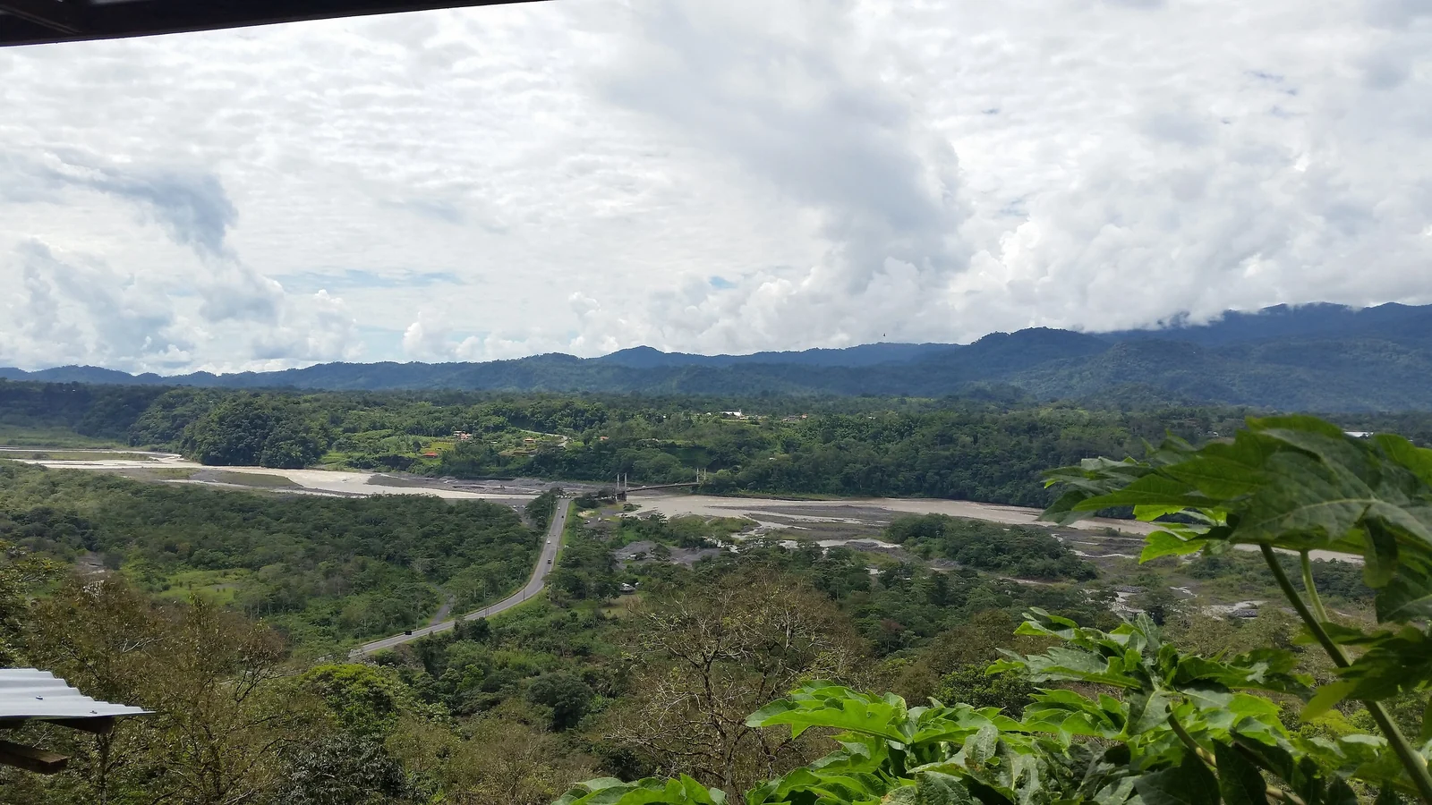
Getting to Macas from Quito
Macas is not close to Quito by Amazon standards. The usual route is by road, a long day through the Andes and down the eastern slope. Many buses and drivers go via Ambato, Baños and Puyo, then south along the foothills to Macas. Another way is to travel south to Cuenca and cross to the east, which makes sense if you are touring the highlands first.
Bus journeys from Quito are commonly quoted at around 8 to 12 hours, so leave early, because mountain roads can be slowed or closed by landslides and heavy rain. Intercity buses serve Macas from the main terminals, and private drivers are available. Scheduled flights from Quito to Macas have operated, with a flight time well under an hour, but schedules have changed over the years, so check with the airlines before relying on them. For times and fares, use the bus companies directly.
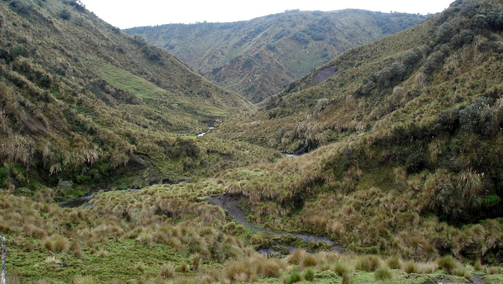
Sangay National Park and the Surrounding Landscape
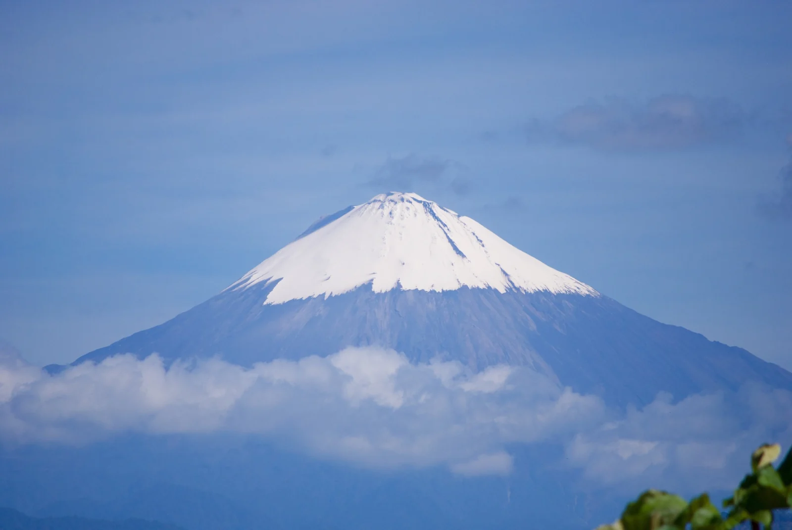
The most dependable reason to come is the setting. Sangay National Park was inscribed on the UNESCO World Heritage List in 1983 for a range that runs from glaciers and high páramo down to tropical rainforest. It includes the active Sangay and Tungurahua volcanoes and the extinct Altar. The park was placed on the List of World Heritage in Danger in 1992 and removed from it in 2005.
Reaching the park's interior usually means trekking with licensed guides and several days of effort, and the volcano itself is remote and unpredictable. Do not approach it without current information from the park authority and local guides. From Macas, the view of the cone on a clear morning is the easy and safe way to appreciate it.
If you like landscape-driven archaeology, compare it with Machu Picchu, which is organized, ticketed and very busy. The Upano Valley is the opposite experience: quiet, informal and partly invisible. More options in the region are collected on our Amazon travel page.
Best Time to Visit Macas and the Upano Valley
The eastern Andean foothills are wet for much of the year, and there is no truly dry season. Rain can fall in any month, and that affects roads, river levels and trekking. Travel sources most often name the middle of the year as the easier time for outdoor plans, but conditions vary from week to week, so keep your schedule flexible.
| Factor | What to expect |
|---|---|
| Rain | Frequent in all months; carry a light rain jacket |
| Temperature | Warm and humid in Macas; much colder at high altitude in the park |
| Roads | Landslides and closures are possible on the Andean descent |
| Volcano | Sangay is active; check official updates before outdoor plans |
Practical Tips and Cautions
- Respect private land. Never walk onto farms or into excavations without permission, and never collect pottery or dig.
- Hire local guides. They know landowners, trails and current conditions, and it keeps money in the community.
- Rely on official bulletins for volcano information, since ash fall and activity can change quickly.
- Prepare for the climate: insect repellent, quick-dry clothing and waterproof bags for electronics.
- Carry some cash for small towns, as card payment is not universal outside Macas.
- Check health advice for the Amazon region, including vaccinations, with a travel clinic before you go.
Plan at least two nights in Macas so that you have time to talk with locals about the sites and adjust to the weather. Sucúa, a short drive south of Macas and home to the Shuar Federation, makes a worthwhile stop if you want to learn about living Indigenous traditions. It also has a local museum that is reported to hold finds from the valley, so check opening times before you go. For wider planning, our South America travel guides are a good next step.
Upano Valley FAQ
Where is the Upano Valley?
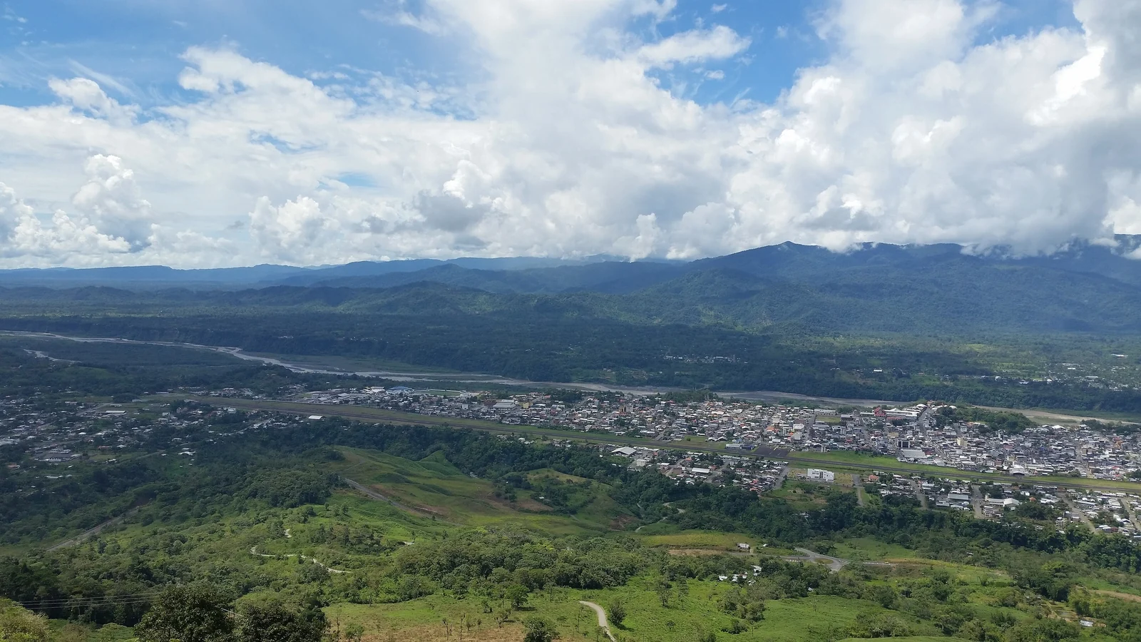
It lies in Morona Santiago province in eastern Ecuador, along the Upano River at the foot of the Andes. Macas is the main town and the usual base for anyone exploring the area.
How old are the Upano Valley cities?
Occupation began around 500 BCE and continued until roughly 300 to 600 CE, according to the research team. That makes the main phase more than 2,000 years old.
What did LiDAR reveal in the Upano Valley?
A survey of about 300 square kilometers showed about 6,000 earthen platforms, plazas and straight roads linking roughly 15 settlements. The laser data removed the forest cover digitally, exposing shapes that are hard to see on the ground.
Can tourists visit the Upano Valley ruins?
Not as a single organized archaeological park. Most sites are on private land or under active research. Ask the tourist office in Macas what is currently accessible, and go only with permission and a local guide.
How do you get from Quito to Macas?
Most travelers go by road, a long day by bus or private driver via Ambato, Baños and Puyo, or via Cuenca. Flights have also operated from Quito. Check current schedules and road conditions before you travel, since both change.
Who were the Upano people?
Their name is unknown. Archaeologists use the river and valley name for convenience. Without written records, what we know comes from pottery, soils and the layout of platforms and roads. Links to present-day groups remain unproven.
Is Sangay National Park worth adding to the trip?
Yes, if you enjoy landscapes. It is a UNESCO World Heritage Site with glaciers, páramo, volcanoes and tropical forest. Trekking inside requires planning and licensed guides, and the Sangay volcano is active, so check official updates first.
Is the Upano Valley open to visitors?
Not as a single archaeological park. Most of the platforms lie under pasture, farms and forest, often on private land, and the main digs are research projects. Ask the tourist information office in Macas what can actually be visited before you plan around any specific site.
Which town is the base for visiting the Upano Valley?
Macas, the capital of Morona Santiago province, is the usual base. It sits beside the Upano River in eastern Ecuador. From there you can ask about local cultural centers and guides, and on a clear morning you can see the cone of Sangay volcano.
Is the Upano Valley worth visiting?
It is worth it if you enjoy quiet, informal travel and landscape-led archaeology. It is not if you expect ruins like Machu Picchu, because most settlements are invisible at ground level. A local guide who knows the research and the landowners makes the trip far more rewarding.