


El Chaltén is a small trekking village in Argentine Patagonia, and it is the best place on the continent to walk straight from your hotel door to a world-class mountain. The three headline day hikes, Laguna de los Tres beneath Fitz Roy, Laguna Torre facing Cerro Torre and the ridge walk to Loma del Pliegue Tumbado, all start in or next to the village.
Most people arrive by bus from El Calafate, roughly three hours away, and stay two to four nights. This guide covers the hikes, how long they really take, the park fee, when to go and where to sleep, plus how to add Perito Moreno Glacier on the way in or out. For the wider picture, see our Argentina travel guides.
Why El Chaltén Is Argentina's Trekking Capital
Argentina's national tourism board calls El Chaltén the country's capital of trekking, and the label fits. The village sits inside Los Glaciares National Park, a UNESCO World Heritage Site since 1981, and the main trails leave from the edge of town. There is no long drive to a trailhead, and you do not need to book a tour to see the big views.
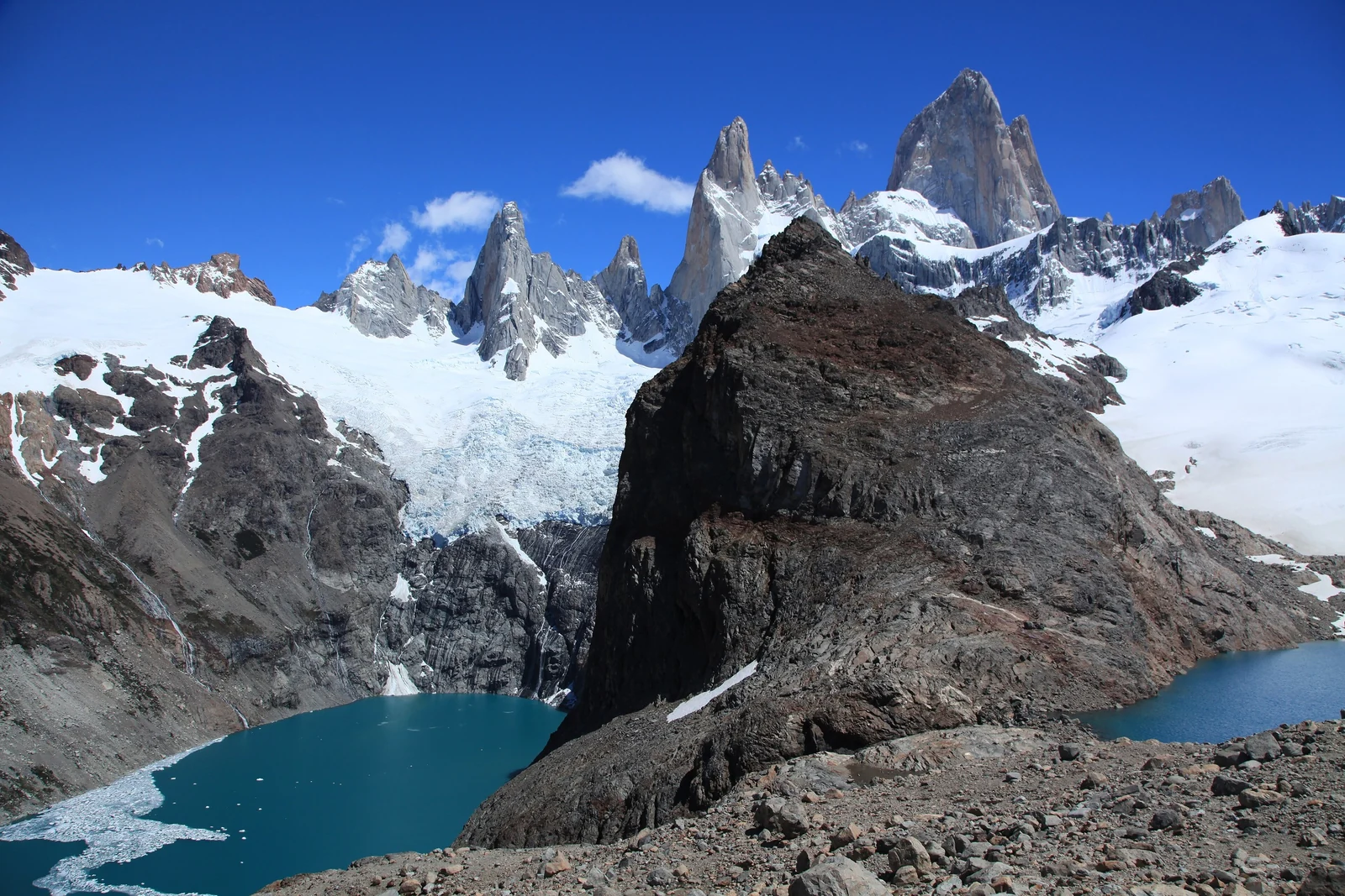
The skyline is the reason. Fitz Roy rises to 3,405 meters, a wall of granite that is often wrapped in cloud and, on a clear morning, turns orange at sunrise. Cerro Torre, a needle of rock and ice, stands a few valleys to the south. Both are climbers' mountains, which is why the trails here feel serious even when they are not technical.
Laguna de los Tres: The Fitz Roy Hike
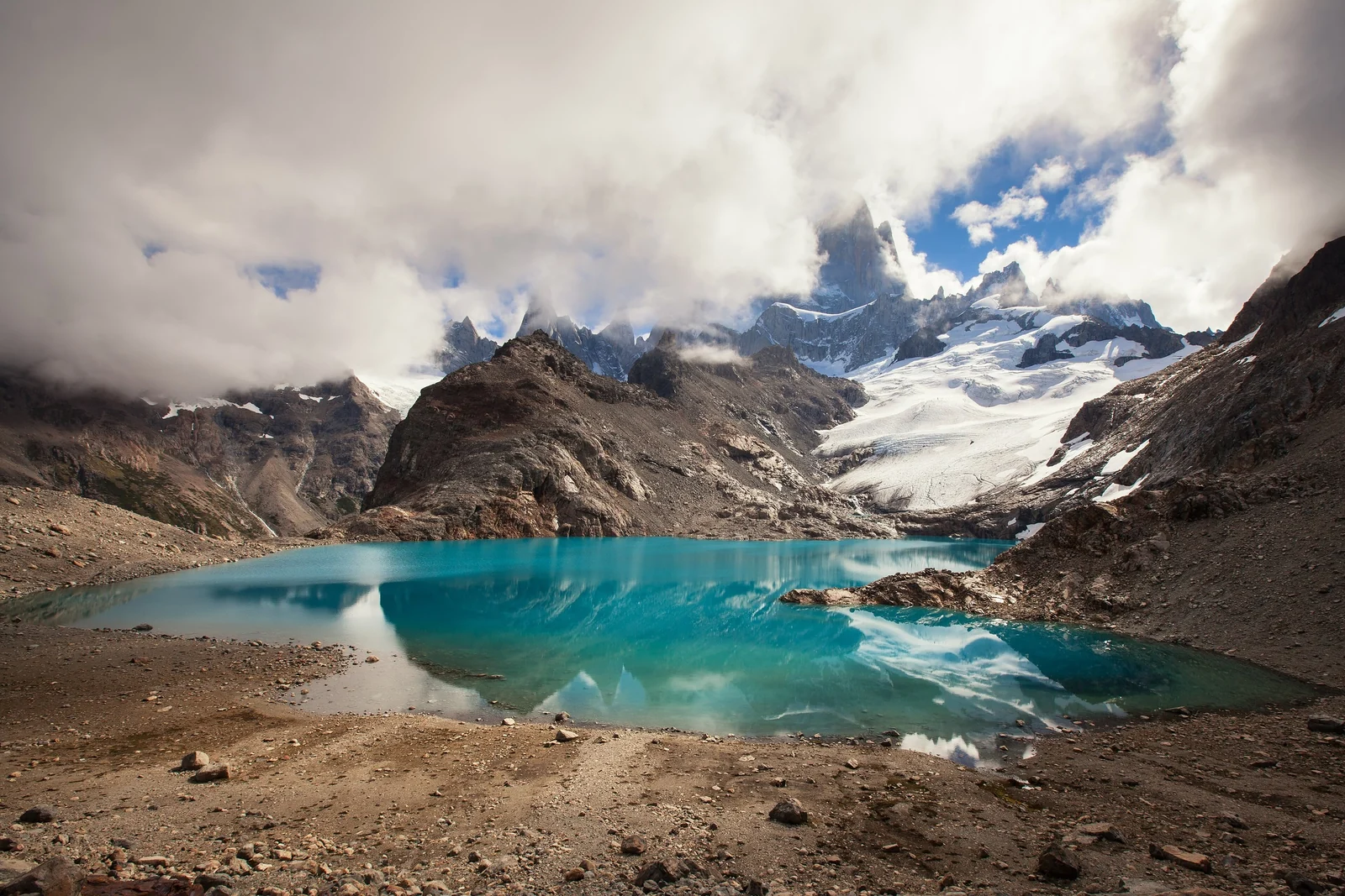
This is the one most visitors come for. The route climbs gently through forest and along the Río Blanco valley, then ends with a steep, rocky push to a viewpoint above a turquoise glacial lake with Fitz Roy straight ahead. Plan on 22 to 25 kilometers round trip depending on where you start, and roughly 8 to 9 hours of walking, with about 800 to 900 meters of climbing.
The first 10 kilometers or so are moderate. The last two are the hard part: about 400 meters of ascent over loose rock in around an hour. Take it slowly. The summit view is also where the wind finds you, so keep a warm layer in your pack for the top.
Starting Early and Choosing Your Route
Start at first light. That gives you time for the climb, a long break at the top and a return before dark, and it keeps you ahead of the afternoon crowds. Carry a headlamp, not just your phone, and at least 1.5 liters of water per person.
A shorter trailhead option exists at Río Eléctrico, about 14 kilometers from town on a provincial road, which saves a few kilometers and adds a view of the Piedras Blancas glacier. It needs a private transfer or taxi. A variant also branches off near the end to pass Laguna Capri, so you can go up one way and come down the other.
Laguna Torre: The Cerro Torre Hike
Laguna Torre is the easier of the two classics and the better choice for a first day. The trail runs along the Río Fitz Roy valley and gains height gradually, ending at a glacial lake with Cerro Torre at the back. Expect about 19 kilometers round trip and 7 to 8 hours, with around 250 meters of climbing, which is why it is rated medium.
Cerro Torre loves to hide. On many days the summit is in cloud and you see only the base, so give yourself a margin and wait a while. If the sky is clear, continue about two kilometers along the moraine ridge to Mirador Maestri for a closer look at the glacier.
Loma del Pliegue Tumbado: The Ridge Walk
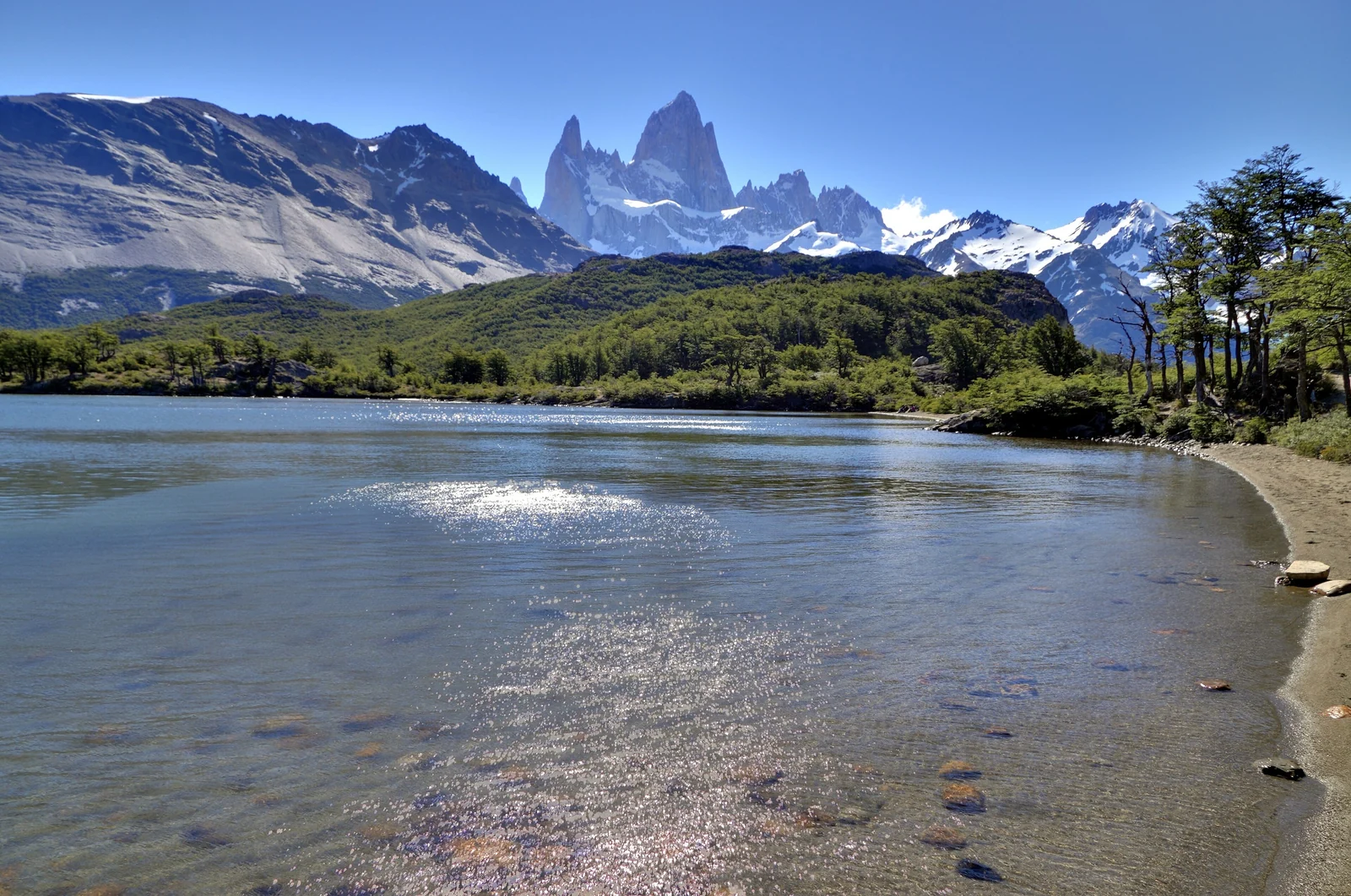
Loma del Pliegue Tumbado is the hike for people who want to see the whole range at once rather than stand under one peak. The trail climbs a long ridge to a summit with a wide panorama of the Fitz Roy massif and the valley below. It is not technical, but it is steep, exposed and long.
Sources differ on the numbers. Count on about 20 kilometers round trip, close to 1,000 meters of climbing and a full day, up to 10 hours at a gentle pace. The ridge is open to wind, so it is a poor choice in strong gusts. Do it on a clear, calm day, and think of it as a break from the crowds on the two lake trails.
Hikes at a Glance
| Hike | Round trip (approx.) | Time | Difficulty | Best for |
|---|---|---|---|---|
| Laguna de los Tres | 22 to 25 km, 800 to 900 m climb | 8 to 9 hours | Moderate to hard | Close views of Fitz Roy |
| Laguna Torre | About 19 km, about 250 m climb | 7 to 8 hours | Medium | Cerro Torre and the glacier |
| Loma del Pliegue Tumbado | About 20 km, about 1,000 m climb | Up to 10 hours | Hard, exposed | Panorama of the whole range |
| Laguna Capri | Easy forest trek, shorter than the big three | 4 to 5 hours | Easy | A relaxed lake with Fitz Roy views |
These are rounded figures from park and local trekking sources, which disagree by a few kilometers depending on the starting point. Check the map at the visitor center for the trail you plan to use.
Park Fees, Rules and Trail Safety
The village itself is open to everyone, but the trails into Los Glaciares National Park require an entry pass, and foreign visitors pay a higher rate than Argentines and local residents. The pass is bought online through the national parks ticketing system, so sort it out before you head for the trailhead. Because prices change, check the current rate and exemptions on the official national parks site.
- Stop at the park visitor center, just before the village, for trail conditions and a map. In the colder months, register there before you set off.
- Weather changes quickly. Pack a windproof shell, a hat and gloves even in summer, plus plenty of food.
- Stay on marked trails and carry out all your trash. Camp only in designated campsites.
- Mobile signal is patchy on the trails, so tell someone your route and your return time.
What to Pack for a Day Hike
Boots with grip matter more than anything else, especially on the loose final climb to Laguna de los Tres. Add trekking poles if your knees complain on descents, a hat, sunscreen and sunglasses, because the Patagonian sun is strong even when the air is cold. Pack your lunch and a few extra snacks; there are no shops on the trails, and a long day burns more than you expect.
When to Go: Season and Weather
The main hiking season runs from about October to April, when the days are long and the trails are mostly clear. Winter, from roughly May to September, brings snow, short days and fewer visitors, and some services in town slow down.
- October and November: quieter, cooler and changeable, with snow possible high up.
- December to February: peak summer, longest days and the busiest trails. Book beds well ahead.
- March and April: shorter days and often more settled weather, with autumn color in the forest.
- May to September: cold, with snow and mud possible on the final stretch to Laguna de los Tres.
Wind is the constant. Even in the best weeks you can lose a day to cloud or gusts, so build in a spare day rather than packing the trip too tight.
Getting to El Chaltén from El Calafate
El Chaltén is about 215 kilometers from El Calafate, and the usual way to cover it is a direct bus, which takes roughly three hours. You can also drive or take a shared transfer. El Calafate has the nearest airport, with flights from Buenos Aires; if you are building a route from the capital, our Buenos Aires travel guide is a good start.
Buses between the two towns run more often in the high season than in winter, so check schedules in advance. If your trip also crosses into Chile, our Chile travel guide covers the north and center of that country.
Where to Stay in El Chaltén
The village is small and walkable, so location matters less than comfort and timing. Options range from hostels and campgrounds to cabins and mid-range hotels, and beds fill up fast from December to February.
- Near the main street: best for restaurants, bus drop-offs and early starts toward the Fitz Roy trailhead, which is at the end of the main avenue.
- Toward the Laguna Torre side: quieter, with an easy walk to that trailhead.
- Campsites: some are in the park and some in town; use only the designated ones.
- Outside peak season: more choice and lower prices, but check which places are open.
Add Perito Moreno Glacier From El Calafate
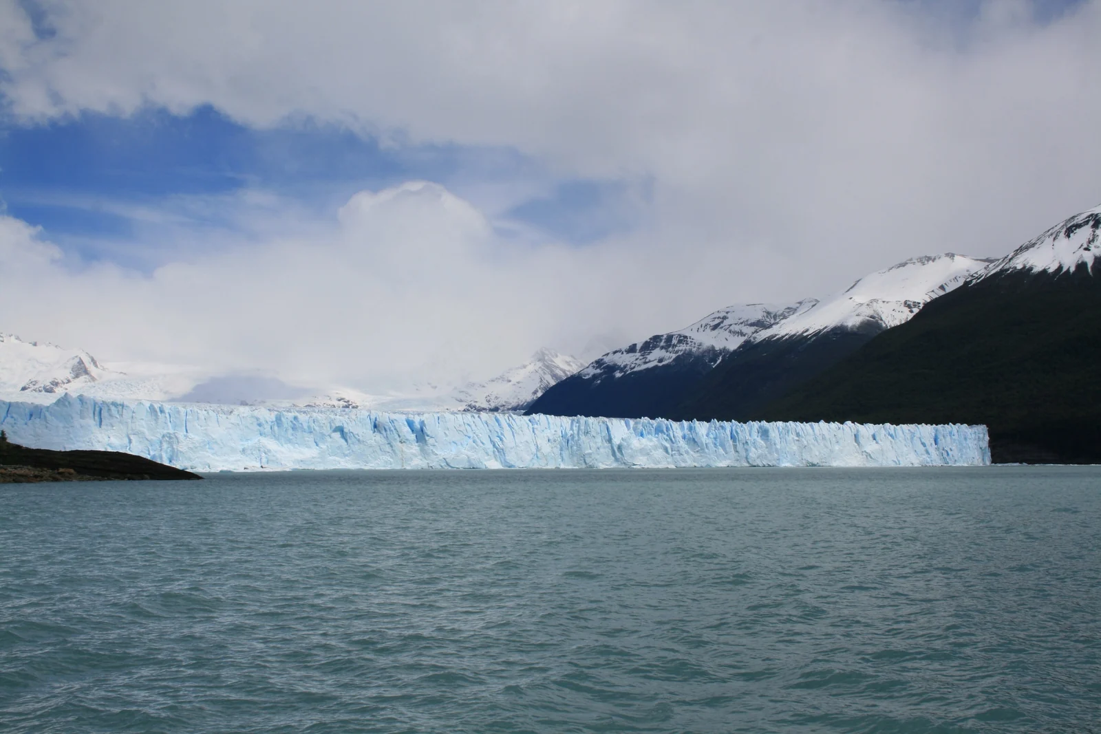
Perito Moreno Glacier is in the same national park, roughly 80 kilometers from El Calafate by road, and it is the easy counterpart to El Chaltén's hard hikes. A network of walkways gives close views of the ice front, which advances and calves into Lago Argentino. Most travelers see it on a day trip from El Calafate, either before heading to El Chaltén or after coming back.
A sensible plan is one night in El Calafate, the glacier the next day, then the afternoon bus to El Chaltén. For more ideas across the continent, browse our South America destination guides.
A Simple 3-Day El Chaltén Plan
- Day 1: arrive, visit the visitor center, buy your park pass and do Laguna Capri or a short walk to a viewpoint to stretch your legs.
- Day 2: Laguna de los Tres on the clearest forecast day.
- Day 3: Laguna Torre, or Loma del Pliegue Tumbado if you still have energy and the wind is low.
If you only have two days, pair Laguna de los Tres with Laguna Torre and skip the ridge. If the forecast is poor on day two, swap the order and keep the Fitz Roy hike for the best window.
El Chaltén FAQ
How many days do you need in El Chaltén?
Three nights is comfortable. That covers Laguna de los Tres and Laguna Torre with a spare day for weather. Two nights works if you are happy with the two classic hikes and a bit of luck, and four allows the Pliegue Tumbado ridge too.
Is Laguna de los Tres hard?
It is a long day, about 22 to 25 kilometers and 8 to 9 hours, with a steep final climb of around 400 meters. It needs no technical skills, but you do need decent fitness, sturdy boots and an early start.
Do you have to pay to hike in El Chaltén?
The village is open, but the trails inside Los Glaciares National Park require an entry pass bought online. Foreign visitors pay a higher rate than Argentines and locals. Check the current price and exemptions on the national parks site.
How far is El Chaltén from El Calafate?
About 215 kilometers by road, usually roughly three hours by direct bus. Many travelers combine the trip with Perito Moreno Glacier, which is around 80 kilometers from El Calafate in the other direction.
What is the best time to hike in El Chaltén?
October to April is the main season. December to February has the longest days and the most people, while March and April bring shorter days and often quieter trails. Winter brings snow and fewer services.
Can you hike in El Chaltén without a guide?
Yes. The main trails are well marked and no guide is required, though guides are available. Check conditions at the visitor center, carry a map, water, food and warm layers, and tell someone your plan.
Is Perito Moreno Glacier close to El Chaltén?
No. It sits near El Calafate, roughly 80 kilometers away, and El Chaltén is a separate three-hour trip north. Most visitors do the glacier as a day trip from El Calafate before or after their trekking days.