


Utah packs five national parks into the southern half of the state, and they are close enough to link in a single loop of roughly a week to ten days. Zion has the river-carved canyon, Bryce Canyon the forest of orange hoodoos, Capitol Reef the long crumpled ridge and old orchards, Arches the stone spans around Moab, and Canyonlands the vast canyon country below it. Add Monument Valley on the Navajo Nation and you have the most photographed stretch of the American Southwest.
This Utah national parks road trip guide gives you a workable loop, an honest read on the shuttles and timed-entry systems, the seasons that suit each park, how to stay safe in desert heat and where to base yourself. Distances are long and the scenery is the point, so plan fewer stops with more time at each. For more on the country, browse our USA travel guides.
A Loop Route Through Utah's National Parks
Most visitors fly into Las Vegas or Salt Lake City, rent a car and drive a loop. From Las Vegas the natural direction is east to Zion, then north-east through Bryce Canyon and Capitol Reef, then on to Moab for Arches and Canyonlands, with Monument Valley as the grand finale before you loop back west. From Salt Lake City you can run the same circuit in reverse. Either way, you will spend a lot of time behind the wheel, so treat the drive as part of the trip.
| Leg | Approx. driving time | What you gain |
|---|---|---|
| Las Vegas to Zion (Springdale) | About 2.5 to 3 hours | Red-rock canyon, river hikes |
| Zion to Bryce Canyon | About 2 hours | Hoodoo amphitheaters, rim walks |
| Bryce Canyon to Capitol Reef (via Highway 12) | About 2.5 to 3 hours | A famous scenic road, then orchards and cliffs |
| Capitol Reef to Moab | About 2.5 hours | Gateway to Arches and Canyonlands |
| Moab to Monument Valley | About 2.5 to 3 hours | Buttes on the Navajo Nation |
| Monument Valley back to Las Vegas | A long day of 6 hours or more | Return via northern Arizona |
Times are rough and depend on stops, road works and traffic, so check a live map on the day. The stretch from Bryce to Capitol Reef follows Utah's Highway 12, one of the best drives in the state, and it deserves daylight and a few pull-offs. Services are sparse between towns, so fill your tank whenever you can.
Zion National Park: Canyon Walls and River Walks
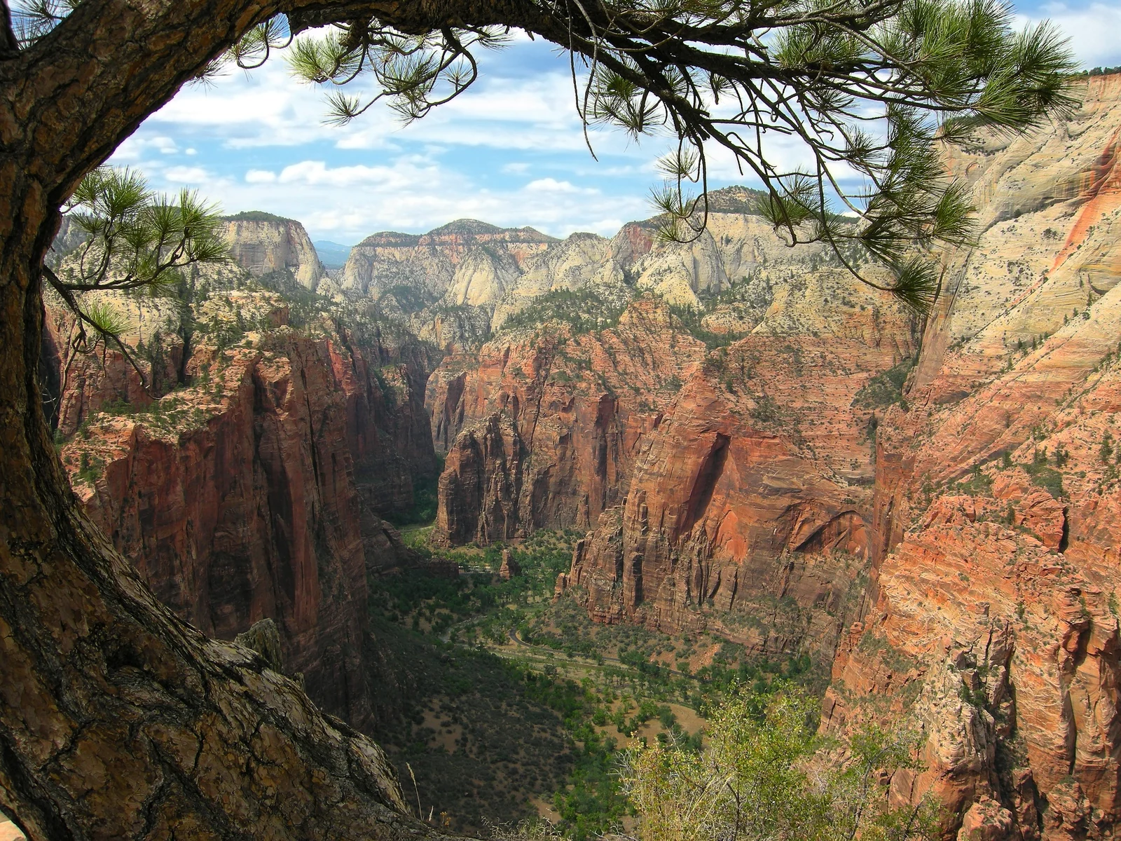
Zion became a national park in 1919, a decade after it was first protected as Mukuntuweap National Monument. The heart of the park is Zion Canyon, about 15 miles long and up to 2,640 feet deep, carved by the Virgin River. The sheer walls rise right from the valley floor, which makes Zion feel more intimate than the other parks on this loop.
The Zion Canyon Shuttle
During the shuttle season, private vehicles cannot drive the Zion Canyon Scenic Drive, so most visitors ride the free park shuttle from the visitor center area to stops along the canyon. According to the National Park Service shuttle page, it generally runs daily from March through November, with no ticket or reservation needed. Exact dates and hours change, so check the posted schedule before you go.
Hikes Worth Your Time
- Riverside Walk: an easy paved path of about two miles round trip that ends where the Narrows begins. It suits almost everyone.
- The Narrows: you walk in the Virgin River itself between towering walls. Wear closed shoes that can get wet, expect cold water even in summer and never start if flash-flood risk is posted.
- Angels Landing: a steep, exposed route with chains along the final section. A permit is required, and rangers may ask to see it. Apply well ahead through the official system.
- Kolob Canyons: a quieter northern section reached from Interstate 15, with a short scenic road and trailheads away from the main crowds.
Zion also has the Zion-Mount Carmel Highway, which opened in 1930 and runs through a tunnel of about 1.1 miles. Oversized vehicles need special handling there, so read the park's current rules if you drive an RV.
Bryce Canyon: A Forest of Hoodoos
Bryce Canyon is not really a canyon but a series of amphitheaters cut into the edge of a high plateau. Frost and rain have sculpted thousands of hoodoos, rock pinnacles that can reach up to 200 feet. The park became a national park in 1928, and the rim sits at roughly 8,000 to 9,000 feet, so the air is thinner and much cooler than in Zion.
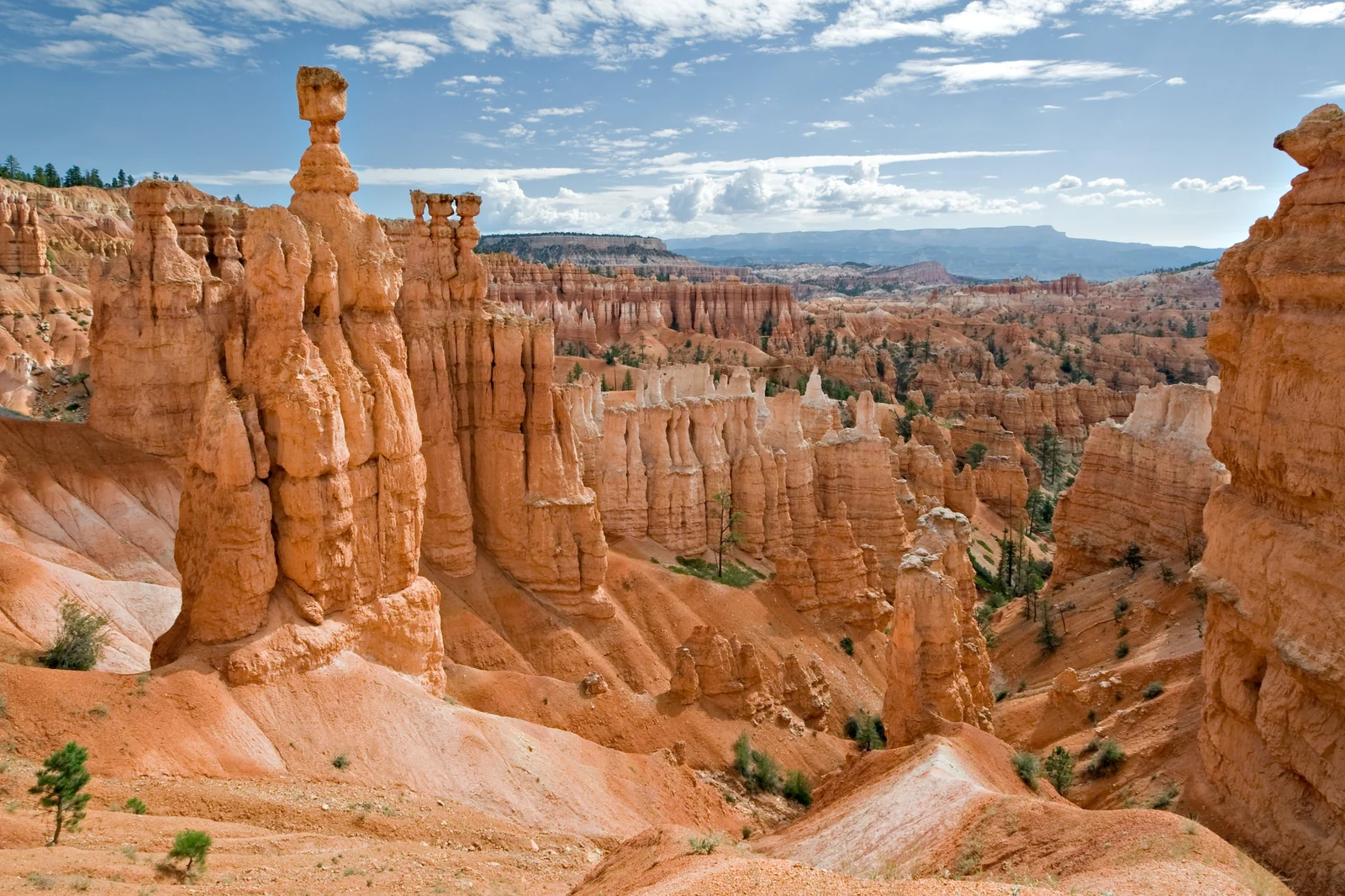
The main viewpoints cluster around Bryce Amphitheater, the largest in the park. Walk the rim between Sunset Point and Sunrise Point for a gentle first look, then drop below it if you have energy. The Navajo Loop from Sunset Point is a moderate hike of roughly one to two hours that takes you among the hoodoos. Remember that every step down is a step back up, and the altitude makes it feel harder than the distance suggests.
Capitol Reef: Cliffs, Orchards and Quiet Roads
Capitol Reef is the least crowded of the five, and many travelers love it for that. Its signature feature is the Waterpocket Fold, a wrinkle in the earth's crust about 100 miles long. The park was a national monument from 1937 and became a national park in 1971.
The base is the small town of Torrey, about 11 miles west of the visitor center on Highway 24, with a handful of motels and restaurants. Drive the paved Scenic Drive of about 8 miles to see the cliffs up close. Near the old settlement of Fruita, the National Park Service maintains historic orchards, and in season visitors can pick fruit for a fee. Check the park's page for what is ripe and when.
If you have a high-clearance vehicle and good weather, the unpaved Cathedral Valley road leads to the Temples of the Sun and Moon. Without that, stick to the paved drive and short walks such as the trail into Capitol Gorge. Dirt roads here can become impassable after rain.
Arches National Park and Moab
Arches protects more than 2,000 natural sandstone arches, one of the densest collections anywhere. It was designated a national monument in 1929 and became a national park in 1971. The entrance lies only about 4 miles north of Moab, which makes the town the easiest base for both Arches and Canyonlands.
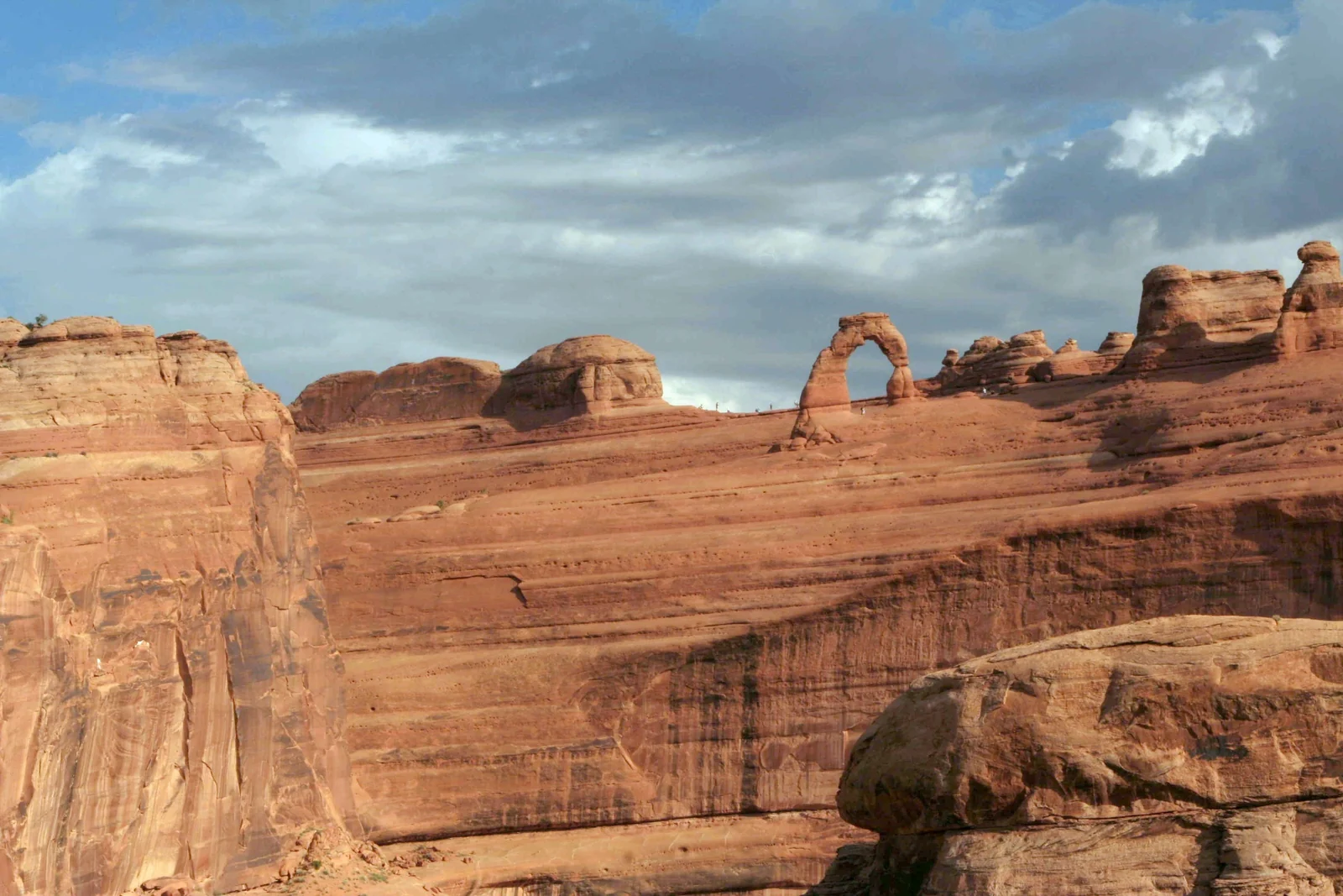
Delicate Arch and the Windows
The hike to Delicate Arch is about 3 miles round trip, with a long climb up open slickrock and almost no shade. Go early or near sunset, and carry far more water than you think you need. If the full hike is too much, a short walk leads to a viewpoint of the arch from a distance. In the Windows section, easy trails reach North Window, South Window and Turret Arch in under an hour.
Timed Entry and Crowds
Arches is the park most likely to ask for a reservation. In recent seasons the National Park Service has used timed-entry systems during peak periods, and the rules and dates have changed from year to year. Check the official Arches planning page before you travel, book early if a system is running and arrive outside the busiest midday hours when you can.
Canyonlands: Island in the Sky and Beyond
Canyonlands became a national park in 1964 and is divided into districts by the Green and Colorado rivers. Island in the Sky is the easiest to reach from Moab and works for a half or full day. The Needles and the Maze lie farther away, need more time and in the Maze's case demand serious backcountry experience.
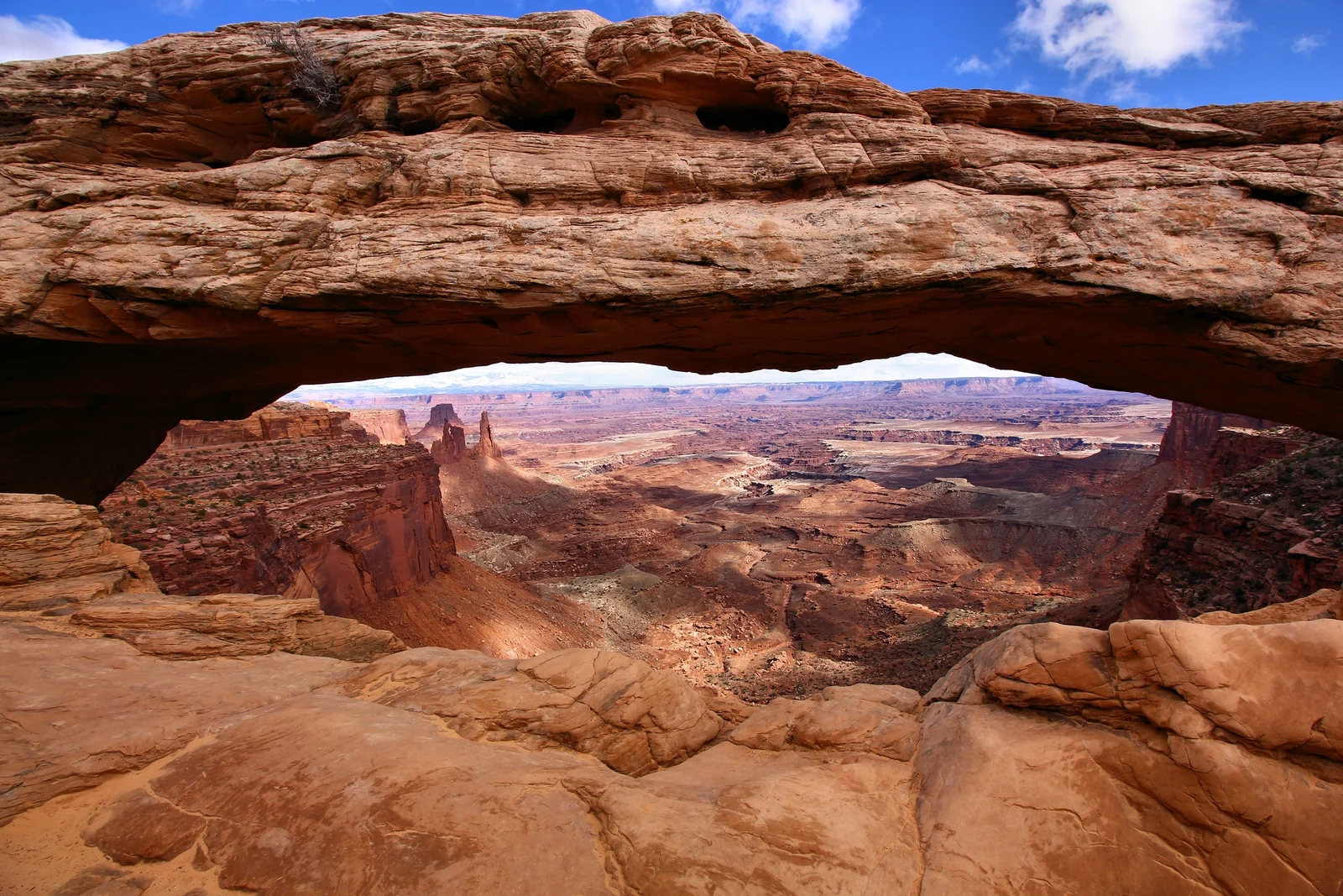
Start at Mesa Arch, a short loop walk that frames the canyons below, then drive to Grand View Point for a wide panorama over the rim. Mesa Arch is a popular sunrise spot, so expect company if you go early. The scale of the landscape is the draw: you look down on a maze of cliffs and benches with no road in sight. Bring plenty of water, because there is little shade and no water on the trails.
Monument Valley on the Navajo Nation
Monument Valley is not a national park. It lies on the Utah and Arizona border within the Navajo Nation, and much of it is managed as Monument Valley Navajo Tribal Park. Sandstone buttes rise up to about 1,000 feet above the valley floor, and the Navajo consider the valley sacred. Its Navajo name, Tsé Biiʼ Ndzisgaii, means valley of the rocks.
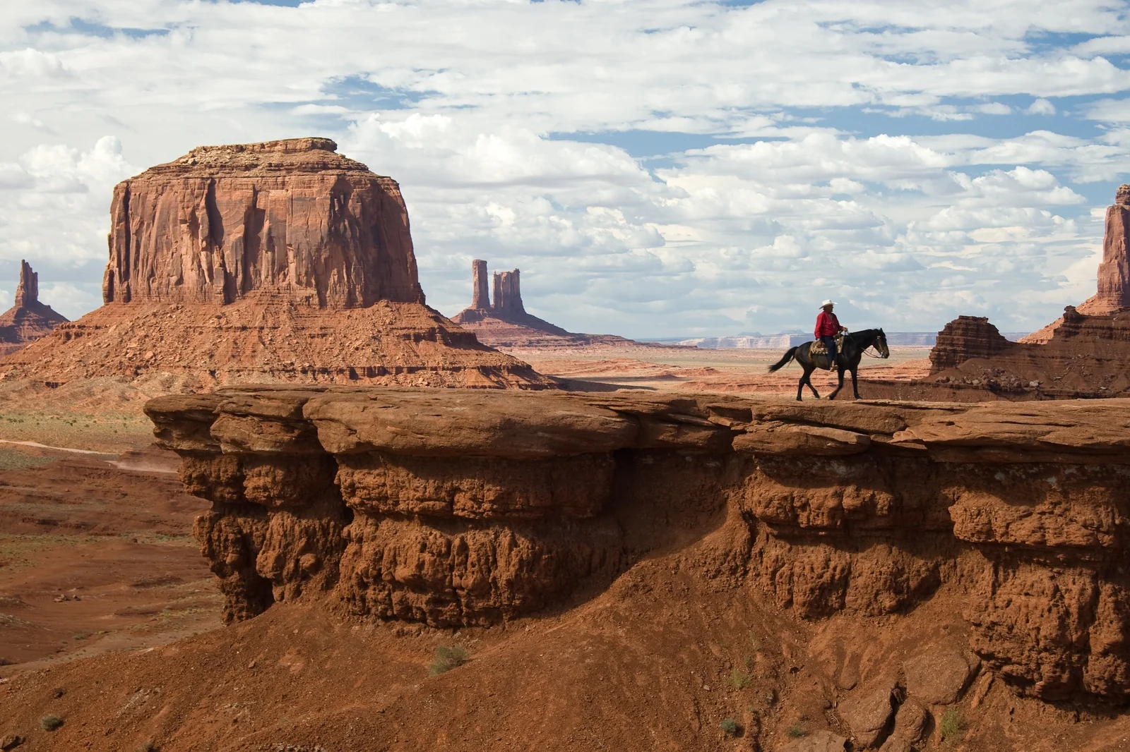
Visitors pay an access fee to drive the unpaved loop of about 17 miles, and some areas, such as Mystery Valley, can only be seen on guided tours led by Navajo guides. A guided tour is the best way to reach places you cannot visit alone and to hear the stories behind the landscape. Treat the land and its people with respect, and check the tribal park's official site for current hours and access rules.
Directors, especially John Ford in films such as Stagecoach and The Searchers, made these buttes the picture of the American West. Late afternoon, when the shadows lengthen, is the moment to be at the viewpoints.
Best Time to Visit Utah's National Parks
Spring and fall are the sweet spots for the whole loop. Temperatures are comfortable in the low-elevation parks, and Bryce is cool but reachable. Summer is the busiest season and brings serious heat to Zion, Arches and Canyonlands, while Bryce, on its high plateau, stays far milder. Winter brings snow and cold to the high country, fewer visitors and some closed roads, yet it can be a magical time for Bryce and Arches.
- Spring: pleasant at lower elevations, with wildflowers and busy parks around school breaks. Snow can linger at Bryce.
- Summer: hot and crowded in the red-rock parks, and the season for afternoon thunderstorms and flash floods. Hike at dawn.
- Fall: stable weather, good light and cooler days, but also strong demand for lodging.
- Winter: quiet and cold. Check road conditions, especially on Highway 12 and in Bryce.
Heat and Desert Safety
The desert will take your plans seriously even if you do not. Summer temperatures in the canyon country regularly climb above 100°F, and the rock radiates it back. Most rescues involve people who underestimated water, sun or distance.
- Water: carry more than you expect to drink and sip steadily. Many trailheads have no water.
- Timing: hike in the early morning and rest in the shade or a museum at midday.
- Flash floods: never enter slot canyons or the Narrows if rain is in the forecast, even if the sky above you is clear.
- Altitude: Bryce's rim is above 8,000 feet, so go slowly on your first day.
- Vehicle: keep the tank full, carry a spare water jug and do not rely on phone service.
Check each park's official page for current alerts, closures and rules, because conditions change quickly. Wear a hat, sunscreen and sturdy shoes, and tell someone your plan if you head into the backcountry.
Where to Base Yourself
You do not need to move every night. A sensible plan uses four bases and keeps the driving manageable.
- Springdale: the town at Zion's south entrance, with the shuttle running alongside. Two nights is a good minimum.
- Bryce Canyon area: small lodgings near the park entrance and along Highway 12. One night lets you catch sunrise.
- Torrey: the quiet gateway to Capitol Reef. One or two nights is plenty.
- Moab: the biggest town on the loop, with the widest choice of rooms and restaurants. Three nights lets you see Arches and Canyonlands without rushing.
- Monument Valley area: lodging is limited, so book far ahead if you want to stay at the edge of the park.
If this trip is part of a longer visit to the continent, you might pair it with the lakes and peaks of our Banff and Canadian Rockies guide, or finish in a city with our New York City travel guide. You can also browse all North America destinations.
Utah National Parks Road Trip FAQ
How many days do you need for a Utah national parks road trip?
Seven days covers the main parks if you move quickly. Ten days is more comfortable and lets you add Capitol Reef and Monument Valley without long, tiring drives. Two weeks gives time for longer hikes and a slower pace.
Do you need to reserve Zion's shuttle?
No. The Zion Canyon shuttle is free and does not need a ticket or reservation. It generally runs daily from March through November, and private vehicles are not allowed on the scenic drive during that season. Check the park's schedule for exact dates.
Do you need a timed-entry reservation for Arches?
Sometimes. The National Park Service has used timed-entry systems during peak periods, and the rules have changed between seasons. Check the official Arches page before you travel and book early if a reservation is required.
What is the best time of year for the Utah national parks?
Spring and fall are best for the full loop, with comfortable temperatures in the low-elevation parks. Summer is hot in Zion, Arches and Canyonlands, while Bryce stays milder on its high plateau. Winter is quiet but cold, with some road closures.
Is Monument Valley part of a national park?
No. Monument Valley lies within the Navajo Nation, and much of it is run as a Navajo tribal park. Entry fees go to the tribal park, and some areas open only on guided tours. Check its official site for current hours.
Where should you stay to visit Arches and Canyonlands?
Moab is the standard base for both. The Arches entrance is about 4 miles north of town, and Island in the Sky in Canyonlands is a drive of under an hour. Moab also has the widest range of rooms and restaurants on the loop.
How do you stay safe in the heat?
Hike early, carry plenty of water, wear a hat and sun protection, and rest at midday. Temperatures regularly top 100°F in summer. Avoid slot canyons and river hikes if rain is forecast, since flash floods can strike without warning.