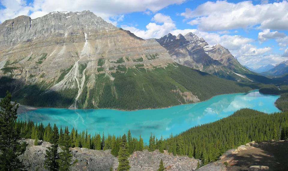



The Canadian Rockies are a chain of national parks in western Alberta and eastern British Columbia, and Banff is the doorway. Within a two-hour drive of Calgary you get glacier-fed turquoise lakes, a mountain town with hot springs, a road lined with ice fields and, if you keep going, the quieter town of Jasper. Banff National Park, created in 1885, is Canada's oldest national park, and the surrounding parks share a UNESCO World Heritage listing.
This Banff travel guide covers the places that earn their reputation (Lake Louise, Moraine Lake, the Icefields Parkway), the day hikes sorted by effort, how wildlife safety actually works, which pass you need and how to handle shuttles and parking. It also compares the seasons and lays out a road-trip route from Calgary to Jasper. For the wider country, start with our travel guide to Canada.
Banff Town: The Base for the Rockies
Banff sits in the Bow Valley, about 130 km west of Calgary, ringed by peaks that seem too close to be real. The main street, Banff Avenue, is a tidy run of restaurants, outfitters and souvenir shops with Cascade Mountain filling the view at its far end. It is busy in summer and unapologetically touristy, but it is also the most practical base in the region.
A few things are worth your time even on a short stay. The Banff Upper Hot Springs let you soak with a mountain view, the gondola on Sulphur Mountain gives a quick overview of the valley, and the Cave and Basin National Historic Site marks the hot spring discovery that led to the park's creation. Lake Minnewanka and the Bow Falls viewpoint are both a few minutes from town.
Why Banff Works Without a Car
Roam Transit, the regional bus network, links the town with Lake Louise and several trailheads in season, and Banff's own local routes cover the hot springs and gondola. You will still want a car for the Icefields Parkway and the less-visited valleys, but you can see a lot of the highlights without one.
Lake Louise and Moraine Lake
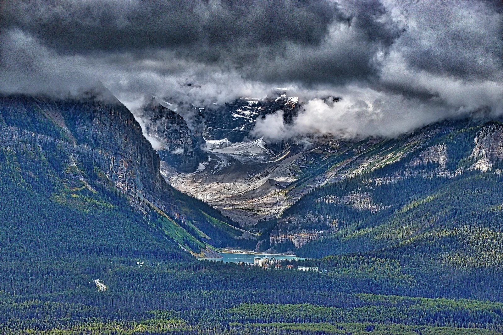
Lake Louise is roughly 55 km northwest of Banff. The lake is a deep milky green because of glacial rock flour, and the Victoria Glacier closes off the far end. It is a lovely sight, but the lakeshore is also a crowd, so arrive early or late and walk a little farther than everyone else.
Moraine Lake Access Rules
Moraine Lake, set below the Valley of the Ten Peaks, is the most photographed spot in the park, and the narrow road to it is managed accordingly. In recent seasons it has been closed to ordinary private vehicles and open to Parks Canada shuttles, Roam Transit, authorized commercial operators and visitors with an accessibility permit. The road is seasonal and closes for winter.
The systems for tickets and bookings change, so do not rely on a blog, including this one. Check the Banff National Park page on Parks Canada for how to reach Moraine Lake and Lake Louise before you build your itinerary around either.
Parking and Shuttles at the Lakes
Parking at Lake Louise fills early on summer days, often before mid-morning, and the lots can close until spaces free up. The easier plan is to use the shuttle or the public bus, or to arrive at sunrise. If you are driving, build in a fallback: a different hike, or a stop at Peyto Lake, if the lots are full.
Banff Hikes by Difficulty
Distances and elevation gains below are approximate and rounded. Trail closures, conditions and group rules vary, so confirm them with Parks Canada or a visitor centre on the day.
| Level | Hike | Where | What to expect |
|---|---|---|---|
| Easy | Lake Louise lakeshore | Lake Louise | A flat walk along the water, about 2 km each way, with the glacier ahead |
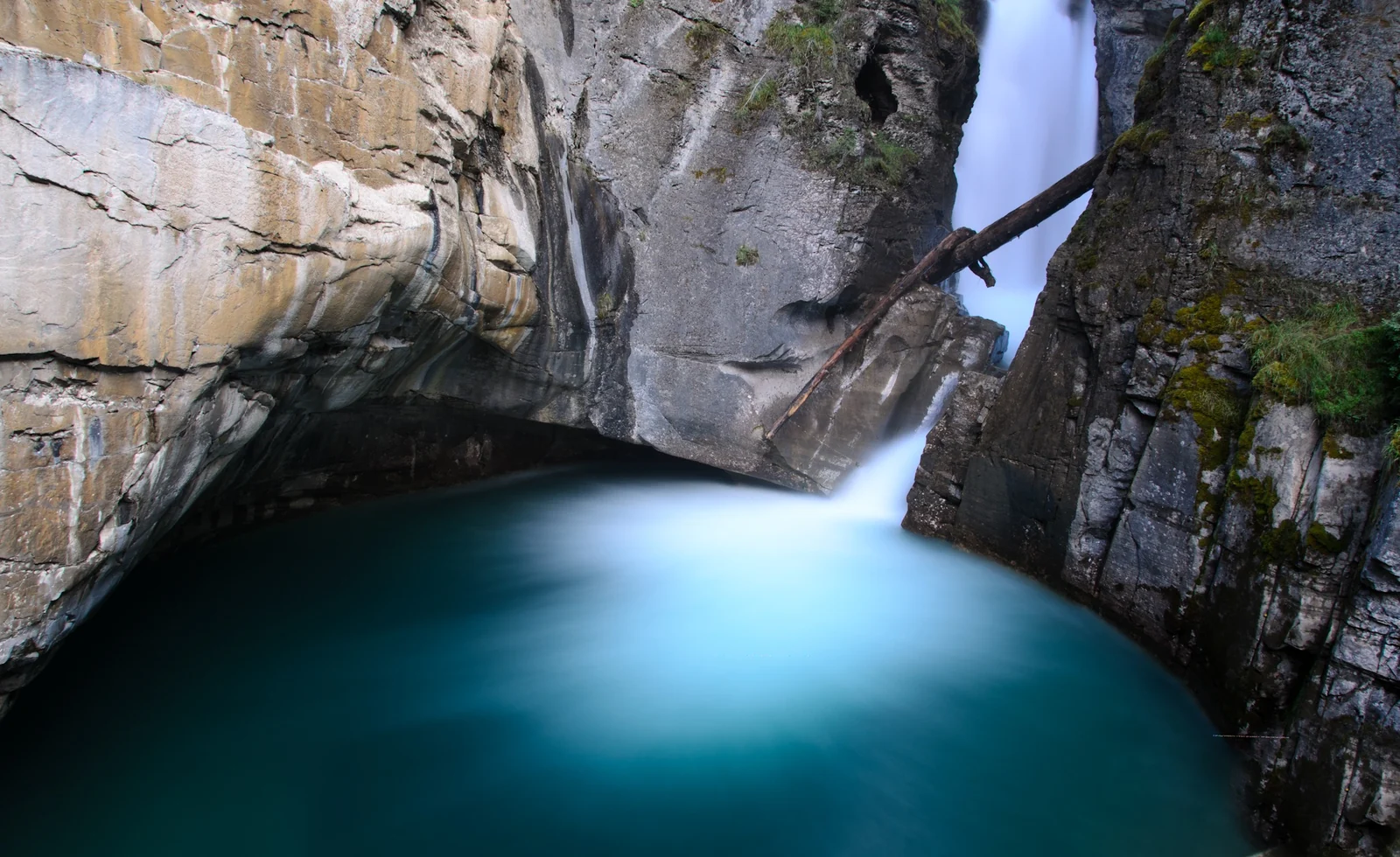
| Easy | Johnston Canyon to the Lower Falls | Bow Valley Parkway | Catwalks bolted to the canyon wall, a short walk to the first waterfall |
| Easy | Emerald Lake loop | Yoho National Park | A lakeside circuit of about 5 km, mostly flat |
| Moderate | Lake Agnes Tea House | Lake Louise | A steady climb of roughly 3.5 km each way to a mountain tea house |
| Moderate | Plain of Six Glaciers | Lake Louise | Longer and more open, ending at a tea house below the ice |
| Moderate | Johnston Canyon to the Ink Pots | Bow Valley Parkway | Beyond the Upper Falls, the trail opens into a meadow with cold springs |
| Hard | Larch Valley and Sentinel Pass | Moraine Lake | A steep switchbacking climb that is famous in the larch season |
| Hard | Sulphur Mountain or Cory Pass | Banff | Big elevation gains; Cory Pass is a demanding loop with exposed sections |
Johnston Canyon
Johnston Canyon is the easiest way to feel like you are inside a mountain. Walkways cling to a limestone gorge, and the Lower Falls are about a 1 km walk from the start. The Upper Falls lie roughly 2.7 km in, and the Ink Pots farther still. It gets very crowded in summer, so go early or on a weekday, and in winter bring microspikes for the icy sections.
The Icefields Parkway
The Icefields Parkway (Highway 93) runs about 230 km between Lake Louise and Jasper, and it is one of the great mountain drives anywhere. There are no towns on the route, only a few services, so fill the tank and carry snacks. Pull-outs are frequent, and you will want to use most of them.
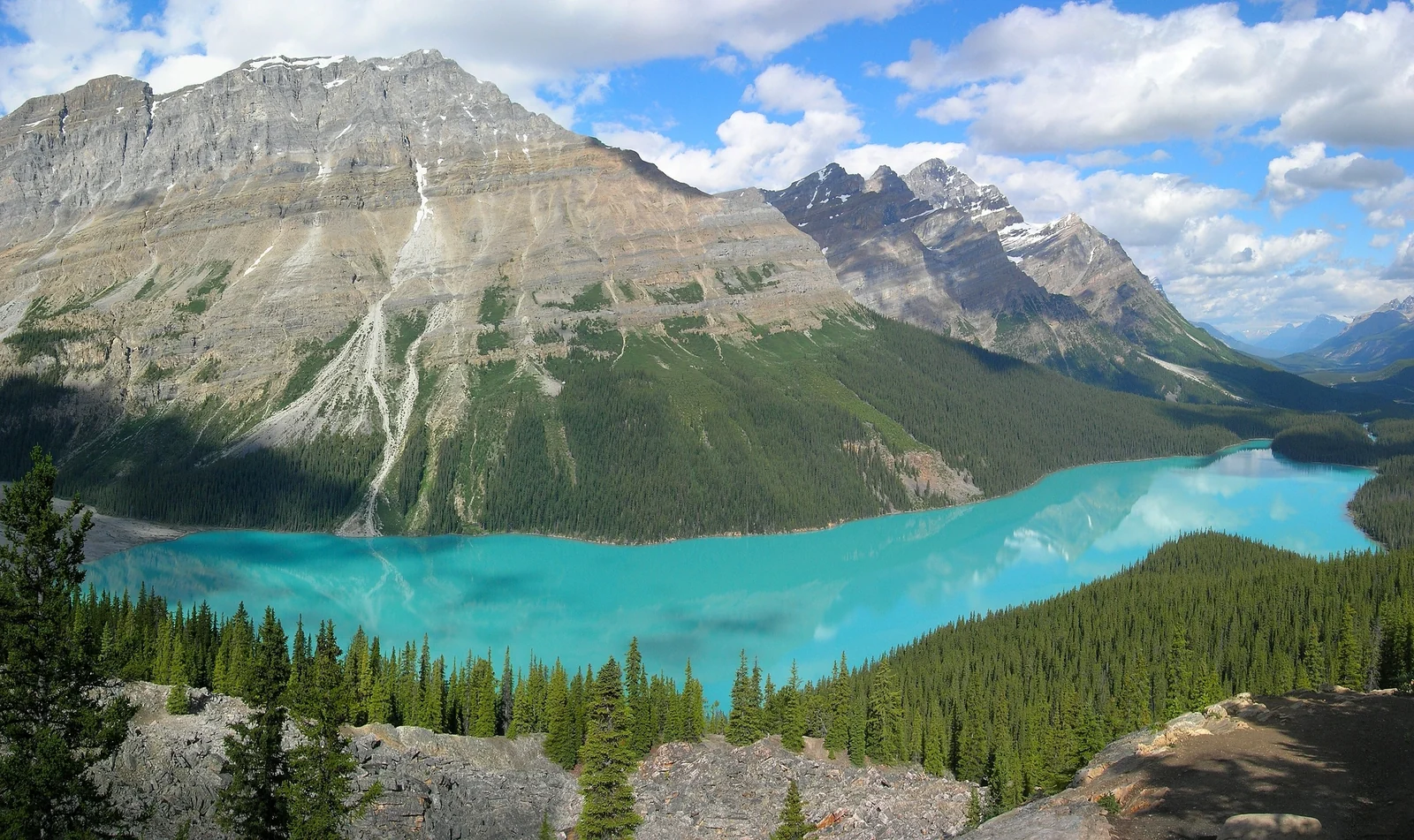
- Bow Lake and Peyto Lake: Bow Lake is right by the road. Peyto Lake needs a short uphill walk from the Bow Summit parking area to a viewpoint, and the brilliant blue water is worth the climb.
- Columbia Icefield: the largest ice field in the Canadian Rockies, with the Athabasca Glacier reachable from the road. Guided glacier trips run in season.
- Athabasca Falls and Sunwapta Falls: powerful waterfalls near the Jasper end, both a short walk from the parking lots.
- Time: without stops the drive is a few hours, but plan for a full day with stops, which is the point.
Winter driving is a different proposition. Parks Canada requires winter tires or chains on the parkway for part of the cold season, and conditions can close the road without warning. Check the official road report before you set out, and do not treat the parkway as a shortcut.
Jasper, Yoho and Kootenay
Jasper
Jasper National Park is larger, wilder and quieter than Banff, with a town that feels more like a working mountain community. Maligne Lake and its boat trips to Spirit Island are the headline, while Pyramid Lake and Athabasca Falls fill an easy day. Wildfire has affected the area in recent years, so check the park's current status for the town, trails and services before you commit.
Yoho and Emerald Lake
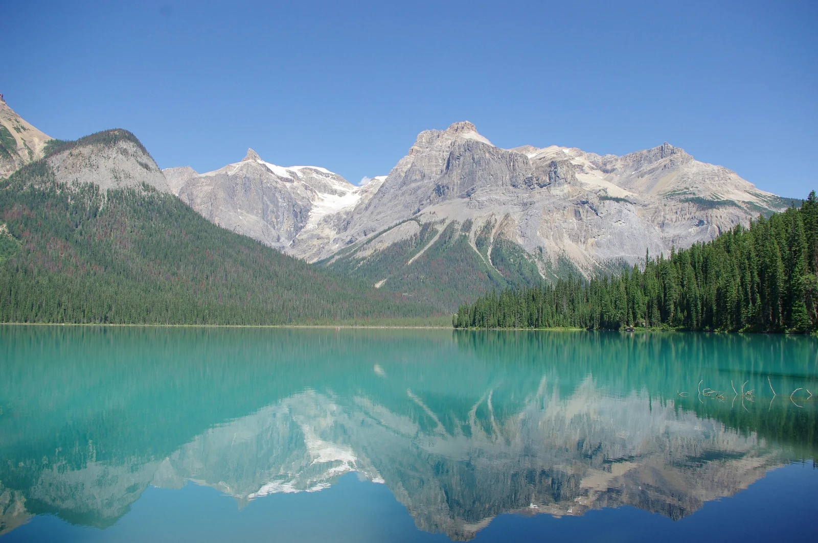
Yoho National Park lies across the border in British Columbia, about 30 minutes from Lake Louise by road. The word is a Cree expression of awe, and the park earns it. Emerald Lake is the star, an easy loop and a canoe rental spot, while Takakkaw Falls, among Canada's tallest, falls from a hanging valley on a seasonal road.
Kootenay
Kootenay National Park, south of Lake Louise, is the quiet one. Marble Canyon is a short walk through a narrow gorge, the Paint Pots are ochre-colored mineral springs, and the road ends at Radium Hot Springs. It makes a good loop back to Banff if you want to avoid driving the same road twice.
Wildlife Safety: Bears and Elk
Black bears and grizzlies live throughout these parks, and so do elk, bighorn sheep, moose and wolves. Almost every incident involves someone getting too close. The rules are simple, and worth following to the letter.
- Keep your distance. Parks Canada asks you to stay at least 100 m from bears and 30 m from elk and other large animals. Elk can be dangerous, especially in the autumn rut and when calves are young.
- Carry bear spray on any hike, keep it on your belt rather than in your pack, and know how to use it before you need it.
- Make noise on blind corners and near streams, and hike in a group where you can.
- Never feed or approach wildlife. If an animal is on the road, stay in the vehicle and keep moving.
- Pack food carefully. Do not leave food in a parked car and use the bear-proof bins.
Read the trail closure and warning notices at the trailhead. Areas are sometimes closed or restricted to groups for wildlife reasons, and the notices are there for a reason.
Park Passes, Shuttles and Parking
Stopping in a Canadian national park requires a valid pass. You can buy a daily pass or an annual Discovery Pass, which covers all the national parks in the country and usually pays off on a longer trip. Passes are available online and at park gates and visitor centres, and you should display yours in the vehicle. The official Parks Canada site lists current fees and what the pass covers.
For parking, the golden rule is to go early. Lake Louise, Johnston Canyon and the Banff town lots all fill up in summer. Consider the Roam Transit buses, which run to several of the busiest trailheads, and treat the shuttle to Moraine Lake as part of your plan rather than a last-minute fix.
Best Time to Visit the Canadian Rockies
| Season | Best for | Watch out for |
|---|---|---|
| Summer (July to August) | Open trails, long days, canoeing, the full Icefields Parkway | Crowds, full parking lots, higher prices; some high trails hold snow into early summer |
| Early fall (late September) | Golden larches, clear air, fewer crowds | A short window, cold mornings, and early snow on high trails |
| Winter (December to March) | Skiing, frozen waterfalls, northern lights, quiet lakes | Short days, cold, winter tires and some seasonal closures, including Moraine Lake |
| Spring (April to June) | Wildlife on the move, lower prices | Mud, closed high trails and variable road conditions |
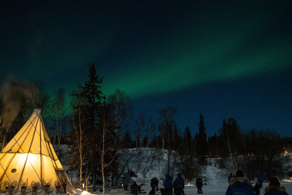
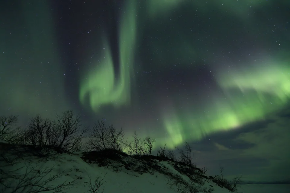
If you can choose one window, I would pick late September. The larches, a conifer that turns gold before dropping its needles, light up the high valleys, and the summer crowds thin out. The catch is that the color peaks briefly and varies by elevation, so keep your dates flexible. Winter has its own appeal, and the clear, dark skies can bring auroras; our guide to aurora hunting in Canada explains how to plan for them.
Road-Trip Route: Calgary to Jasper
Fly into Calgary, pick up a car and head west on the Trans-Canada Highway. This route covers the highlights in about a week, with room to stretch or trim.
- Calgary to Banff (days 1 to 2): about 1.5 hours by road. Settle in, soak at the hot springs and walk Johnston Canyon.
- Banff to Lake Louise (days 3 to 4): use the lakes as your anchor, with a tea house hike and a sunrise at one of the lakes.
- Day trip to Yoho (day 5): Emerald Lake and Takakkaw Falls, or loop back via Kootenay.
- Icefields Parkway (day 6): Peyto Lake, the Columbia Icefield and the falls on the way to Jasper.
- Jasper (day 7): Maligne Lake, then fly or drive on. Drivers can return to Calgary the same way or continue west.
Prefer to keep going? The route connects to bigger Canadian trips, and our Canada travel guides and the best places to watch the northern lights have more ideas.
Where to Stay in the Rockies
Accommodation is limited by park rules, so it books out and gets expensive in summer. Reserve early, and choose your area before the property.
- Banff town: the most choice for restaurants, transit and evenings out. Best for a first visit and for car-free travelers.
- Canmore: just outside the park gate, usually a better value than Banff, with a local feel and quick access.
- Lake Louise village and the lakeshore: closest to the lakes and the early-morning light, but pricey and quiet after dark.
- Jasper town: a good base for the north end, and the end point of the Icefields Parkway.
- Campgrounds and hostels: a cheaper way to stay near the trails, though campsites often need booking well in advance.
Banff and Canadian Rockies FAQ
How many days do you need in Banff and the Canadian Rockies?
Three days cover Banff, Lake Louise and a hike. Five to seven days let you add Yoho, the Icefields Parkway and Jasper without rushing. If you can only manage a long weekend, stay around Banff and Lake Louise.
Can you drive to Moraine Lake?
In recent seasons the road has been closed to ordinary private vehicles, with access by shuttle, public bus and authorized tours. Rules and booking systems change, so check the Parks Canada website before you plan the day.
Do you need a pass for Banff National Park?
Yes, if you stop in the park you need a valid Parks Canada pass, either a daily pass or an annual Discovery Pass. Display it in your vehicle and check the official site for current fees.
When is the best time to see the larches?
Usually the last week of September, though it varies with the weather and the elevation. The color peaks briefly, so watch local trail reports and keep your dates flexible if you can.
Is bear spray necessary on Banff hikes?
It is strongly recommended on any trail. Carry it where you can reach it quickly, practice with the safety clip, and combine it with the other precautions: noise, groups and distance.
How far is the Icefields Parkway?
It is about 230 km from Lake Louise to Jasper. Driving straight through takes a few hours, but with stops at lakes, glaciers and waterfalls you should plan a full day.
Can you visit Banff without a car?
Yes. Calgary airport shuttles and buses reach Banff, and Roam Transit connects the town with Lake Louise and some trailheads. A car makes the Icefields Parkway and remote trails much easier.