


Namibia is one of the best countries in Africa for a self-drive trip: huge empty landscapes, wide gravel roads, wildlife you can watch from your own car, and a tourism system built around lodges, campsites and national parks. The classic route links Windhoek with the red dunes of Sossusvlei, the Atlantic town of Swakopmund and the waterholes of Etosha National Park, with Fish River Canyon as an add-on in the south.
The catch is distance. Namibia is large and thinly populated, so every highlight is several hours apart and fuel, water and daylight need planning. This Namibia travel guide explains the route, what to see at each stop, how to handle gravel roads, when to go and what to watch for on safety. For other African trips, browse our Namibia guides or the wider Africa section.
A Classic Namibia Self-Drive Route
Most visitors fly into Windhoek, collect a rental car and drive a loop through the center and west of the country. Two weeks is comfortable. Ten days works if you skip the south. The table below shows a sensible order and how long each stop deserves.
| Stop | Why go | Suggested nights |
|---|---|---|
| Windhoek | Arrival, supplies, car pick-up | 1 |
| Sossusvlei and Sesriem | Giant dunes, Deadvlei, Sesriem Canyon | 2 |
| Swakopmund and Walvis Bay | Coast, desert activities, seafood | 2 to 3 |
| Cape Cross and the southern Skeleton Coast | Seal colony, shipwreck coastline | Day trip or 1 |
| Etosha National Park | Waterhole wildlife on self-drive | 3 to 4 |
| Fish River Canyon (optional) | One of Africa's great canyons | 1 to 2, with extra driving |
Most of this loop follows tarred main roads, with gravel on the side routes to lodges and into the dunes. Fish River Canyon sits far to the south, so it fits best on a separate trip or as an out-and-back extension from Sossusvlei if you have time to spare.
Windhoek: Arrival and Preparation
Windhoek is a calm, tidy capital and a practical place to start. Spend your first night here to recover from the flight, pick up the car, buy groceries and water, and change money if you need cash. Fuel stations get less frequent once you leave the main roads, so fill the tank before every long leg.
Namibia drives on the left. If you are not used to that, spend the first hour on quiet suburban streets before you head onto the highway. Many rental companies offer a short briefing, a second spare tire and a satellite phone or tracker as options. Take them seriously.
Sossusvlei and Deadvlei: Namibia's Famous Dunes
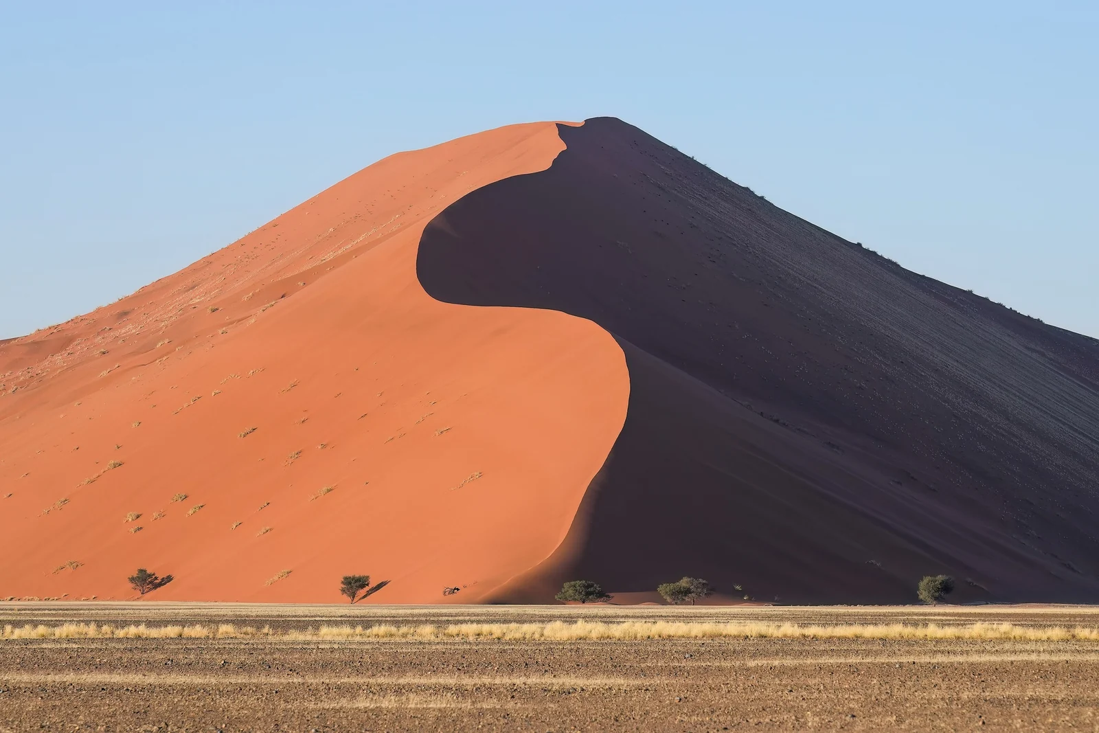
Sossusvlei lies in the Namib-Naukluft area of the Namib Desert, and it is the image most people have in mind when they picture Namibia. The surrounding dunes are part of the Namib Sand Sea, which UNESCO added to the World Heritage List in 2013. The base for visiting is Sesriem, where the park gate and several lodges and campsites cluster.
Dune 45, Big Daddy and the Road In
From Sesriem a paved road of roughly 60 km runs into the dunes. Dune 45 sits about 45 km along it and is the easy sunrise climb, around 80 meters high. Big Daddy, at roughly 325 meters, is the tallest dune in the area and a much harder walk on soft sand. The last stretch toward Sossusvlei itself is deep sand, so you either park and take the shuttle or walk, unless you have a 4x4 and experience.
Deadvlei and the Best Timing
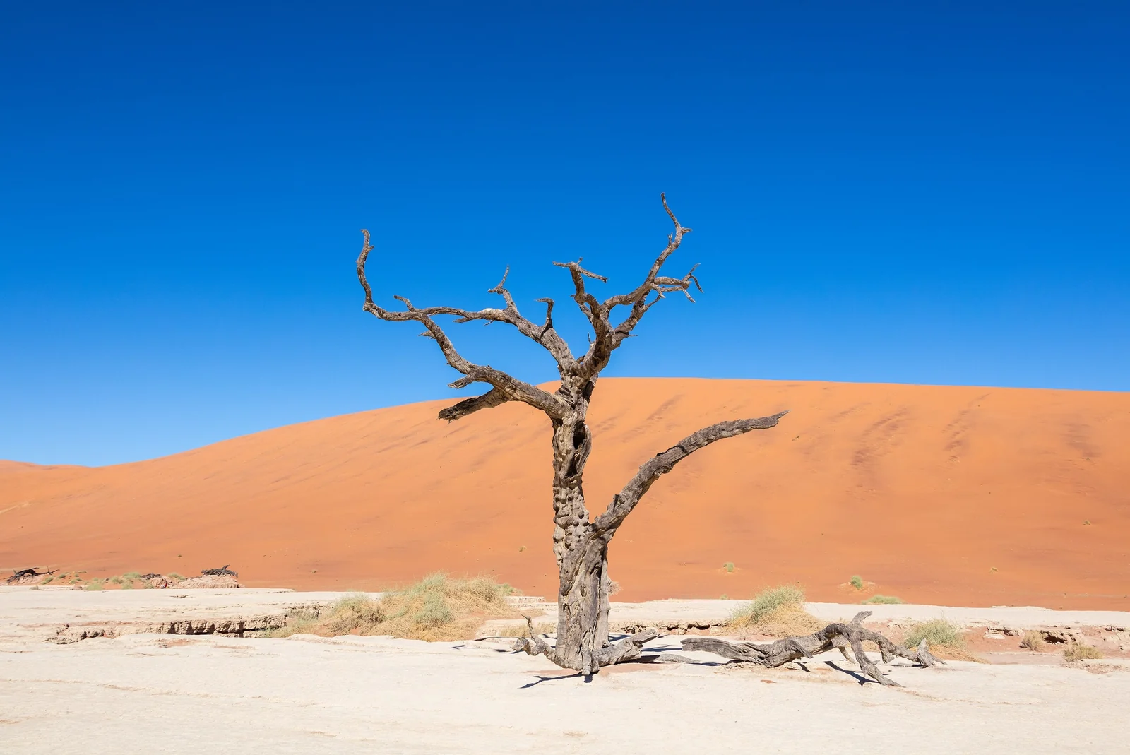
Deadvlei is a white clay pan ringed by orange dunes, scattered with the blackened skeletons of camel thorn trees. The trees died when the river that fed the pan was cut off by shifting dunes, and the dry air has preserved them for centuries. Walk across the sand from the parking area and go early, because the light is softest and the heat is manageable.
Gate opening times follow sunrise and sunset, which changes by season, so check the current hours and fees on the Namibia Wildlife Resorts website. Staying inside the Sesriem area lets you be among the first through the gate. Bring water, a hat and shoes you can empty of sand.
Sesriem Canyon
A short drive from the gate, Sesriem Canyon is a narrow gorge cut by the Tsauchab River. It makes a good midday stop when the dunes are too hot, and the cool rock walls are a nice contrast to the open desert.
Swakopmund and Walvis Bay: Coast, Fog and Adventure
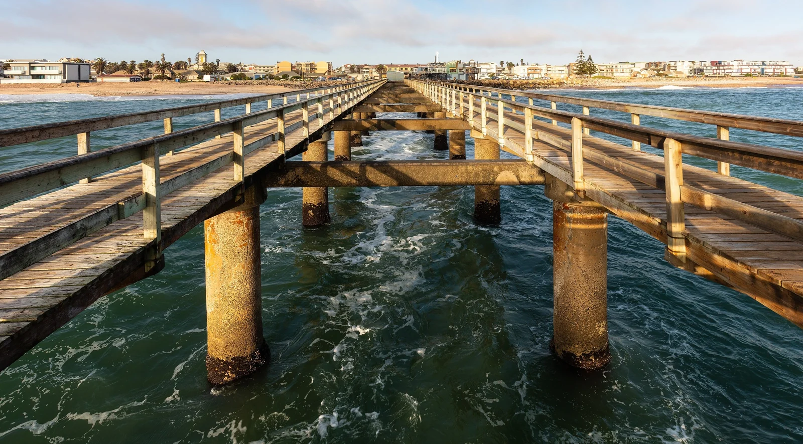
Swakopmund was founded in 1892 as the main harbor of German South West Africa, and it still feels more like a European seaside town than an African city. It lies about 352 km west of Windhoek along the B2 road. Colonial buildings such as the Woermannhaus, dated to 1906, line the streets, and the sea air is cool because of the Benguela Current. Fog is common on the coast and can drift well inland, so pack a light jacket even in summer.
Things to Do around Swakopmund
Swakopmund is the country's adventure hub. Typical activities include sandboarding and quad biking on the dunes, skydiving, camel rides and scenic flights over the desert. Many are weather dependent, so keep a spare day. If you prefer something slower, walk the jetty, visit the museum or take a guided desert tour to learn about the small animals that live in the dunes.
Walvis Bay
Walvis Bay is Namibia's main port, a short drive south of Swakopmund. Boat trips from here go out to see seals and dolphins, and the lagoon is known for flamingos. It is a useful stop if you want wildlife without leaving the coast.
Cape Cross and the Skeleton Coast
The Skeleton Coast runs for roughly 500 km along Namibia's northern Atlantic edge, from the Kunene River down to the Swakop River. Cold ocean currents breed thick fog, which has caught many ships over the centuries. The wrecks lie scattered along the shore, and parts of the coast are protected as the Skeleton Coast National Park, which covers around 16,000 square kilometers from the Ugab River north to the Kunene.
Most self-drivers see only the southern end. Head north from Swakopmund to Cape Cross, a headland that is home to one of the largest Cape fur seal colonies in the world. Expect noise, crowds of animals and a strong smell. Check conditions on arrival, and keep your distance from the seals. The remote northern sections of the Skeleton Coast need special arrangements and are usually visited with a tour operator or on a fly-in trip rather than in a rental car.
Etosha National Park: Self-Drive Safari
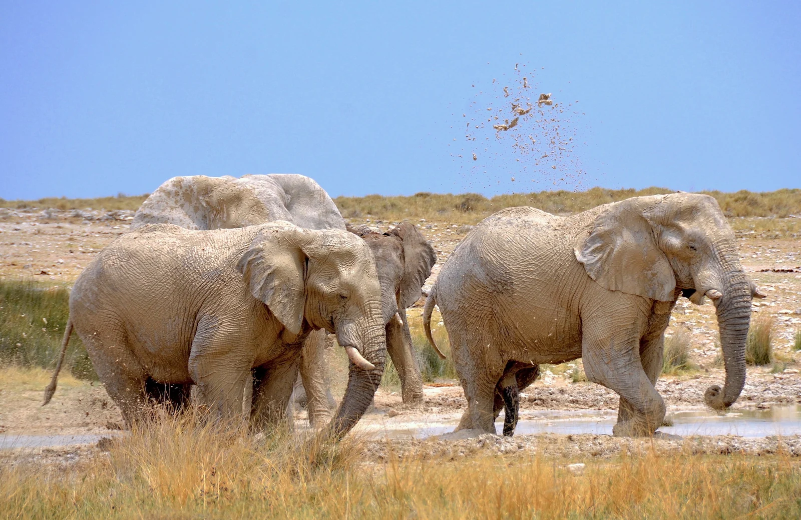
Etosha was first proclaimed as a game reserve in 1907 and became a national park in 1967. It covers about 22,270 square kilometers, and the vast Etosha Pan, roughly 4,760 square kilometers of salt and clay, dominates the landscape. It is one of the easiest places in Africa to watch wildlife on your own, because animals gather at waterholes along the park roads.
What You Can See
Etosha is home to elephants, lions, leopards, cheetahs, giraffes, zebras and both black and white rhinos. Sightings are never guaranteed, but the dry months from roughly May to September are the best time because animals depend on the waterholes. Spend time at one spot instead of racing between them. Often the best sightings come from patience.
Rest Camps and Waterholes
Three main rest camps sit inside the park: Okaukuejo, Halali and Namutoni. Okaukuejo and Namutoni are known for their waterholes, which many visitors watch after dark under floodlights. Book early, since camps fill up in the dry season, and use the Namibia Wildlife Resorts page for current rates and park rules. Stay on marked roads, keep inside the car except at designated points and leave the park before the gates close.
Fish River Canyon in the South
Fish River Canyon is one of the largest canyons on the planet, about 160 km long, up to 27 km wide and nearly 550 meters deep. It is commonly described as the biggest canyon in Africa. The main viewpoint sits near Hobas, and sunrise and sunset are the best times to look down into the gorge.
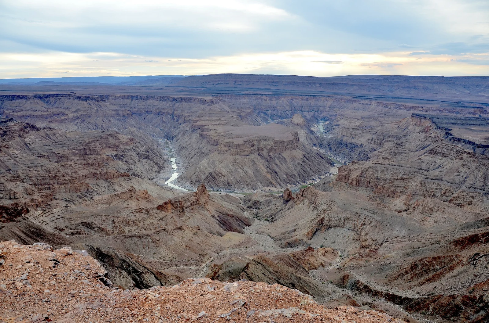
Experienced hikers can walk the canyon floor on a trail of about 90 km that usually takes five days. It is only open in the cooler winter months, with permits issued from around May to mid-September, and it needs advance booking and good fitness. If you prefer comfort, the hot springs resort at Ai-Ais at the lower end offers a good place to recover. Add at least two extra driving days from the central part of the country.
Gravel Roads and Driving Tips
Most of Namibia's road network is gravel, and even popular routes to lodges are unpaved. Gravel is easy to drive once you adapt, but it punishes impatience.
- Go slower than you think you need to. Loose gravel means longer braking distances. Corners and crests are where most rollovers happen.
- Never swerve hard. If a tire slips onto the soft edge, lift off gently and steer straight instead of yanking the wheel.
- Check the spares. Confirm that you have two usable spare tires, a jack and a wheel brace, and that you know how to use them.
- Refuel often. Top up whenever you pass a fuel station on longer stretches, and carry extra water.
- Avoid driving at dusk and after dark. Livestock and wildlife wander onto roads, and visibility is poor.
- Keep your distance on dust. Oncoming traffic throws up clouds on gravel, so slow down and give other vehicles space.
Phone coverage vanishes outside towns. Download offline maps before you leave, tell your lodge when to expect you and, if your rental offers it, take the tracker or satellite phone.
Best Time to Visit Namibia
Namibia is a dry country, and most travel happens in the cooler dry season. The best time depends on what matters most to you.
| Season | What to expect | Best for |
|---|---|---|
| May to September | Dry, sunny days and cold nights, especially in the desert | Etosha wildlife, hiking Fish River Canyon, comfortable dune walking |
| October to November | Hot and dry, building toward the rains | Fewer visitors, strong light, but high heat |
| December to March | Main rainy period, warm and green, with occasional storms | Birdwatching and lush landscapes; some gravel roads can become difficult |
| April | Rains fade and the country is green | Quiet roads and good light |
If you only have one trip, aim for the dry months, when wildlife is easiest to find and roads are more reliable. Rain can arrive suddenly in the wetter season and turn dry riverbeds into dangerous crossings, so never drive into flowing or flooded water.
Safety and Practical Advice
Namibia is generally considered one of the more relaxed destinations in southern Africa for visitors, but sensible precautions still apply. The biggest risks are not crime but roads, heat and remoteness.
- City precautions: keep valuables out of sight in parked cars and avoid walking alone at night in Windhoek and other towns.
- Heat and water: carry more water than you think you need, especially on dune walks, and use sun protection.
- Wildlife: never leave your vehicle outside permitted areas in parks, and do not approach wild animals.
- Health: ask a travel clinic about vaccines and malaria precautions before going, particularly if you plan to visit the north.
- Entry rules: requirements change, so check your government's travel advice and the official Namibian immigration information before booking.
Book accommodation well ahead for Sossusvlei, Swakopmund and Etosha in the dry season, since lodges and campsites in the best spots fill early. Hoping to combine Namibia with South Africa? Our Cape Town travel guide covers the usual flight connection, and our Kenya safari guide shows how a different safari region compares. For broader inspiration, read the wonders of Africa.
Namibia Travel FAQ
How many days do you need for a Namibia road trip?
Ten days covers Windhoek, Sossusvlei, Swakopmund and Etosha at a steady pace. Two weeks is more comfortable and allows an extra night at each stop. Adding Fish River Canyon needs several more days because of the long drive south.
Is it safe to self-drive in Namibia?
Yes, many visitors do it every year. The main hazards are gravel roads, long distances, heat and animals on the road. Drive slowly on gravel, avoid night driving, carry spare tires and water, and plan fuel stops ahead.
Do you need a 4x4 in Namibia?
Not for the classic route. A sturdy two-wheel-drive car or SUV handles most main roads and the paved road to Sossusvlei. A 4x4 helps on remote tracks and in deep sand, but you can use the shuttle at Sossusvlei instead.
What is the best time to visit Namibia?
The dry months from roughly May to September are best for most travelers. Etosha wildlife gathers at waterholes, days are sunny and nights are cool. The wetter months bring green landscapes but more difficult roads.
Can you see Sossusvlei without an overnight stay nearby?
It is possible but hard. The park gate opens around sunrise, and the best light comes early. Staying at or near Sesriem lets you get there first, so most travelers book at least one night in the area.
Is Etosha good for a self-drive safari?
Yes. Roads link the waterholes, and animals come to you, so you can watch from your own car. Visit during the dry season, stay in the car except in marked areas and spend time at waterholes rather than rushing.
Can you hike Fish River Canyon?
Yes, but only in the cooler months, with permits issued from about May to mid-September. The trail is roughly 90 km and takes about five days, so it needs advance booking, fitness and self-sufficiency. Viewpoints at the rim need no hike.