


The best Iceland Ring Road itinerary takes 7 to 10 days and follows Route 1, a paved loop of about 1,322 kilometers (820 miles) around the island. Along the way you pass the Golden Circle, the waterfalls and black beaches of the south coast, the glacier lagoon at Jökulsárlón, the East Fjords, the Mývatn lava country and the northern town of Akureyri.
Seven days works if you drive hard and accept some long days at the wheel. Ten is far more comfortable, with time for a hike, a hot spring and the odd detour. Below you will find a day-by-day route, the driving rules that trip people up, what changes with the seasons, and a realistic view of when the northern lights show. For the wider picture, start with our Iceland travel guides.
How Long Do You Need for the Ring Road?
The loop is not long on paper, but Iceland punishes rushed plans. Weather closes passes, sheep and photo stops eat hours, and the best sights sit several kilometers off the main road. Here is how the options compare.
| Trip length | Pace | What you can realistically do |
|---|---|---|
| 7 days | Fast, 3 to 5 hours of driving most days | Golden Circle, south coast to Jökulsárlón, East Fjords, Mývatn, Akureyri; few extra stops |
| 8 to 9 days | Balanced | The same route plus a glacier hike and Goðafoss at an easy pace |
| 10 days | Relaxed | Add Dettifoss, a whale-watching trip from the north and a day on the Snæfellsnes peninsula or around Reykjavík |
Most travelers drive counterclockwise, starting with the south coast, because the famous sights come early and the long, emptier stretches come when you are warmed up. Either direction works. What matters is to pick one and not backtrack.
Days 1 and 2: Reykjavík and the Golden Circle
Most international flights land at Keflavík, about 45 minutes from Reykjavík by road. Pick up the car, spend a few hours in the capital if you are fresh, and save the big driving for the next morning. The Golden Circle is a loop of roughly 230 kilometers that links three stops, and it is an easy first day because the distances are short.
Thingvellir National Park
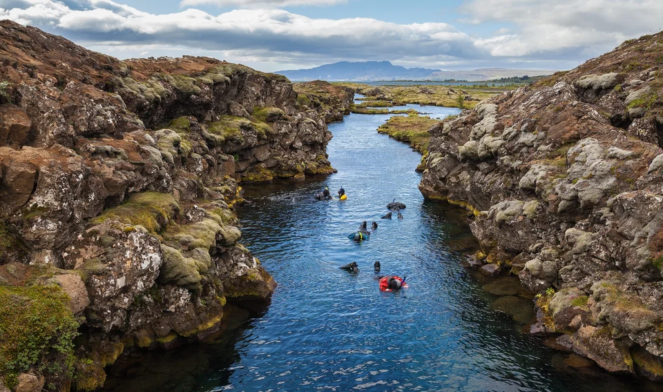
Þingvellir is where Iceland's parliament, the Althing, first met around 930, and it sits on the rift where the North American and Eurasian tectonic plates pull apart. The park was inscribed as a UNESCO World Heritage Site in 2004. Walk down the Almannagjá gorge for the clearest view of the rift, then look at the lake beyond.
Geysir and Gullfoss
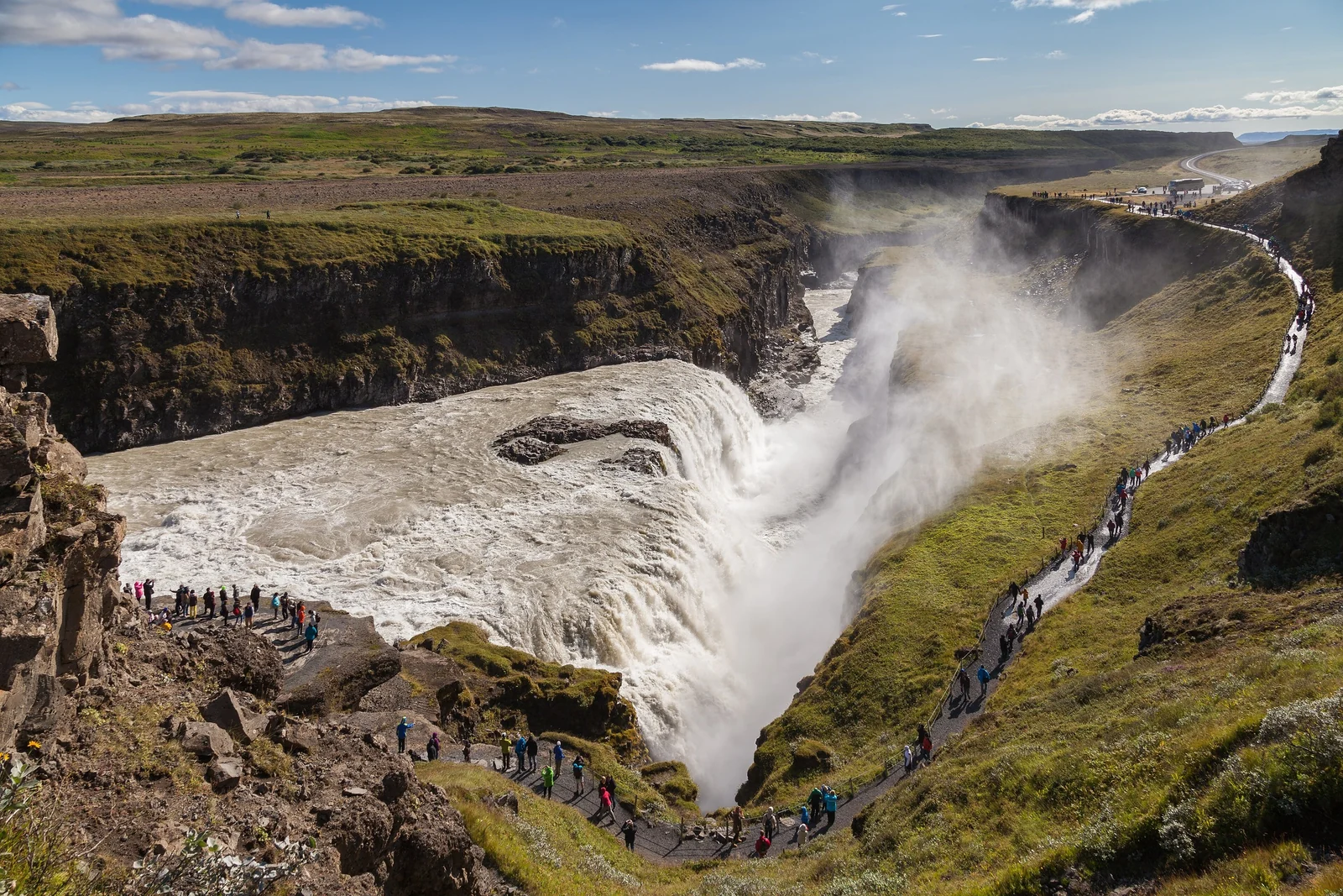
At the Geysir geothermal area, the original Geysir is rarely active, but its neighbor Strokkur erupts every few minutes, shooting water well above the surrounding steam. Wait beside the pool and watch for the bulge of blue water just before it goes. Gullfoss, a short drive on, is a wide river dropping in two stages into a narrow canyon. The spray is heavy, so bring a waterproof jacket even on a clear day.
Sleep somewhere around Selfoss or Hella, which puts you on Route 1 and a head start on day two. If you are weighing Iceland against other far-north trips, our comparison of Svalbard, Lofoten or Iceland may help you decide.
Days 2 and 3: South Coast Waterfalls and Black Sand
The south coast is the most photographed stretch of the Ring Road, and for good reason. Waterfalls, volcanoes, glaciers and black beaches all line up within a couple of hours of driving. It is also the busiest part, so start early.
Seljalandsfoss and Gljúfrabúi
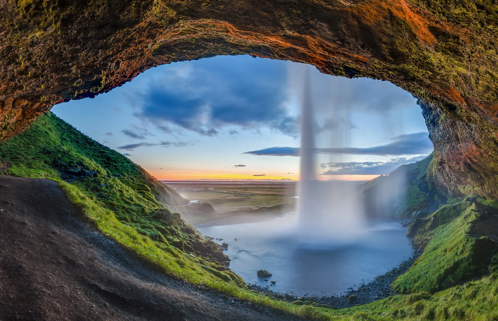
Seljalandsfoss drops about 60 meters, and a path loops behind the curtain of water, so you can see it from the inside. The trail is wet and slippery, which makes a rain shell and shoes with grip essential. A short walk along the cliff leads to Gljúfrabúi, a smaller fall hidden in a narrow cleft. You wade in a stream to look into it.
Skógafoss
Skógafoss is a straight, broad curtain of water about 60 meters high, and you can walk right up to the pool at its base. A staircase on the side climbs to a viewing platform and, beyond it, the start of the Fimmvörðuháls trail. Most visitors stop at the top for ten minutes. If you have the legs, the first kilometer or two along the river above the falls shows a string of smaller cascades with almost nobody around.
Reynisfjara and Vík
Reynisfjara is a black volcanic beach with basalt columns, a cave and the Reynisdrangar sea stacks offshore. It is also dangerous. Sneaker waves surge much further up the sand than they appear to, and people have been swept out. Stay well back from the waterline, never turn your back on the sea, and read the warning signs and the light system at the entrance.
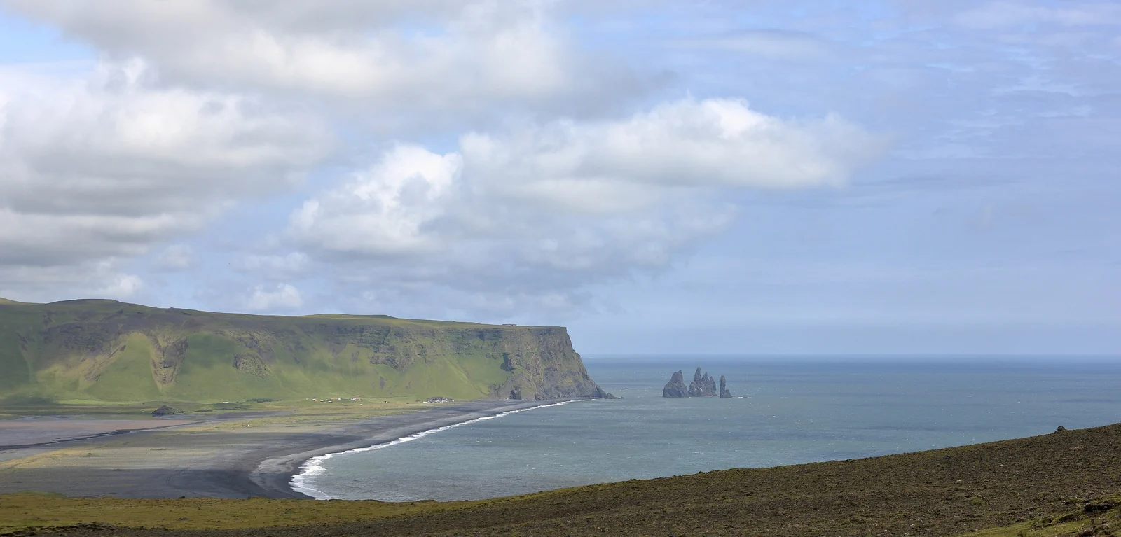
The village of Vík just down the road has a café, a supermarket and plenty of guesthouses, so it makes a natural overnight stop. Dyrhólaey headland gives the best view back over the beach.
Days 4 and 5: Vatnajökull and Jökulsárlón Glacier Lagoon
East of Vík the land turns to lava fields and moss, then to the vast black outwash plains below Vatnajökull, Europe's largest glacier by volume. Plan a stop at Skaftafell in Vatnajökull National Park, where short trails lead to the Svartifoss waterfall and its hexagonal basalt columns, or up to a view over a glacier tongue.
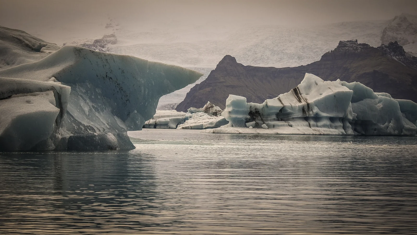
Jökulsárlón is the highlight. Icebergs calve off the Breiðamerkurjökull glacier and drift across the lagoon toward the sea, in shades from white to deep blue. Boat tours run on the lagoon in the warmer months, and a short stretch of black sand across the road, known as Diamond Beach, is scattered with ice chunks that wash ashore. Go early or late in the day when light is soft and fewer tour buses are parked.
Guided glacier hikes and ice cave tours depart from this area. Ice caves in the natural glacier are generally a winter activity, because they are only safe when meltwater is low, so book with a licensed operator and follow their advice. Höfn, about an hour farther east, is a good base with decent restaurants.
Days 6 and 7: The East Fjords
The East Fjords are the quiet part of the loop. The road threads in and out of steep inlets, climbs over mountain passes and passes small fishing villages such as Djúpivogur and Seyðisfjörður. Many visitors rush through. That is a mistake, because this is where you can slow down and see reindeer, hike without a crowd and eat in a village with five houses and a very good fish soup.
Seyðisfjörður, reached by a mountain road from Egilsstaðir, is the prettiest of the fjord towns, with painted wooden houses and a ferry link to Europe. If time is tight, drive straight from Höfn to Egilsstaðir and use the saved hours for the north.
Days 7 and 8: Mývatn, Dettifoss and Goðafoss
Between Egilsstaðir and Akureyri the road crosses a high, empty plateau and drops into the volcanic Mývatn area. This is the geothermal heart of the north. You will see Hverir, a field of boiling mud pots and steaming vents that smells of sulfur, the Dimmuborgir lava formations, and the pseudocraters at Skútustaðir. The Mývatn Nature Baths offer a geothermal soak.
A detour to Dettifoss is worth the time. It is often described as the most powerful waterfall in Europe by volume, a brown, thundering wall of glacial water. Check road conditions before you go, since the approach roads can close or turn rough outside summer. On the way west, Goðafoss, the waterfall of the gods, is a wide, horseshoe-shaped fall right beside the Ring Road.
Days 9 and 10: Akureyri and the Way Back to Reykjavík
Akureyri is the largest town in the north and works well as a base, with a botanical garden, good coffee and a fjord backdrop. From here you can go whale watching on Eyjafjörður, or on a clear day take the short drive to Siglufjörður on the Troll Peninsula.
The final leg back to Reykjavík covers roughly 390 kilometers and takes around five hours without stops. With an extra day, split it, spending a night on the Snæfellsnes peninsula, which has its own volcano, black church and sea cliffs. For other long-distance trip ideas beyond Iceland, see our list of epic routes for travel enthusiasts.
Driving the Ring Road: Rules, Weather and F-Roads
Route 1 is fully paved, but it is still a remote road with weather that can change in an hour. These rules matter.
- Speed limits: typically 90 km/h on paved rural roads, 80 km/h on gravel and 50 km/h in towns. Speed cameras exist, and fines are steep.
- Headlights: keep your dipped headlights on at all times, day and night.
- Single-lane bridges: common in the south and east. The car nearest the bridge has the right of way, so slow down early.
- Stay on the road: off-road driving is prohibited because it scars fragile moss and soil, and the fines are large. Park only in designated spots.
- Wind: gusts can rip a car door off its hinges. Park facing the wind and hold the door with both hands.
- Fuel: stations are spaced out in the east and north, so top up whenever you pass one at half a tank.
F-Roads and the Highlands
F-roads are unpaved mountain tracks into the highlands, marked with an F before the number. They are open only for a short time in summer, and they require a four-wheel-drive vehicle with good ground clearance. Many have unbridged river crossings, and rental insurance often does not cover water damage. You do not need an F-road to complete the Ring Road, and a standard car is fine in summer. Skip them unless you have the right vehicle and experience.
Before every driving day, check road.is for conditions and SafeTravel for alerts, and register your travel plan there if you are heading somewhere remote. The Icelandic Met Office at vedur.is covers the forecast.
Best Season for the Ring Road
| Season | Conditions | Good for |
|---|---|---|
| June to August | Longest days, near-midnight sun in June, mild temperatures, all main roads open | Easiest driving, puffins, hiking, F-roads when open |
| September to October | Cooler, fewer crowds, autumn color, dark nights return | Northern lights plus decent road conditions |
| November to March | Short days, snow and ice, closed passes possible | Aurora, ice caves, low prices; needs winter driving confidence |
| April to May | Thawing, changeable weather, some mountain roads still closed | Quieter sights, lambs, spring waterfalls |
If you can only travel in one season, late summer is the safest pick for a full loop. Winter trips are possible and beautiful, but plan fewer kilometers per day and be prepared to change the route when a storm closes a section.
Northern Lights Season
Iceland's aurora season runs roughly from September to mid-April, when nights are dark enough. You need a clear sky, darkness and some solar activity, and none of those can be promised. Plan at least three or four nights in the dark months, stay away from town lights, and check the aurora forecast and cloud cover on the Icelandic Met Office site. The glacier lagoon area, Mývatn and anywhere on the south coast away from villages all work well.
For more places that suit the lights, read our guide to places to watch the northern lights. Treat any sighting as a bonus, not the plan.
Where to Stay and What to Book
- Reykjavík or Selfoss: first and last nights, with the widest choice of restaurants.
- Vík or the Skógar area: convenient for the south coast waterfalls and the black beach.
- Höfn or near Skaftafell: the base for glacier hikes and Jökulsárlón.
- Egilsstaðir or a fjord village: a calm stop for the East Fjords.
- Mývatn or Akureyri: the northern anchor with hot springs, restaurants and whale watching.
In summer, book your car and the south coast and Mývatn rooms well ahead, because they fill first. Leave one night unbooked if you can, so a storm or a good day does not wreck the plan.
Iceland Ring Road FAQ
How many days do you need for the Ring Road in Iceland?
Seven days is the practical minimum for the full 1,322-kilometer loop with a few stops. Eight to ten days is far more relaxed and lets you add Dettifoss, a glacier hike and a whale-watching trip. Less than a week means skipping the north or the East Fjords.
Is the Ring Road paved and safe to drive?
Yes, Route 1 is paved all the way around. It can still be dangerous in winter or high wind, with ice, closed sections and one-lane bridges. Check road.is and SafeTravel every morning, and slow down for gusts and gravel patches.
Do I need a 4x4 for the Iceland Ring Road?
Not in summer. A regular car is enough for Route 1 and the main sights. In winter many travelers choose a 4x4 for extra grip. You do need a 4x4 with high clearance for F-roads, which are separate mountain tracks and not part of the Ring Road.
Which direction should I drive the Ring Road?
Most travelers go counterclockwise from Reykjavík, covering the Golden Circle and south coast first. Either direction works. The choice matters less than keeping a steady pace, avoiding backtracking and reserving rooms for the busiest south coast and Mývatn stops.
When is the best time to see the northern lights in Iceland?
The season runs roughly from September to mid-April, when nights are dark. Clear skies matter more than the exact month, so allow several nights and watch the cloud forecast. Summer nights are too bright for the aurora.
Is Reynisfjara beach dangerous?
It can be. Sneaker waves run far up the sand without warning and have swept visitors out to sea. Stay well back from the water, never turn your back on the waves, and heed the warning signs and light system at the entrance.
Can you drive the Ring Road in winter?
Yes, many people do, and the scenery is beautiful. Expect short daylight, ice and sudden closures. Allow extra days, drive fewer kilometers, and check road.is and SafeTravel daily. If you are not used to snow driving, consider a guided tour for the long stretches.