


The Congo River is Africa’s second-longest river, about 4,700 kilometers from its headwaters to the Atlantic, and the deepest river ever measured. Along its banks, thousands of fishing villages and river towns in the Democratic Republic of the Congo (DRC) and the Republic of the Congo still depend on it for food, trade and travel, much as they have for centuries.
It is one of the great adventures in Africa, but also one of the hardest to undertake. This guide explains how life on the river works, which places visitors can realistically reach and, importantly, what current government travel advice says as of late September 2026. For more on the region, see our Congo guides.
The Congo River at a Glance
| Fact | Detail |
|---|---|
| Length | About 4,700 km, second in Africa after the Nile |
| Discharge | Around 41,000 cubic meters per second on average, among the largest in the world |
| Depth | Measured depths of about 220 m, the deepest recorded river |
| Basin | About 4 million square kilometers across ten countries |
| Unusual feature | The only major river to cross the equator twice |
| Fish | Almost 800 species recorded in the basin |
Because parts of its basin lie north and south of the equator, different tributaries are in flood at different times of year. That keeps the Congo’s flow unusually steady, which is one reason it has always been such a reliable highway through the rainforest.
Is It Safe to Travel on the Congo River Now?
Honest answer: for most travelers, not at the moment, especially in the DRC. Advice changes quickly, so always check your own government’s latest guidance before planning. As of late September 2026:
- Ebola outbreak: an outbreak of Bundibugyo ebolavirus confirmed in Ituri Province in May 2026 was declared a public health emergency of international concern by the World Health Organization. By late September cases had been reported in several provinces, including Tshopo, whose capital is the river city of Kisangani.
- US advice: the US State Department advises its citizens not to travel to the DRC (Level 4), citing health, crime, unrest, terrorism and kidnapping.
- UK advice: the UK Foreign Office advises against all travel to the eastern provinces and other areas, and against all but essential travel to Kisangani’s airport, among other places. It also warns that boats on DRC rivers are often poorly maintained and overloaded.
- Republic of the Congo: UK advice focuses on the area near the border with the Central African Republic, and travelers may face Ebola screening on arrival.
If you still need to travel, for work or family, go with an organization or operator that has a proper security and medical plan, register with your embassy and make sure your insurance is valid for the region.
Life in the Congo River Villages
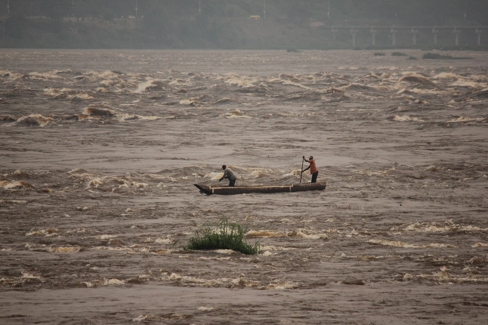
For people living along the river, the Congo is a road, a supermarket and a workplace. Most villages sit on the banks or on islands, and many have no road connection at all. Families fish from dugout canoes called pirogues, tend cassava and plantain gardens, and trade smoked fish, bushmeat, charcoal and forest produce with passing boats.
The river has also shaped language. Lingala grew out of the trade language used by river traders between Lisala and Kinshasa and is now spoken widely in both Congos, helped by the army and by the huge popularity of Congolese rumba and other music sung in Lingala. A few words of greeting in Lingala or French go a long way.
The Wagenia fishermen of Kisangani
One of the best-known river traditions is found at the last cataract of the Boyoma Falls, near Kisangani. There, Wagenya (Wagenia) fishermen build tall wooden tripods anchored to the rocks and hang large conical baskets in the rapids to catch fish. The method is selective, trapping mostly large fish, and was already described by Henry Morton Stanley in the 1870s.
River Towns from Kinshasa to Kisangani
The main navigable stretch runs about 1,700 kilometers between Kinshasa and Kisangani. Below Kinshasa, the Livingstone Falls, a chain of powerful rapids, block boats from reaching the sea. The best-known stops along the way are real, sizable towns rather than hidden villages:
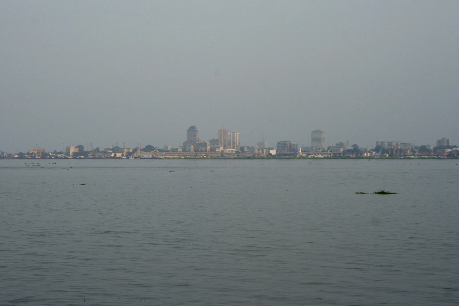
- Kinshasa and Brazzaville: the two capitals face each other across the Pool Malebo, about 4 kilometers apart with no bridge, the closest pair of national capitals in the world.
- Mbandaka: the main town of Équateur Province, right on the equator, where the river crosses it for the second time on its way to the sea.
- Lisala and Bumba: river ports on the great northern bend, supplied largely by boat.
- Kisangani: the largest city upriver, at the head of navigation just below the Boyoma Falls.
The Congo Riverboats: Floating Markets
Instead of passenger ferries on a timetable, most long-distance traffic on the Congo travels on pushed barges and cargo boats. They carry goods, livestock and hundreds of passengers, and they become floating markets: at each village, canoes paddle out to sell fish and produce and buy salt, soap, fuel and other goods from traders on board.
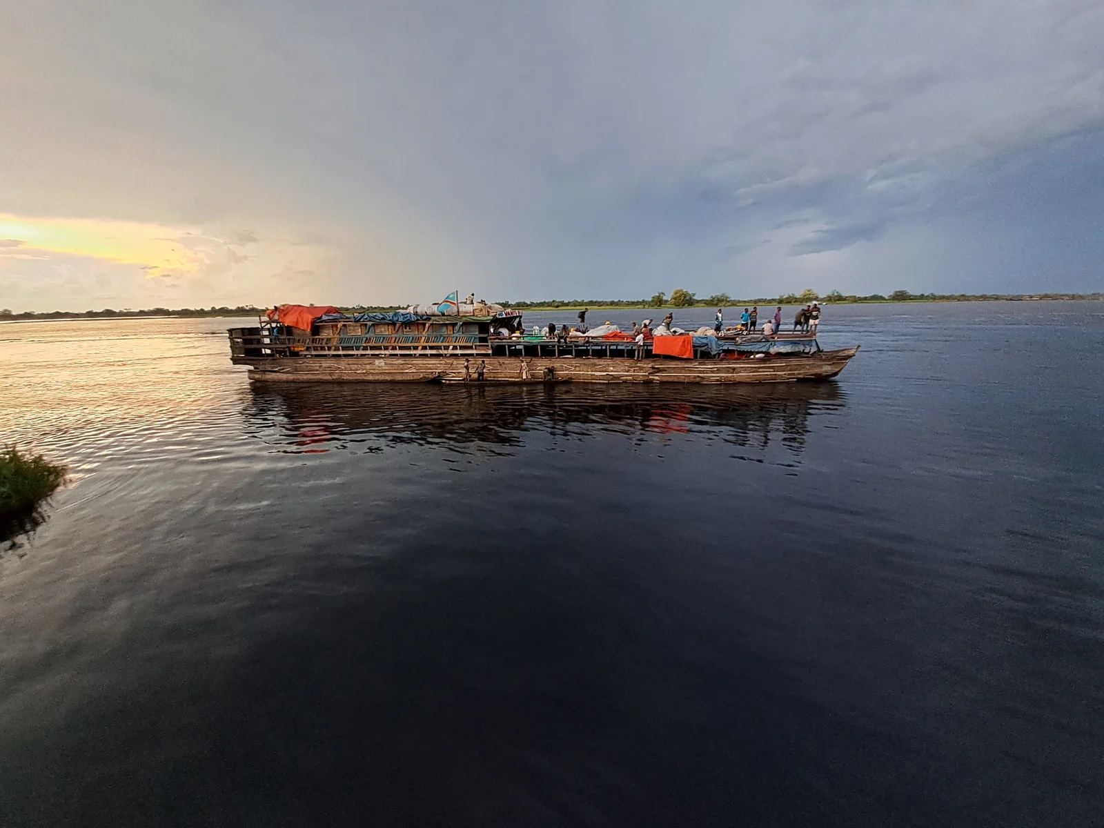
Journeys have no fixed duration and can take weeks, depending on cargo, fuel, water levels and breakdowns. Conditions are basic, boats are often overloaded and accidents happen, which is why most governments advise against this kind of travel. If you want to understand river life from home, the travel literature and documentaries on the Congo are a safer starting point.
Wildlife of the Congo Basin
The Congo Basin holds the second-largest tropical rainforest on Earth after the Amazon. The river itself is a natural barrier: bonobos, our closest living relatives along with chimpanzees, live only in the DRC, south of the river. Forest elephants, gorillas, okapis and hundreds of bird species live in the wider basin, although many of the best-known reserves are in regions where travel is currently not advised.
If the rainforest fascinates you, our guide to lost cities in the Amazon rainforest explores the world’s largest tropical forest.
What Visitors Can Realistically See
When advice allows, travelers usually experience the river from the two capitals and from organized nature trips, rather than by roaming remote villages.
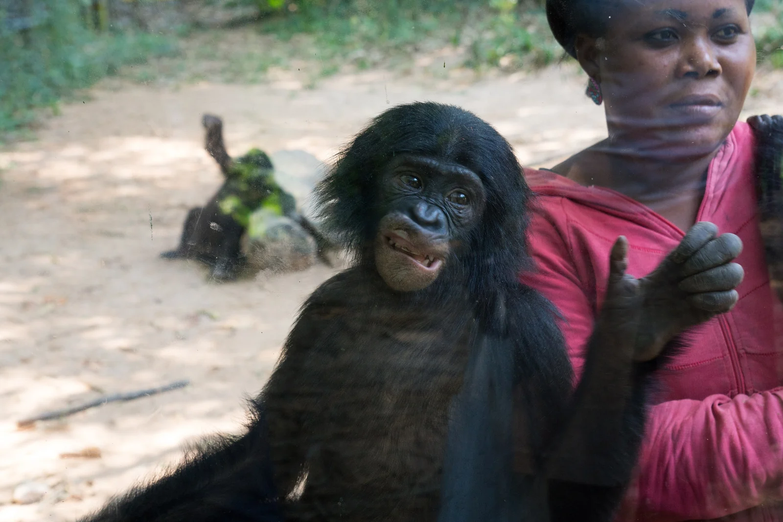
- Lola ya Bonobo: the world’s only sanctuary for orphaned bonobos, founded in 1994 and based near Kimwenza on the southern edge of Kinshasa. Around 60 rescued bonobos live in 30 hectares of forest.
- The rapids and riverbank at Brazzaville and Kinshasa: fishermen working the fast water below the Pool Malebo are one of the most memorable sights of the river.
- Odzala-Kokoua National Park: in the northwest of the Republic of the Congo, a UNESCO World Heritage Site since 2023 and known for western lowland gorillas and forest elephants. It is managed by African Parks and visited on organized trips.
Responsible Travel on the Congo
River communities are not a spectacle. If you do travel, a local guide who knows the area and its people is essential, both for safety and for making sure your visit benefits the community.
- Ask permission before photographing people, and respect a no. Photographing government buildings, military sites, bridges or borders is illegal in the DRC and can lead to arrest.
- Check entry and health rules early. The DRC requires proof of yellow fever vaccination, and malaria is present throughout the basin; see a travel health clinic well before you go.
- Pay fairly for guides, canoes and food, and buy crafts directly from the people who make them.
- Never buy bushmeat, ivory or products from protected animals.
- Do not travel on overloaded boats or after dark on the river, and carry your own life jacket if you go on the water.
For safer ways to see Africa’s great landscapes, try our guides to the tallest waterfalls in Africa or the must-see places in Africa.
Congo River FAQ
Can tourists travel on the Congo River?
It is possible in principle, and a few travelers have made the trip on cargo barges between Kinshasa and Kisangani. In 2026, however, governments including the US and UK advise against travel to the DRC or large parts of it, and river boats are often overloaded and unsafe. Check current advice first.
How long is the Congo River?
The Congo River is about 4,700 kilometers long, making it the second-longest river in Africa after the Nile. It is also the deepest river ever measured, at around 220 meters, and it carries one of the largest volumes of water of any river on Earth.
Which countries does the Congo River flow through?
The main river flows through the Democratic Republic of the Congo and forms part of the border between the DRC and the Republic of the Congo, and near its mouth with Angola. Its basin reaches into about ten countries, including Zambia, the Central African Republic, Cameroon and Tanzania.
Why is the Congo River hard to navigate to the sea?
Below Kinshasa and Brazzaville, the river drops through the Livingstone Falls, a series of rapids stretching for hundreds of kilometers. Boats from the Atlantic can only reach Matadi, and goods continue by rail or road to Kinshasa, where river navigation starts again.
Are Kinshasa and Brazzaville really across the river from each other?
Yes. The capitals of the DRC and the Republic of the Congo face each other across the Pool Malebo, about 4 kilometers apart, the closest pair of national capitals in the world. There is no bridge; people cross by ferry and boat.
Where can you see bonobos?
Wild bonobos live only in the DRC, south of the Congo River. The easiest place to see them is the Lola ya Bonobo sanctuary on the southern edge of Kinshasa, which cares for orphaned bonobos rescued from the bushmeat trade, when travel conditions allow.