


Salar de Uyuni is the largest salt flat in the world, a sheet of white salt of roughly 10,500 square kilometers on the high Altiplano of southwestern Bolivia. It lies at about 3,660 meters above sea level, in the Potosí Department, close to the town of Uyuni and not far from the borders with Chile and Argentina.
It is famous for one thing above all: after rain, a thin film of water turns the flat into a mirror so perfect that the horizon disappears and the sky seems to continue under your feet. This guide explains when to see the reflections, how to reach Uyuni and how to choose a tour, plus the lagoons, volcanoes and flamingos that make the wider region one of the great trips in South America.
Where Is Salar de Uyuni?
Although it is often described simply as “South America’s salt flat,” Salar de Uyuni is entirely in Bolivia, in the Daniel Campos Province of the Potosí Department. The nearest town is Uyuni, a railway junction at about 3,700 meters, and the salt-mining village of Colchani sits on the flat’s eastern edge.
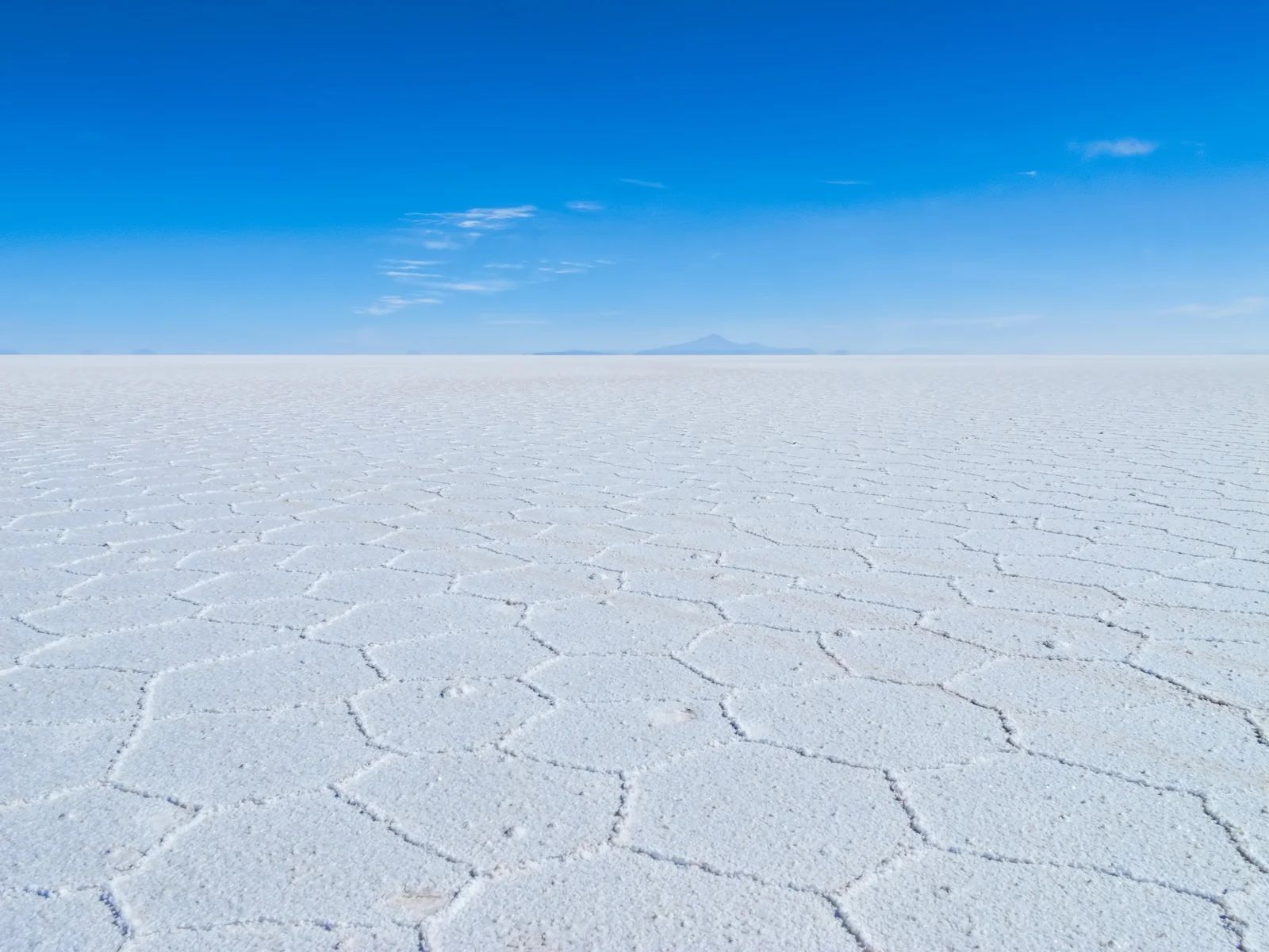
The surface is astonishingly level: across the whole area, the average elevation varies by less than one meter. That flatness, combined with the bright white salt, is why satellite scientists use the salar to calibrate instruments that measure the height and reflectivity of Earth’s surface.
How the Uyuni Salt Flat Formed
Tens of thousands of years ago, this part of the Altiplano was covered by a series of large prehistoric lakes, including Lake Minchin and later Paleo Lake Tauca. As the climate dried, the water evaporated and left behind thick layers of salt. Lakes Poopó and Uru Uru to the north, along with the smaller Salar de Coipasa, are remnants of the same ancient system.
Today a salt crust several meters thick covers a brine rich in lithium, sodium, potassium and magnesium. According to NASA’s Earth Observatory, the brine holds one of the largest lithium deposits in the world, and Bolivia has built evaporation ponds at the southern end of the salar to extract it.
When to See the Salar de Uyuni Mirror Effect
The famous reflections appear during the rainy season, roughly December to April, when rain collects in a shallow layer on top of the salt. On calm, clear mornings and evenings, that water reflects clouds, mountains and people perfectly. The effect depends on the actual rainfall, so a wet month does not guarantee a mirror on any given day, and heavy flooding can close some routes.
The dry season, roughly May to November, shows a different face of the salar: a hard white surface cracked into hexagonal tiles, clear skies and easy access to the whole flat, including Isla Incahuasi. Days are sunny, but nights on the Altiplano are very cold, especially from June to August.
| Season | Months (approx.) | What you see | Trade-offs |
|---|---|---|---|
| Wet season | December to April | Mirror reflections, dramatic clouds | Some areas and islands can be unreachable; tours may be shortened |
| Dry season | May to November | Bright white hexagon crust, clear skies | No mirror; very cold nights, especially June to August |
| Shoulder weeks | Late March to April, November | Chance of both water patches and dry crust | Conditions vary year to year |
How to Get to Uyuni
Almost every visit starts in the town of Uyuni, where tour operators are based. There are several ways to get there:
- By air: Uyuni’s Joya Andina Airport has domestic flights from La Paz and other Bolivian cities. It is the quickest option, but schedules change, so check with the airlines.
- By train: Uyuni sits on the railway between Oruro and Villazón on the Argentine border, but passenger services are limited, so check the current timetable with the rail operator, Ferroviaria Andina, before you plan around it.
- By bus: overnight buses connect Uyuni with La Paz, and there are regular services from Potosí and Sucre.
- From Chile: many travelers arrive on a multi-day jeep tour from San Pedro de Atacama that crosses the border and ends at the salt flat.
If you are combining Bolivia with Peru, Uyuni fits well after La Paz and Lake Titicaca, and before or after a visit to Machu Picchu.
Choosing a Salar de Uyuni Tour
The salt flat is huge, featureless and easy to get lost on, so almost everyone visits with a local operator in a 4x4. Tours vary a lot in comfort, group size and safety standards, so read recent reviews, ask about the vehicle and driver, and confirm what is included before you pay.
Day tours and sunset or sunrise tours
A full-day tour from Uyuni usually covers the train cemetery, Colchani, the central salar and, in the dry season, Isla Incahuasi, ending with sunset on the flat. In the wet season, shorter sunrise, sunset or stargazing trips focus on finding a stretch of water for reflections.
Three-day tours to the lagoons
The classic multi-day route crosses the salar and heads south through the Sur Lípez region into the Eduardo Avaroa Andean Fauna National Reserve, with colored lagoons, geysers and volcanoes, before returning to Uyuni or dropping travelers at the Chilean border. Nights are spent in simple lodgings, sometimes built from salt blocks, and park entry fees are usually paid separately.
Top Sights On and Around the Salt Flat
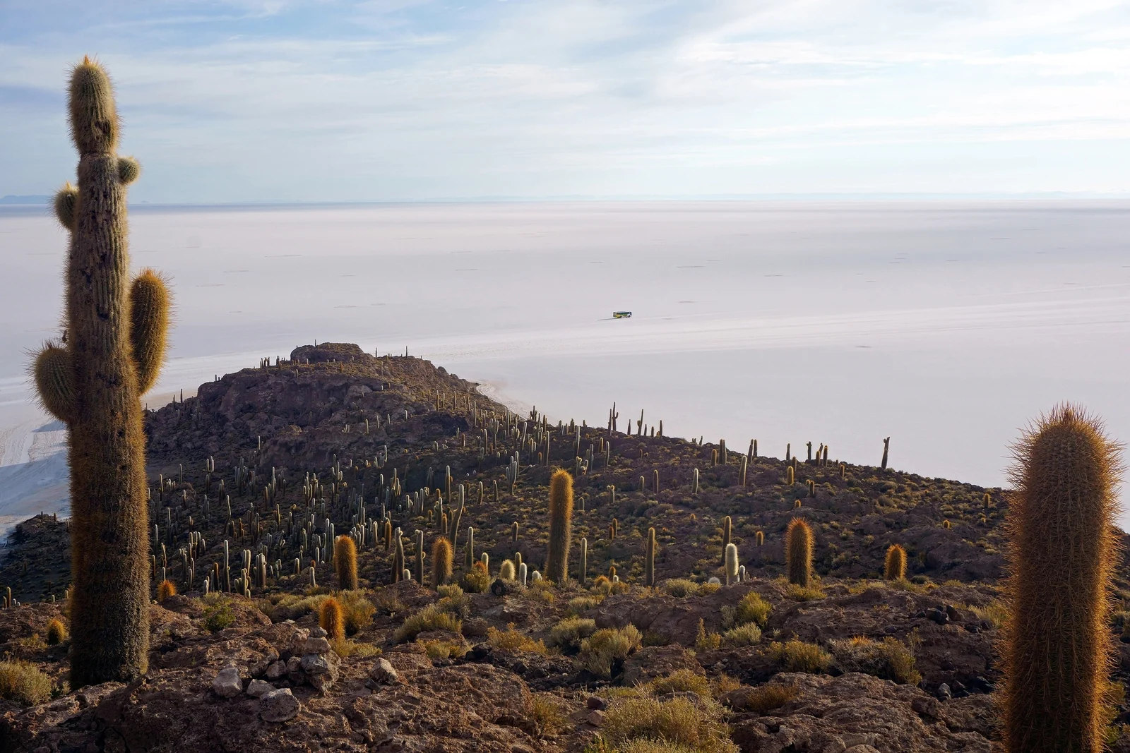
Isla Incahuasi
This rocky outcrop in the middle of the salar is covered in giant columnar cacti and offers wide views over the white expanse. A short trail leads to the top; an entrance fee is charged. In the wet season it may be unreachable when the surrounding flat is flooded.
The train cemetery
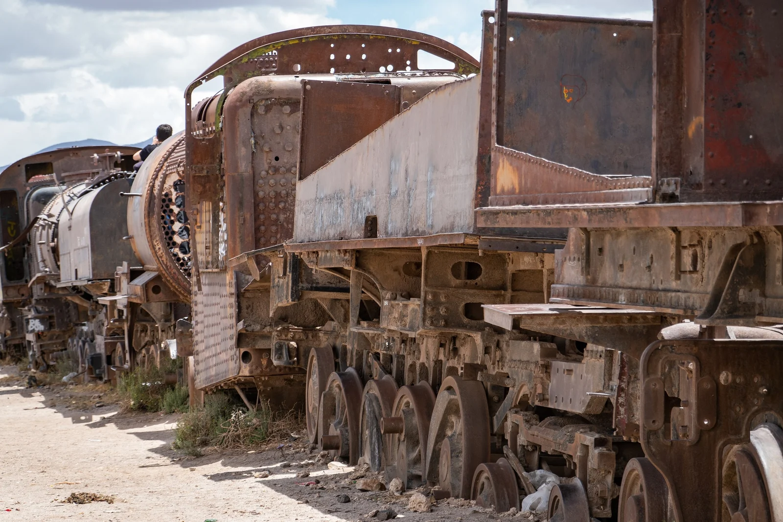
About three kilometers outside Uyuni, dozens of rusting steam locomotives and wagons sit in the desert. They date from the era when Uyuni was a hub for trains carrying minerals to Pacific ports; many were abandoned when the mining economy collapsed in the mid-20th century.
Colchani and Tunupa volcano
In Colchani, families still dry and pack salt by hand, and small workshops sell salt carvings and woven textiles. On the northern edge of the salar, the dormant Tunupa volcano rises to about 5,300 meters, with small villages at its foot and views over the whole flat.
Laguna Colorada and the flamingos
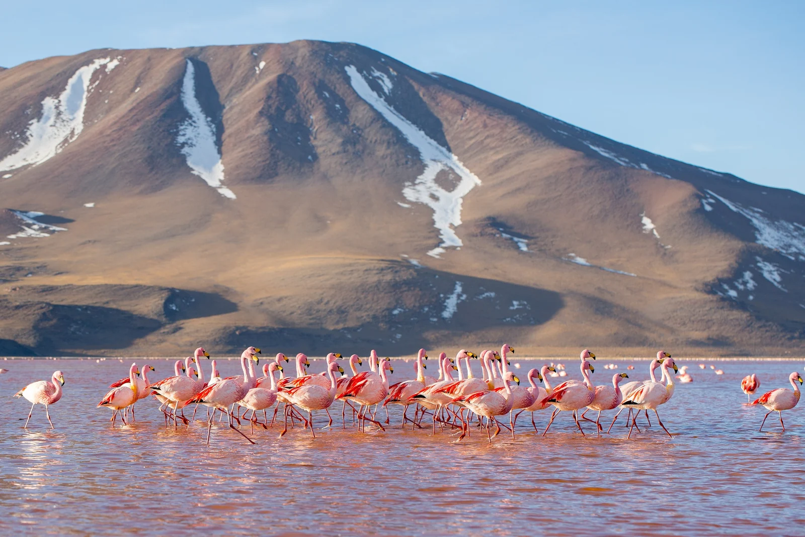
South of the salar, Laguna Colorada lies at about 4,280 meters inside the Eduardo Avaroa reserve. Its red-tinted water attracts three flamingo species: Andean, Chilean and James’s flamingos. Nearby are the Árbol de Piedra rock formation, the Sol de Mañana geothermal field and Laguna Verde beneath Licancabur volcano.
Photography Tips for the Salt Flat
- Shoot at the edges of the day. Sunrise and sunset give soft color in the sky and the best reflections when the wind is calm.
- Get low. In the mirror season, placing the camera close to the water makes the reflection symmetrical and hides the horizon.
- Play with perspective. With no reference points, forced-perspective shots, where people appear tiny next to everyday objects, work remarkably well in the dry season.
- Protect your gear. Salt water is corrosive; wipe shoes, tripods and cameras with fresh water afterward.
- Mind the glare. The white surface is dazzling, so expose carefully and wear good sunglasses.
Altitude, Weather and Packing Tips
Uyuni and the salar are well above 3,600 meters, and multi-day tours climb above 4,000 meters, with some stops close to 5,000 meters. Spend a few days at altitude beforehand if you can, drink plenty of water, go easy on alcohol and talk to a doctor about altitude sickness before you travel.
- Warm layers, a hat and gloves for freezing nights and early starts.
- High-factor sunscreen, lip balm and sunglasses; UV and glare are intense.
- Rubber boots in the wet season (many operators provide them).
- Cash in bolivianos for park fees, toilets and small purchases, as card payment is limited outside Uyuni.
Love wild, surreal landscapes? Our guides to the glaciers and mountains of Patagonia and Madagascar’s baobab-lined roads are good next reads.
Salar de Uyuni FAQ
Which country is Salar de Uyuni in?
Salar de Uyuni is in southwestern Bolivia, in the Potosí Department near the town of Uyuni. It is often called South America’s great salt flat, but it lies entirely inside Bolivia, not far from the borders with Chile and Argentina.
When is the best time to see the mirror effect at Salar de Uyuni?
The mirror effect appears in the rainy season, roughly December to April, when a thin layer of water covers the salt. Calm, clear mornings and evenings give the best reflections. It depends on actual rainfall, so conditions change from year to year.
How big is Salar de Uyuni?
The salt flat covers roughly 10,500 square kilometers, making it the largest in the world. It sits at about 3,660 meters above sea level, and its surface is so flat that elevation varies by less than a meter across the whole area.
Can you visit Salar de Uyuni without a tour?
It is possible to reach Colchani and the edge of the flat independently, but the salar is vast, has no landmarks and is easy to get lost on. For the central flat, Isla Incahuasi and the lagoons, joining a 4x4 tour with a local driver is by far the safest option.
How many days do you need for Salar de Uyuni?
One full day is enough to see the salt flat itself, Colchani and the train cemetery. To include Laguna Colorada, the geysers and Laguna Verde, plan a three-day tour, which can also end at the Chilean border for travelers heading to San Pedro de Atacama.
Is altitude sickness a problem at Salar de Uyuni?
It can be. The salar is about 3,660 meters high and southern tours go above 4,000 meters. Acclimatize for a few days beforehand, for example in La Paz or Sucre, drink plenty of water and seek medical advice if you have health concerns.