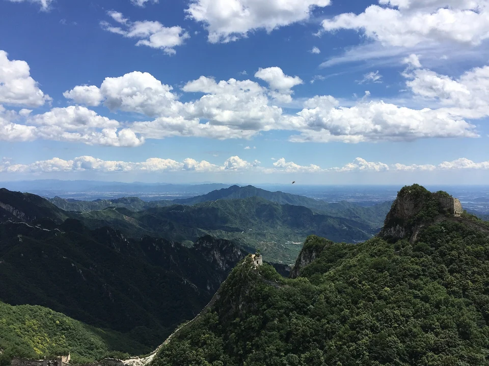



The Ha Giang Loop is a multi-day circuit through the far north of Vietnam, where limestone peaks, terraced hillsides and one of the country's most dramatic mountain roads sit within sight of the Chinese border. Most travelers ride it in three or four days from Ha Giang city, passing Quan Ba, Yen Minh, Dong Van, Meo Vac and the Ma Pi Leng Pass.
It is a loop for people who like the road itself: hairpins, cloud, roadside markets and long lunches in village kitchens. You can ride it yourself, sit behind a local driver, or skip the bike entirely and go by jeep or minibus. This guide covers the Ha Giang Loop itinerary, how to choose between riding options, the license and permit questions, the best season and what to pack. For the wider trip around it, see our Vietnam travel guide from Hanoi to Saigon.
What the Ha Giang Loop Is and Why It Matters
The loop runs across the Dong Van Karst Plateau, a high limestone region (see the national geopark overview) that UNESCO added to its Global Geoparks network in 2010. It was the first geopark in Vietnam, and its status has been renewed several times since. The geopark covers most of four districts: Quan Ba, Yen Minh, Dong Van and Meo Vac, which are also the heart of the loop.
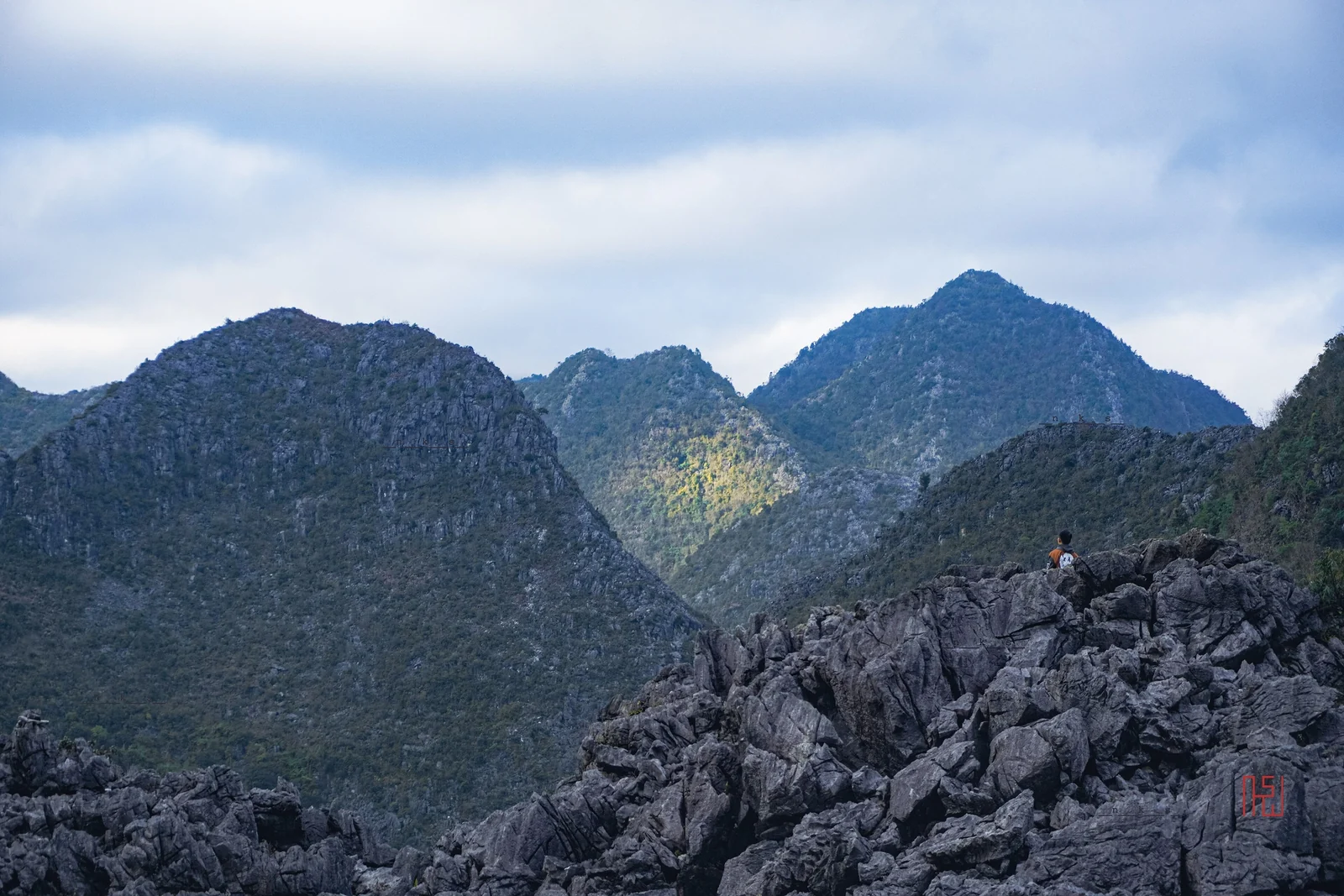
The rock is the story here. Grey karst spikes poke through fields, farmers grow corn between boulders, and villages sit on terraces cut into slopes that look too steep to plant. The people who live on the plateau include Hmong, Tay, Dao and Lolo communities, among others, and the loop works best when you treat it as a region where people live rather than a scenic backdrop.
One note on names: recent administrative changes folded Ha Giang province into Tuyen Quang province, but signs, maps and tour operators still use Ha Giang for the city, the loop and the plateau.
Ha Giang Loop Itinerary: Route and Day Plan
The classic route starts and ends in Ha Giang city. Operators vary the details, and weather or road work can change a day, so treat the table as a template. The Ha Giang Loop in 3 days is the standard; a fourth day adds Du Gia and Bao Lac at a calmer pace.
| Day | Route | Main stops |
|---|---|---|
| 1 | Ha Giang city to Quan Ba to Yen Minh to Dong Van | Quan Ba Heaven's Gate viewpoint, Yen Minh for lunch, then the long climb toward Dong Van |
| 2 | Dong Van to Lung Cu to Dong Van to Meo Vac | Lung Cu flag tower, Hmong villages, Dong Van old quarter, then the Ma Pi Leng Pass into Meo Vac |
| 3 | Meo Vac to Nho Que River to Du Gia to Ha Giang city | Boat trip in the Tu San Canyon, the Du Gia valley and its terraces, return via Bao Lac or the main road |
| 4 (optional) | Slower return through Du Gia and Bao Lac | Extra time in the valley, a homestay night, shorter riding days |
Day 1: Ha Giang City to Quan Ba and Yen Minh
You leave the city and climb steadily to Quan Ba, where the road crests at the viewpoint known as Heaven's Gate. Expect tour groups here; a short coffee stop and a look back down the valley is enough. Beyond Quan Ba the road drops to Yen Minh, a market town where many groups have lunch before the long afternoon toward Dong Van.
Day 2: Dong Van, Lung Cu and Meo Vac
Dong Van is the geopark's main town and the usual overnight stop. From here a side trip leads to Lung Cu, the northernmost point most visitors reach. The flag tower there flies a flag of 54 square meters, a figure said to represent the 54 ethnic groups of Vietnam.
In the afternoon the road leaves Dong Van for the best-known section of the loop, the Ma Pi Leng Pass, then drops into Meo Vac.
Day 3: Nho Que River, Du Gia and the Return
Many groups start the day with a small boat on the Nho Que River at the bottom of the Tu San Canyon, then head south via Du Gia and, depending on the operator, Bao Lac. The road follows river valleys and terraces before reaching Ha Giang city by evening. Four-day versions simply stretch this day into two.
Ma Pi Leng Pass and the Nho Que River
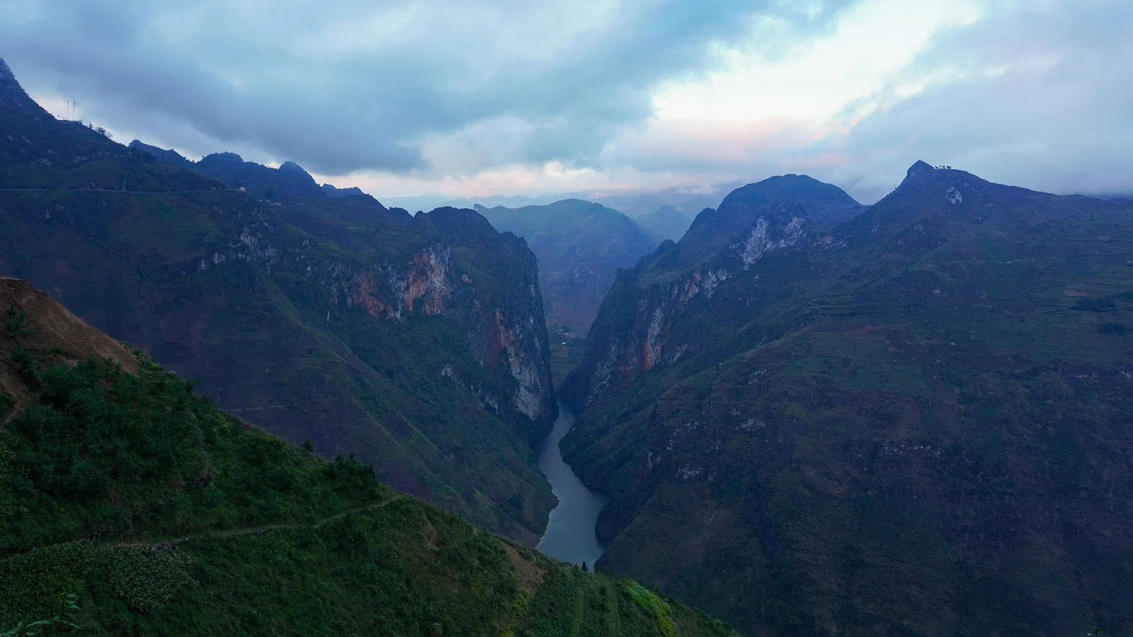
Ma Pi Leng Pass is a stretch of National Highway 4C between Dong Van and Meo Vac, at about 1,500 meters above sea level and roughly 20 kilometers long. The road clings to a cliff above the Nho Que River and the Tu San Canyon. The pass was listed as a national scenic monument in 2009.
It has a history worth knowing. The road is part of the Happiness Road, built between 1959 and 1965 largely by youth volunteers and local laborers, many from minority communities. The hardest section, the rock cutting above the gorge, took close to two years.
The canyon below is often described as the deepest in Southeast Asia, as Vietnam's tourism authority notes. Sources give depth estimates between about 800 and 900 meters, so treat any single figure with caution. A boat ride on the river puts the scale in perspective: the walls rise so high that the sky shrinks to a strip. Ask your operator or homestay about boat availability, since water levels and local conditions vary.
Ha Giang Loop Self-Ride or Easy Rider: Which Option?
This is the question behind the search for Ha Giang Loop self ride or easy rider, and the honest answer depends on your experience and your license.
| Option | How it works | Best for | Watch out for |
|---|---|---|---|
| Self-ride | You rent a motorbike and ride it yourself | Experienced riders with a valid license who want freedom | Steep drops, fog, loose gravel, limited rescue options, insurance conditions |
| Easy rider | A local driver rides; you sit behind | Riders without a license, nervous riders, photographers | Variable quality between operators; ask about driver experience |
| Jeep or minibus tour | Seats in a four-wheel vehicle | Families, cold or wet weather, travelers with back or knee problems | Fixed stops, less flexibility, tighter schedules |
If you have ridden in mountains before and have the right paperwork, self-riding is rewarding. If you have not, an easy rider is a safer way to enjoy the scenery, and you can pay attention to the view instead of the next bend. The loop is not a good place to learn how to ride a motorbike.
Whichever you choose, read recent reviews of the operator, ask what the price includes, and confirm that helmets are provided and fit properly.
Licenses, Insurance and Border Permits
Rules for foreigners riding in Vietnam change, and they are checked at police stops along the loop. Before you book, check current rules with the Vietnamese embassy in your country or the official tourism sources listed below. As a general picture, Vietnam recognizes a foreign motorbike license only when it comes with an International Driving Permit that Vietnam accepts, and sources disagree about which convention applies to which country. Do not assume a car license or a car-only permit covers a motorbike.
Do not ride without a valid license. Beyond the legal risk, travel insurance policies commonly exclude accidents when the rider is unlicensed, and rental shops may ask to see your documents. If you do not have the right license, choose an easy rider or a jeep tour instead, and check that your insurance covers you as a passenger on a motorbike.
Border Area Permit
Parts of the loop lie in border districts, and foreign visitors are generally asked to hold an entry permit for them. Reports name Quan Ba, Yen Minh, Dong Van and Meo Vac as the main districts affected. Most travelers get the permit through a tour company, hostel or homestay, which can arrange it with local authorities, while independent riders apply through local immigration or police offices in Ha Giang. Fees, forms and processing details change, so ask for the current arrangement in writing and carry your passport at all times.
- Passport (the original, not just a photo)
- Valid license and permit if you ride yourself
- Travel insurance that covers motorbike use
- Your accommodation details and some cash for fees and small purchases
Best Time to Ride the Ha Giang Loop
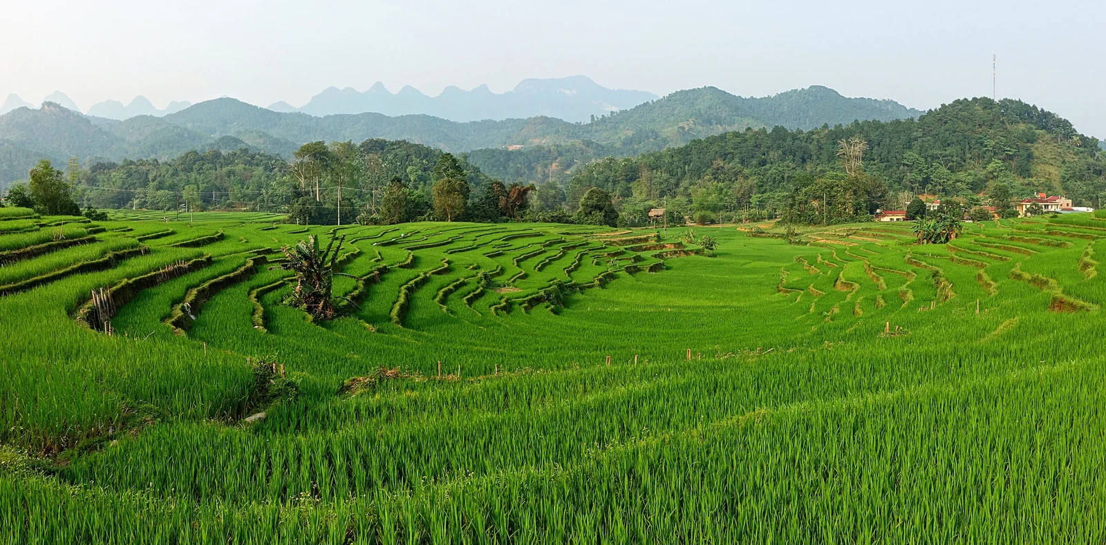
Most sources point to September through November as the best window. The air is clearer, the rain eases and the fields change color. Mid-September to early October is the usual time for golden rice on terraces such as those near Hoang Su Phi, a detour away from the main loop. Buckwheat flowers bloom later, roughly late October into November, covering rocky hillsides in pink and white.
Timing shifts by a couple of weeks from year to year, so confirm with a local operator before you plan a trip around the flowers. Other months have their own character. Winter can be cold, foggy and damp at altitude, which makes riding harder. Summer brings heavy rain, and landslides can close or damage mountain roads. In any season, check the forecast and be ready to adjust the day plan.
Getting to Ha Giang from Hanoi
Most travelers take a sleeper bus or limousine van from Hanoi to Ha Giang city. The trip takes roughly five to seven hours depending on traffic and stops, and many people choose a night service so that they arrive early and start riding the same morning. Check the operator's pickup point in Hanoi, because it may differ from the central bus station.
Spend your last night in Ha Giang city or go straight back to Hanoi the next morning. If your trip includes other regions, our Vietnam travel guides help you plan what comes before and after the north, and the Cambodia travel guide and Chiang Mai guide suit a longer Southeast Asia route.
Safety, Packing and Homestays
Riding Safely
- Wear a proper helmet with a chin strap, and ask for gloves and knee protection if you can.
- Ride slowly through blind bends; trucks and buses use the whole road.
- Avoid riding at night. Fog and unlit hairpins make the dark far more dangerous.
- Stop at viewpoints rather than shooting photos on the move.
- Do not drink and ride, and stay off the road in heavy rain.
What to Pack
Bring layers, because it can be warm in the valleys and cold on the passes. A waterproof jacket, closed shoes, sunscreen, a small first aid kit and a power bank cover most needs. Pack light enough to strap a small bag to a bike, and keep documents and electronics in a waterproof pouch.
Homestays
Many overnight stops are family homestays or simple guesthouses, often with shared rooms, shared bathrooms and a communal dinner. Stay areas are Ha Giang city, Quan Ba or Yen Minh, Dong Van and Meo Vac; check recent reviews for cleanliness and noise, and ask whether dinner is included.
Meeting the Local Communities Respectfully
The plateau is home to Hmong, Tay, Dao, Lolo and other communities, each with their own dress, language and customs. A few simple habits make a difference.
- Ask before photographing people, and accept a no. Do not photograph children without a parent nearby.
- Do not walk into homes, fields or graveyards without an invitation.
- Buy from local stalls and markets rather than handing out sweets or money, which can create habits that locals do not welcome.
- Dress modestly in villages and keep noise down at night.
- Treat the border zone with care: ask before flying a drone and avoid photographing military sites.
Ha Giang Loop FAQ
How many days do you need for the Ha Giang Loop?
Three days is the standard length and covers the main stops. Four days lets you add Du Gia and Bao Lac and ride shorter stretches. Two days is possible but rushed, with long hours on the bike and little time in villages.
Is the Ha Giang Loop dangerous?
The road is steep and winding, with fog, gravel and heavy vehicles, so risk depends on your skill and judgment. Riding slowly, avoiding night and rain, and choosing an easy rider or jeep if you are inexperienced reduce it considerably.
Do foreigners need a license to ride the Ha Giang Loop?
Generally yes: a valid motorbike license plus an International Driving Permit that Vietnam accepts. Rules change and are checked at roadside stops, so verify them with the embassy before you travel. If you lack the right documents, go with an easy rider or a jeep tour.
Do you need a permit for the Ha Giang Loop?
Foreigners are generally expected to hold a border area permit for the districts on the route. Tour companies, hostels and homestays commonly arrange it, and independent riders can ask local authorities. Confirm the current process and fees before you go.
What is the best month for the Ha Giang Loop?
September to November is the usual choice. Golden rice peaks from mid-September into early October, and buckwheat flowers follow from late October into November. Dates move each year, so ask a local operator close to your travel date.
How do you get from Hanoi to Ha Giang?
Take a sleeper bus or limousine van from Hanoi to Ha Giang city. The ride takes about five to seven hours, and many travelers use a night service to start riding at dawn. Confirm your pickup point when you book.
Is Ma Pi Leng Pass worth the ride?
Yes. It is the highlight of the loop, with a narrow road above the Nho Que River and the Tu San Canyon. Go in clear weather if you can, stop at the viewpoints, and keep your speed low on the cliff sections.