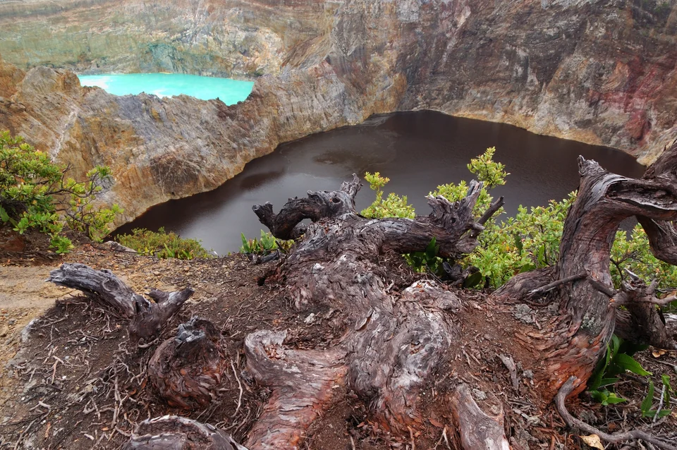



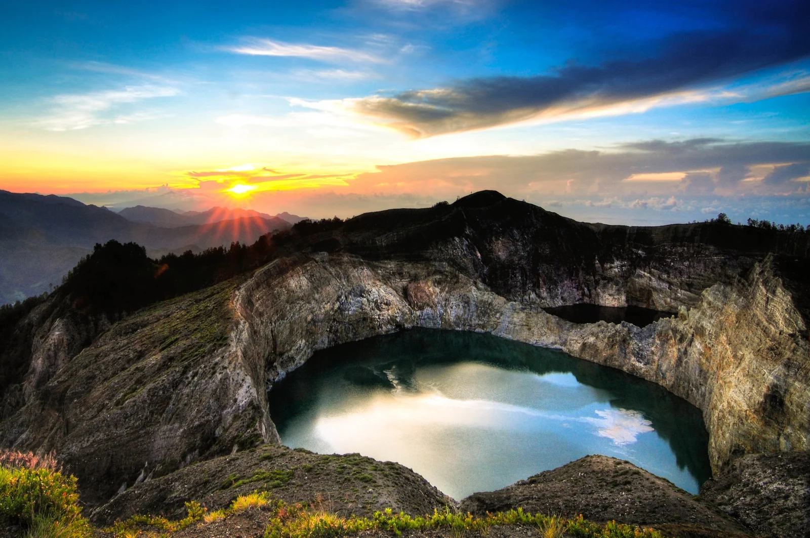
Kelimutu is a volcano on the Indonesian island of Flores with three crater lakes that sit side by side in different colors, and the colors do not stay the same. The best way to see them is a Kelimutu sunrise visit from the village of Moni, a short drive and an even shorter walk from the car park to the rim.
This guide covers how to get to Kelimutu, how a sunrise morning runs, why the lakes change color, what the Lio people believe about them, and what else to do around Moni. It also shows how Kelimutu fits into a Flores overland trip that starts or ends at Labuan Bajo. If you are building a wider Indonesia route, our Indonesia travel guides are a good next stop.
The Three Lakes of Kelimutu
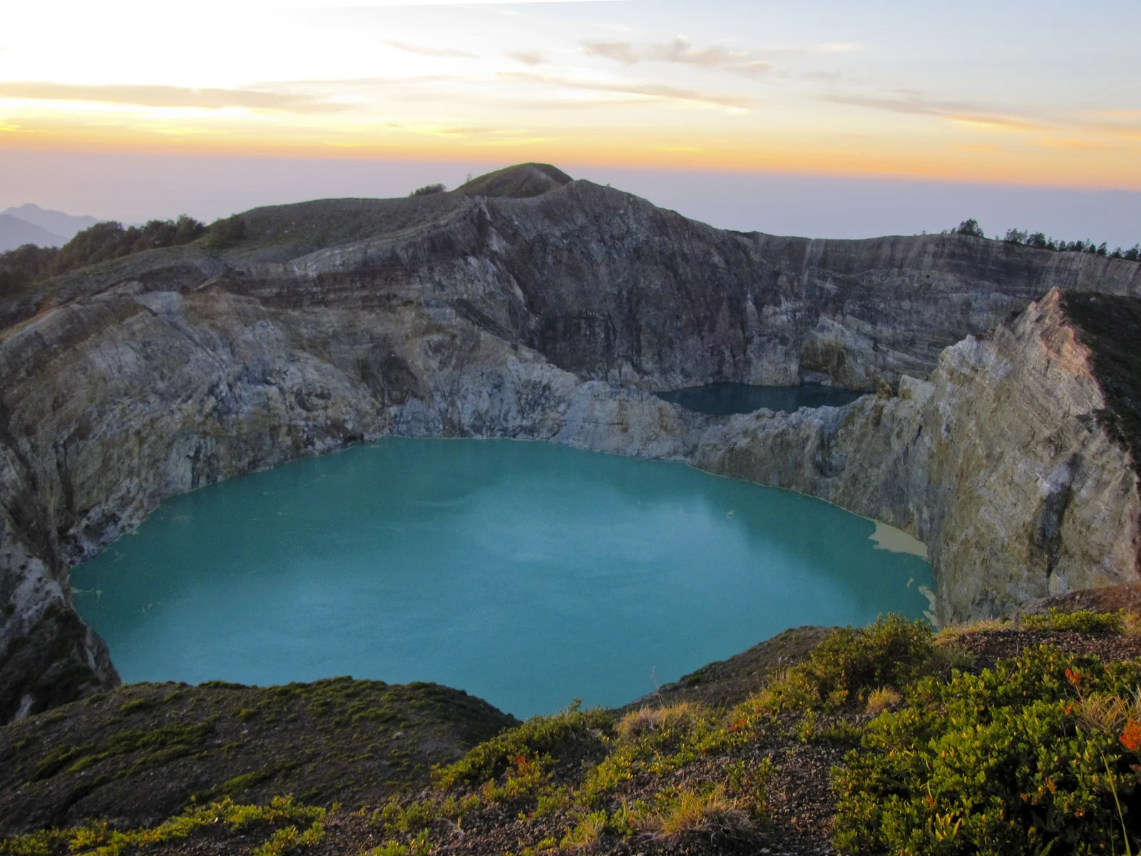
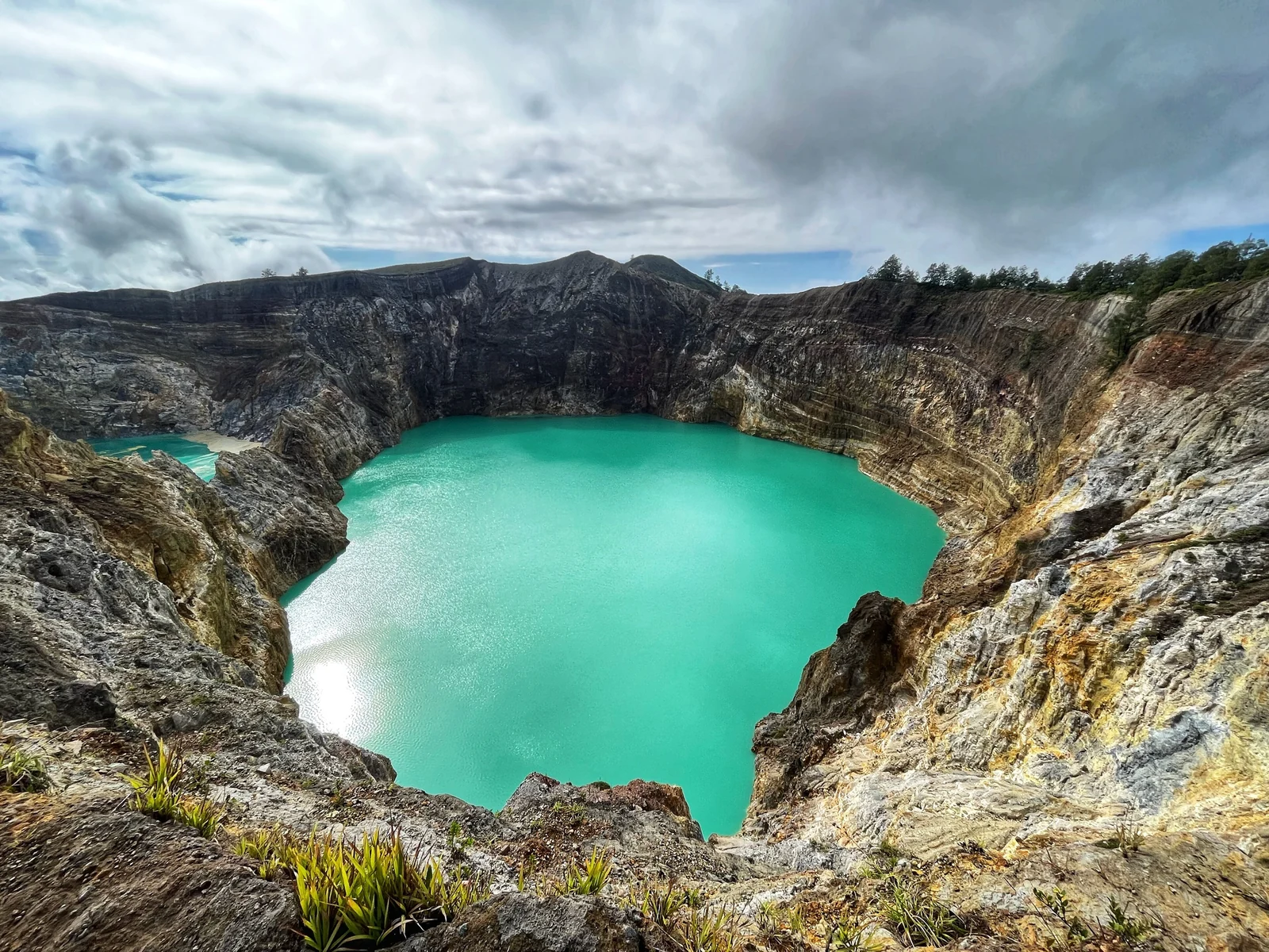
Kelimutu rises to about 1,639 meters (5,377 feet) in central Flores, and its summit holds three crater lakes inside Kelimutu National Park. Two of them share a single crater wall and sit very close together. The third lies a little apart to the west. Trails and viewpoints run along the rim, so you can look down on all three from a few different angles.
Each lake has a Lio name, and the names say something about how local people understand them. The usual color of each lake is a rough guide only, because all three have changed over the decades.
| Lake (Lio name) | Meaning | Color often reported |
|---|---|---|
| Tiwu Ata Mbupu | Lake of Old People | Blue |
| Tiwu Nuwa Muri Koo Fai | Lake of Young Men and Maidens | Green |
| Tiwu Ata Polo | Bewitched or Enchanted Lake | Red |
Spellings vary between sources, and you will see Tiwu Ata Bupu and Tiwu Ko'o Fai Nuwa Muri on signs and maps. Treat the colors in the table as what visitors have often reported, not a promise. On any given morning the lakes can look quite different from the photos you have seen.
Why the Lakes Change Color
Kelimutu is a volcano, and the lakes are fed in part by gases rising from vents beneath the water. Volcanologists describe these as subaqueous fumaroles, releasing gases such as sulfur dioxide, hydrogen sulfide and carbon dioxide. That gas input is considered a main driver of the lakes' changing chemistry and temperature, and it can make the water bubble.
The color shifts are linked to the oxidation-reduction state of the water, which depends on the volcanic gas supply, rainfall and dissolved minerals such as iron and manganese. When that balance changes, the same lake can move from one color to another. Each lake changes independently of the others, which is why you can see two similar lakes one season and three very different ones the next.
Scientists are still working out exactly how all of this fits together, so be wary of any single neat explanation. What is well documented is that changes can be frequent: the lakes are reported to have changed color several times within a single year. In practice that means you cannot plan on a particular color. Go for the setting, and treat whatever the lakes are doing as a bonus.
For the bigger picture on crater lakes that shift color, see our piece on Indonesia's color-changing volcano lakes.
Lio Beliefs About the Lakes
The lakes are not only a scenic stop. The Lio people, who live around the mountain, regard Kelimutu as sacred. A widely repeated belief holds that the souls of the dead travel to the lakes, and which lake they join depends on how old they were and how they lived. Young people go to one lake, older people to another, and those who lived badly to the enchanted one.
Indonesia's official tourism site also describes the lakes as a resting place of departed souls and the mountain as sacred. Offerings are made at ceremonial stones in an annual ritual, which falls in mid-August according to some sources. Details vary by village and by teller, so take this as a general picture rather than a fixed doctrine.
The practical side is simple. Keep your voice down at the rim, stay on the marked paths, and do not climb over barriers to get closer. Some areas near the lakes are restricted because they are dangerous. If a local guide shares a story, listen to it as one person's account of a living tradition.
How to Get to Kelimutu and Moni
Almost everyone bases themselves in Moni, a small village on the road between Ende and Maumere. From Moni, the car park below the rim is roughly 11 to 13 kilometers away depending on the source. The last stretch to the viewpoint is on foot.
| Starting point | Route to Moni | Rough travel time |
|---|---|---|
| Ende (ENE airport) | Road east, about 50 km | Roughly 1.5 to 2.5 hours |
| Maumere (MOF airport) | Road west, about 95 km | Roughly 2.5 to 4 hours |
| Labuan Bajo | Fly to Ende or Maumere, or drive overland via Ruteng, Bajawa and Ende | About 1 hour by air, or a very long day or two by road |
Distances and times are approximate; add a buffer if you have a flight to catch.
Flying In
Ende and Maumere both have airports, and both are linked to Labuan Bajo and other Indonesian hubs. Ende is the shorter transfer to Moni. Maumere is the better choice if you are traveling the island west to east and want to finish on the Flores coast. Check routes and schedules with the airlines, since they change often.
By Road and Public Transport
A hired car with a driver is the easiest option, and most guesthouses in Moni can arrange transfers. Local buses between Maumere and Ende pass through Moni, and Indonesia's tourism site notes that these include the basic wooden-bodied trucks locals use. They are cheap and slow, and they do not run to your door. From Labuan Bajo, overland travel crosses the mountains through towns such as Ruteng and Bajawa and takes more than a day of driving in total, so most people break it up.
Kelimutu Sunrise Step by Step
A Kelimutu sunrise works like this. You wake very early in Moni, usually around 3:30 to 4:00 a.m., and head up by car or motorbike taxi in the dark. Guides and drivers commonly leave Moni around 4:00 a.m., and the park gate is reported to open about then, though hours can change, so confirm with your guesthouse the night before.
At the car park you pay the park entry fee, which varies by source and by whether you are a foreign or domestic visitor, so check the current rate with the park or your host rather than relying on an old blog. Bring a headlamp or phone light, because the first stretch is unlit.
From the car park, a path with steps climbs to the main viewpoint. Guides describe it as a walk of roughly 10 to 30 minutes at an easy pace, and Indonesia's tourism site gives about 30 minutes. It is short, but at that hour and altitude it feels steeper than it is. Anyone with sturdy shoes will manage fine.
Where to Stand
The upper viewpoint near the summit gives the widest view over all three lakes. Lower points along the rim give closer angles on a single lake. If the crowd is thick at the top, walk a short way along the path and you will usually find space. Sunrise light changes quickly, so stay put for a while rather than leaving after the first colors.
What to Bring
- A warm layer, because the rim is cool and often windy before sunrise
- A headlamp or phone flashlight
- Water and a snack, since facilities are basic
- Rain protection, in case clouds roll in
- Cash for entry, parking and tea or coffee from stalls
Best Season and Dealing With Clouds
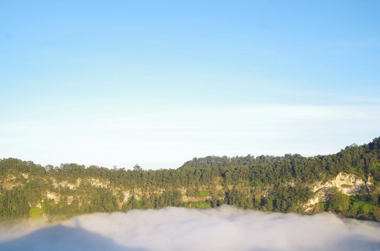
Clouds are the biggest risk at Kelimutu. The summit is high enough to catch mist, and in the wet season a lake can disappear for the whole morning. The drier months, roughly the middle of the year, give the best odds of a clear view, although even then a cloud bank can sit on the rim.
Rather than trying to predict the weather, build slack into your plans. Staying two nights in Moni lets you try a second morning if the first is socked in. If you arrive to a white wall, wait at least 30 minutes, since cloud often moves and the lakes can appear quickly.
Where to Stay in Moni
Moni is a village of simple guesthouses and homestays, not resorts. Staying here means a short pre-dawn drive instead of a long one from Ende or Maumere, and it puts you near the waterfalls, springs and villages listed below.
- In Moni village itself: the most convenient base, with small restaurants and easy transport arrangements for the early start.
- Along the road toward the park: quieter stays with views over rice fields and hills, and cooler nights. You will want your own transport or a pre-arranged driver.
- Near Koanara: Indonesia's tourism site lists an ecolodge in Koanara village that offers birdwatching and visits to traditional villages. Check availability directly.
Book ahead during school holidays and the peak travel months, and ask any host about hot water, since nights at this altitude can be cold.
Things to Do Around Moni
Searches for Moni Flores things to do mostly lead back to the lakes, but the area has more to fill a free afternoon.
Waterfalls
A waterfall near Moni is spelled in several ways, including Murukeba and Murundao. Reports describe a short ride from the village followed by a walk through forest, and some warn that paths are not well marked. Hiring a local guide is sensible, particularly after rain.
Hot Springs
Warm springs along the road between Moni and the national park are a popular way to ease sore legs after the early start. Some are free to enter and busier with locals on weekends and afternoons. Kolorongo and Liasembe are names that come up. Be considerate of other bathers, and ask about local expectations for swimwear.
Villages, Weaving and Walks
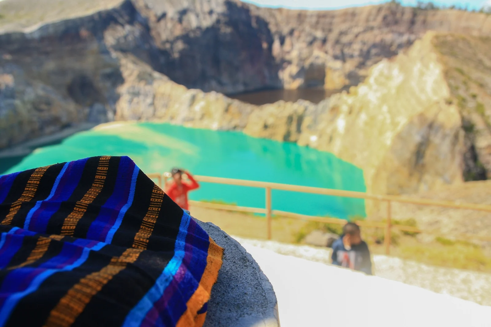
Lio communities around Moni weave ikat textiles, and some guides run village visits that include a weaving demonstration. Buying directly from a weaver is a better way to support the craft than a roadside stall. Walking trails also cross rice paddies and hills, and coffee and cocoa plantations are common nearby.
Combining Kelimutu With Komodo and Labuan Bajo
A Flores overland route usually runs east to west or the reverse, linking Maumere or Ende, Moni, Bajawa, Ruteng and Labuan Bajo, where boats leave for Komodo National Park. Many people do the whole thing in about a week, with Kelimutu as the mountain highlight and Komodo as the wildlife finale.
If time is short, fly into Ende or Maumere, give Kelimutu two nights, then fly back to Labuan Bajo. If you have more time, take the road and stop in Bajawa, whose cool highlands and traditional villages are worth a night. Roads are winding and slower than maps suggest, so avoid tight connections.
Planning Bali before or after Flores? Our Bali travel guide covers Ubud, beaches and a 9-day route. Check the official Indonesia tourism page for Kelimutu and your boat operator for current visiting rules before you book.
Practical Tips for Visiting Kelimutu
- Go with a flexible plan. Two mornings give you a second chance if clouds block the first.
- Dress in layers. The rim is cold before sunrise and warms quickly.
- Stay on marked paths. Parts of the rim are unstable and some areas are closed for safety.
- Ask before photographing people. This applies to villagers and weavers as well as ceremonies.
- Confirm costs on arrival. Entry fees, parking and guide rates change, so ask your host rather than trusting old figures.
- Pack cash. Bank machines are limited in Moni, so bring enough rupiah from Ende or Maumere.
Kelimutu FAQ
What color are the Kelimutu lakes?
The lakes are often reported as blue, green and red, but the colors change and each lake changes on its own. You cannot rely on a particular color on a given day, so treat any photo as one moment in time.
Why do the Kelimutu lakes change color?
Volcanic gases rise through vents under the lakes and change the water chemistry. Rainfall and dissolved minerals such as iron and manganese also play a role. The exact mechanism is still being studied.
How do I get to Kelimutu?
Fly to Ende or Maumere, then drive to Moni, which is the usual base. Ende is roughly 50 km from Moni and Maumere roughly 95 km. From Moni, a car or motorbike taxi takes you up to the car park, and a short walk leads to the viewpoint.
What time should I start for sunrise?
Most people leave Moni around 4:00 a.m. so they reach the car park and make the walk before first light. Hours can change, so check with your guesthouse the evening before and allow extra time in the dark.
Is the walk to the viewpoint hard?
No. It is a short walk with steps from the car park, commonly described as 10 to 30 minutes. The altitude and early hour make it feel harder than it is. Wear shoes with grip and carry a light.
When is the best time to visit Kelimutu?
The drier months around the middle of the year usually give the best chance of clear skies. Clouds can still hide the lakes at any time, so staying two nights in Moni improves your odds of a good view.
How many days do I need in Moni?
Two nights is a comfortable minimum. That gives you a sunrise, a backup morning if the weather turns, and an afternoon for the waterfall, hot springs or a village visit.