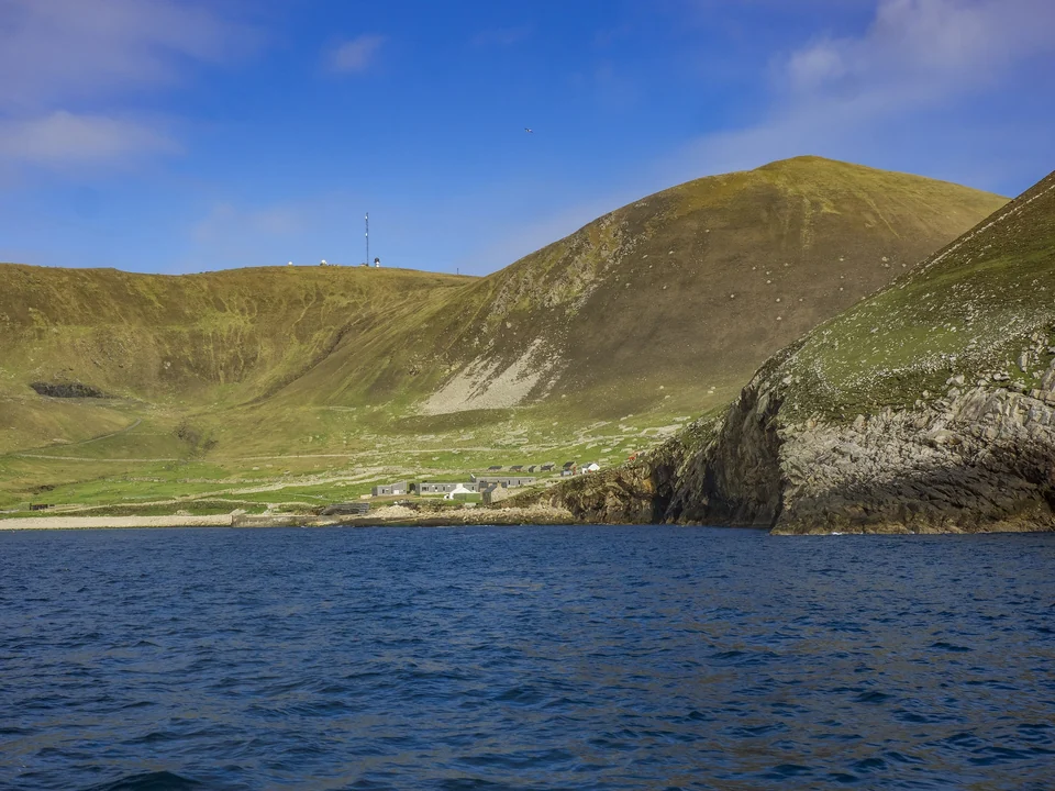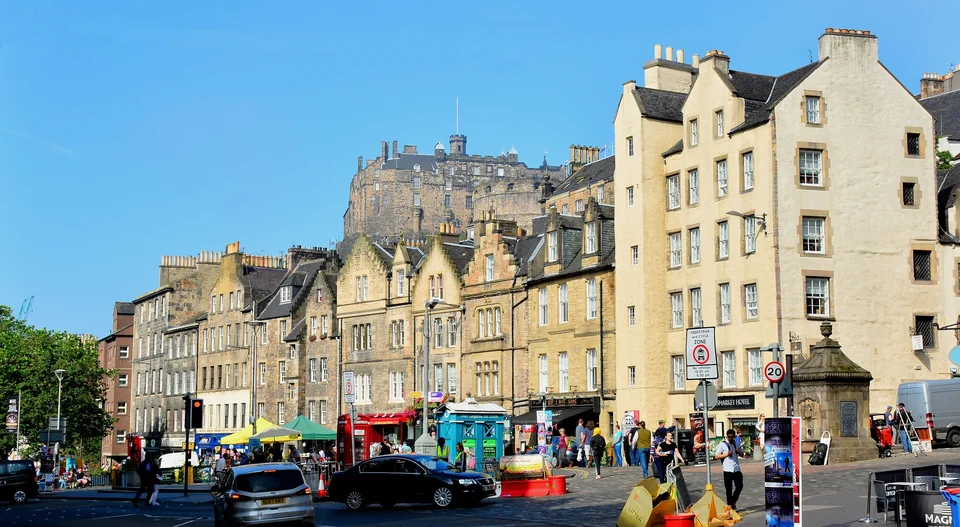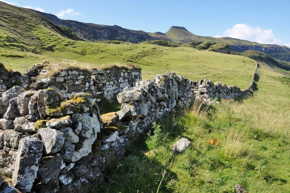



The classic Isle of Skye and Highlands road trip runs north from Glasgow through Glencoe and Fort William, swings past Eilean Donan Castle, crosses the Skye Bridge and then loops the island's big sights: the Old Man of Storr, the Quiraing, the Fairy Pools and Neist Point. It is roughly 500 miles round trip if you start and finish in Glasgow, and it works best over five to seven days.
This guide gives you the route, the stops worth your time, and the practical things that decide whether the trip goes well: single-track road manners, midges, parking and when to go. If you are flying into Edinburgh first, start with our Edinburgh travel guide, then pick up a car.
The Route at a Glance
Most people drive the loop in this order: Glasgow, Loch Lomond, Rannoch Moor and Glencoe, Fort William, then north on the A82 and west on the A87 to Eilean Donan and the Skye Bridge. On Skye you base yourself in or near Portree, do the island in day-sized pieces, and leave by the same bridge or by ferry from Armadale to Mallaig.
| Stop | Known for | Time to allow | Notes |
|---|---|---|---|
| Glencoe | Steep valley, walks, clan history | Half to full day | Layby views are free; walks need proper footwear |
| Fort William | Base for Ben Nevis and Glenfinnan | 1 night | Good restaurant and hotel choice |
| Glenfinnan | Viaduct, monument, loch | 2 to 3 hours | Check steam train times before you go |
| Eilean Donan | Castle on a tidal islet | 1 to 2 hours | Photo stop on the road to Skye |
| Old Man of Storr | Rock pinnacles above the coast | 2 to 3 hours | Busy car park; go early or late |
| Quiraing | Landslip cliffs and ridge walk | 2 to 4 hours | Narrow road, windy, often cloud-covered |
| Fairy Pools | Waterfalls under the Black Cuillin | 1.5 to 3 hours | Paid parking; wet, uneven path |
| Neist Point | Lighthouse on sea cliffs | 2 hours | Long single-track drive; sunset spot |
Glencoe: The Valley That Sets the Tone
Glencoe is where the Highlands stop being a rumor. The A82 drops from Rannoch Moor into a glacier-carved valley with the Three Sisters, three steep buttresses of Bidean nam Bian, on your left. It is dramatic even from the car, and it is why many road trippers add a night here.
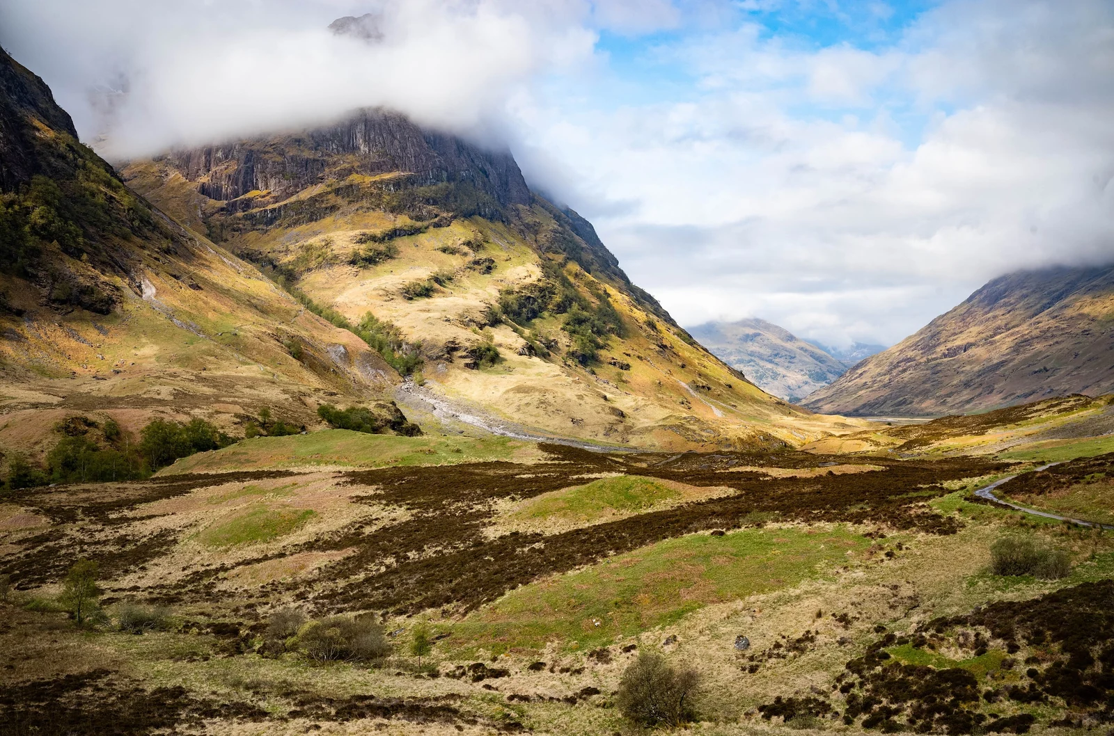
The glen also carries a heavy story. In 1692, soldiers killed members of the MacDonald clan who had hosted them, an event known as the Massacre of Glencoe. The National Trust for Scotland runs a visitor center and trails here; see the Glencoe page on the NTS site for current facilities and walking suggestions.
If you have time for only one walk, choose something short on the valley floor rather than a ridge. Glencoe weather changes quickly, and the high routes are serious mountain days that need navigation skills and a forecast check.
Fort William and Glenfinnan
Fort William sits at the foot of Ben Nevis, Britain's highest mountain, and makes a practical overnight stop with plenty of rooms and places to eat. It is not the prettiest town on the route. Treat it as a base, not a destination.
The better reason to stay is Glenfinnan, a short drive west on the A830. The Glenfinnan Viaduct, a curving concrete railway bridge with 21 arches completed in the late 1890s, is the one you may know as the Hogwarts Express crossing in the Harry Potter films. A footpath climbs to a viewpoint above the track. Steam trains run on the line on selected days in the warmer months, so check timetables with the operator before you plan your day around one.
Glenfinnan matters for history too. It is where Charles Edward Stuart raised his standard in 1745 at the start of the Jacobite rising, and a monument by the head of Loch Shiel marks the spot. It makes a good counterpart to the story of abandoned Highland communities in our guide to Scotland's ghost towns.
Eilean Donan Castle and the Skye Bridge
Eilean Donan stands on a small island where three sea lochs meet, linked to the shore by a stone bridge. The medieval fortress was largely destroyed in the early 1700s and rebuilt in the early twentieth century, with the work finished in 1932, so what you see is a romantic restoration rather than a surviving original. That does not make it less photogenic.
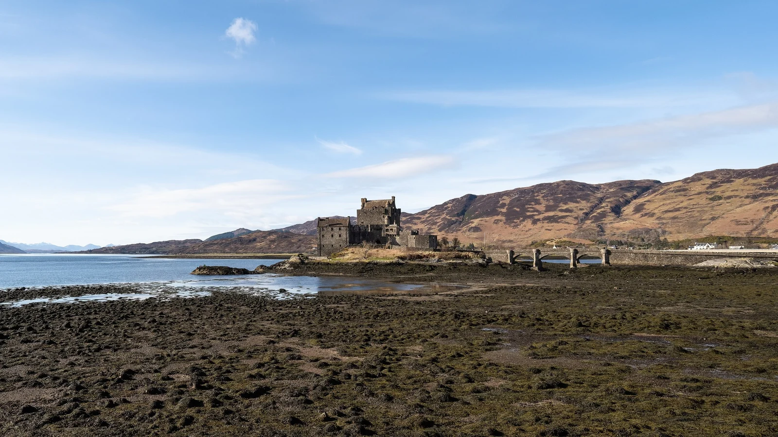
You can see the exterior from the roadside viewpoint for free. For interior visits, hours and tickets, use the official Eilean Donan website. Allow an hour or two, and expect tour groups in summer.
From Kyle of Lochalsh the Skye Bridge takes you onto the island. It opened in 1995 and was tolled for its first nine years, but the tolls were abolished in December 2004, so the crossing is free today. A seasonal CalMac ferry from Mallaig to Armadale is the alternative, and it is a nice way to vary the loop if you do not want to cross the same bridge twice. Book ahead in summer.
Old Man of Storr and the Trotternish Peninsula
Trotternish is the long northern peninsula of Skye, and almost every famous viewpoint on it comes from one cause: a huge ancient landslip that left a chain of cliffs, pinnacles and tilted hillsides along the east coast. The best known is the Old Man of Storr, a rock needle roughly 50 meters tall standing among broken spires above the Sound of Raasay.
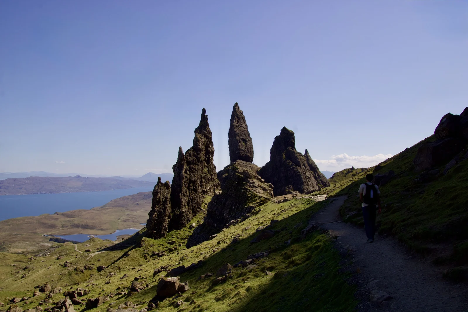
Walking to the Old Man of Storr
The trail starts at a car park on the A855 a few miles north of Portree and climbs steeply on a stepped path. Plan on about two hours round trip at an ordinary pace. The car park fills early in summer, so aim for first thing in the morning or the evening, when the light is also better. The path can be slick after rain, and cloud often drops over the pinnacles. That is part of the atmosphere, but bring a waterproof.
The Quiraing
Farther north, the Quiraing is the same landslip in its most theatrical form: grassy shelves, needles and a hidden plateau called the Table. A loop walk starts from the high road between Staffin and Uig. The road is narrow and exposed, and parking is limited, so do not leave your car in passing places. If visibility is poor, enjoy the roadside views and save the ridge for another day.
Portree, the Fairy Pools and the Cuillin
Portree, the island's main town, is the practical base for most visitors. Rooms are limited and book out early, so reserve accommodation well ahead for summer. The painted harbor front is pleasant for an evening walk, and there are shops, a supermarket and fuel. Smaller bases such as Staffin, Dunvegan or Carbost put you closer to specific sights.
South of Portree, the road passes Sligachan beneath the Black Cuillin, the jagged gabbro mountains that define Skye's skyline. A single-track road leads from near Carbost to Glenbrittle and the Fairy Pools, a series of clear waterfalls and pools running down from the hills, with the Cuillin ridge as backdrop.
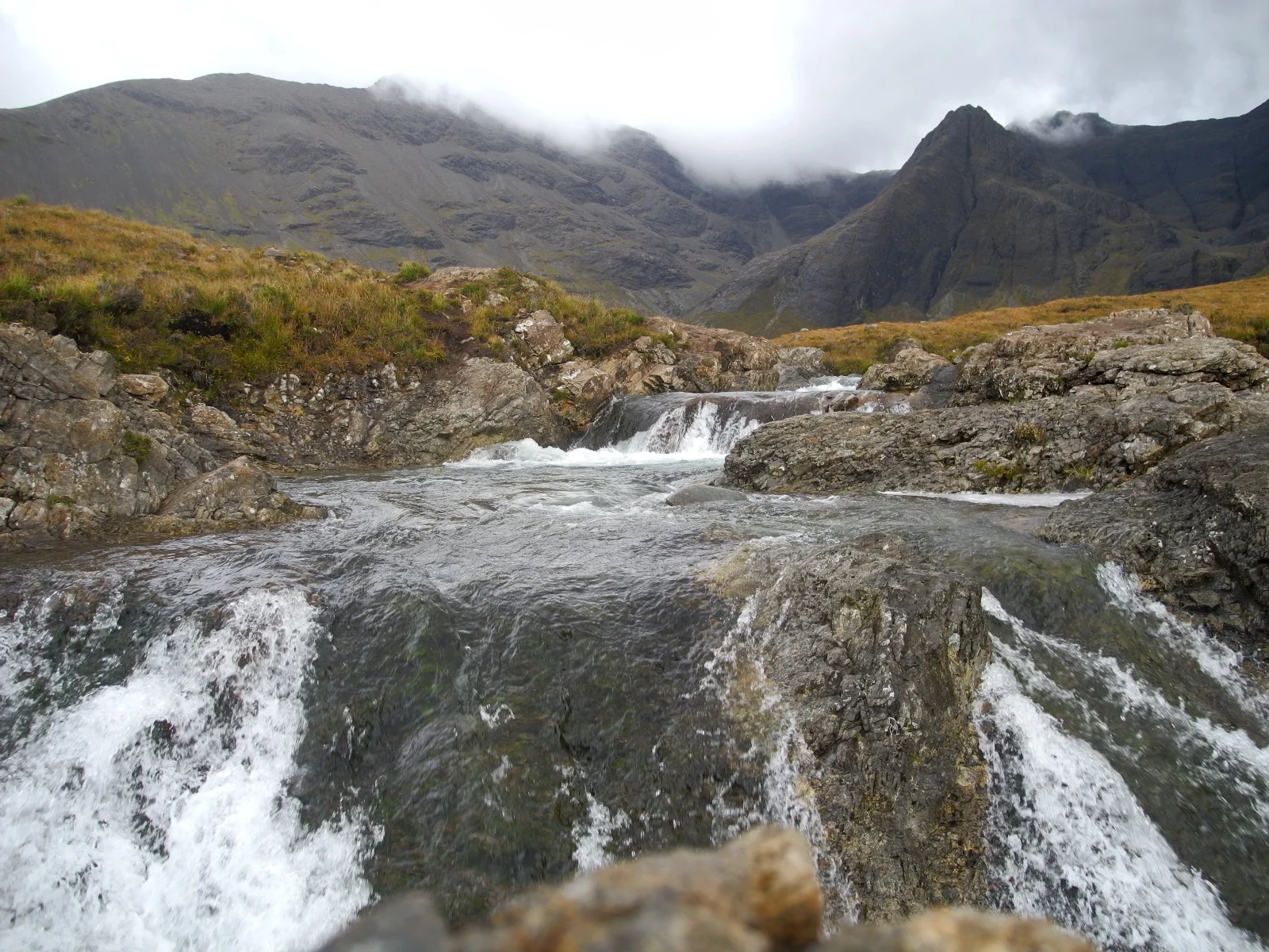
A paid car park serves the walk, and the charges support path repair, so expect to pay. The Outdoor Access Trust for Scotland, which looks after the site, publishes current information on its official website. The path is uneven and crosses streams, so wear boots or sturdy shoes. Swimming is possible in summer, but the water is very cold, and you should never swim after heavy rain, when the streams rise fast.
Neist Point and the Far West
Neist Point is the westernmost tip of Skye, reached by a long single-track road across the Duirinish peninsula. A stepped path drops to a lighthouse built in 1909, perched at the end of a ridge of basalt cliffs. It is a favorite sunset spot, and on a clear evening you can see the Outer Hebrides across the water.
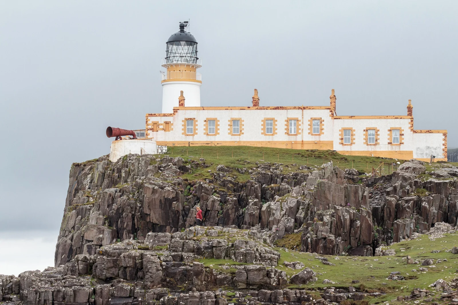
Remember the climb back up, which feels longer than the walk down. Take a headlamp or phone light if you are staying for sunset in the cooler months, since the path is not lit. Dunvegan, with its castle, is the nearest town of any size for food and fuel.
Driving Single-Track Roads
Much of the Skye loop is single-track with passing places, and this is where visitors cause the most frustration. A few rules cover nearly every situation.
- Use passing places on your left. If the passing place is on the right, stop opposite it on the left side instead.
- Pull in for faster traffic. If a car is behind you, let it pass at the next passing place. Locals are working, not sightseeing.
- Never park in a passing place. That includes photo stops, picnics and walking trailheads.
- Look well ahead. Decide who is closer to a passing place early and commit, rather than meeting nose to nose in the middle.
- Give a wave. A raised hand to anyone who pulls in for you is standard courtesy.
- Plan for fuel. Fill up in larger towns, because remote stations are few and may close early.
Allow more time than the map suggests. Slow caravans, sheep on the road and photo stops stretch every journey, and driving at dusk in rain on these roads is tiring. If you hire a car, an ordinary small car is fine, but book an automatic early if you want one.
Midges, Weather and the Best Season
The Highland midge, a tiny biting fly, is real, and it can spoil a calm evening. The season is generally from late spring to early autumn, with the worst of it in still, damp, overcast weather and around dawn and dusk. Wind keeps them away, so exposed viewpoints are usually safe, while sheltered lochside spots and forest paths are not. Pack a repellent that works for you, light long sleeves and, if you plan to camp, a head net.
| Season | What to expect | Trade-offs |
|---|---|---|
| Spring (April to May) | Long days, fewer crowds, lingering snow on high peaks | Changeable weather; some seasonal services still closed |
| Summer (June to August) | Longest daylight, everything open | Busiest roads and car parks, midges, high prices |
| Early autumn (September to October) | Fewer midges, softer light, quieter | Shorter days, more rain, ferry and tour schedules shrink |
| Winter | Dramatic snowy scenery | Very short days, icy roads, many closures |
Whatever the month, pack for rain and wind. A waterproof jacket, warm layer and sturdy shoes matter more than any gadget, and the forecast on the day beats any plan you made in advance. Skye can be bright in the morning and in cloud by lunchtime.
Planning the Trip: Days, Lodging and Booking
Five days is the minimum for a relaxed loop: one for Glencoe, one for Fort William and Glenfinnan, and three on Skye. Seven days adds a night in Portree, a buffer for weather and time to hike the Cuillin foothills or visit Dunvegan. Our Scotland guides cover more places if you want to extend the trip.
- Book early. Skye and Fort William accommodation fills months ahead for summer, and flexible cancellation is worth paying for.
- Choose areas, not just prices. Portree is central for Storr and Quiraing; Carbost and Glenbrittle suit the Cuillin; Dunvegan suits Neist Point.
- Shop ahead. Stock up on groceries in larger towns, since small island shops have limited ranges.
- Allow a buffer day. Low cloud and rain can hide views, and a spare day lets you reshuffle the plan.
- Check official sources. VisitScotland has current travel and event information on its official tourism site.
If you want a wilder coda, remote island stories such as the one in our St Kilda guide show how far the Hebrides can take you.
Isle of Skye Road Trip FAQ
How many days do you need for Skye and the Highlands?
Five days gives you Glencoe, Fort William, Glenfinnan and a quick Skye loop. Seven is more comfortable, with a buffer for rain and time to walk at the Old Man of Storr, Quiraing and Fairy Pools without rushing between them.
Do you need a car for Skye?
A car gives the most freedom, since public transport on the island is limited and many sights are off the main roads. Organized tours from Portree and mainland towns exist if you prefer not to drive single-track roads.
Is the Skye Bridge free?
Yes. The Skye Bridge opened in 1995 and was tolled until December 2004, when tolls were abolished. You can cross for free by car, bike or on foot. A ferry from Mallaig to Armadale is the other route onto the island.
When are midges worst in Scotland?
Midges are worst from late spring to early autumn, especially at dawn and dusk and on calm, damp, cloudy days. Wind disperses them. Use repellent, cover skin, and stay on breezy ridges and coasts when the air is still.
How do you drive on single-track roads?
Use passing places to pull in on the left, or stop opposite one on the right. Let faster vehicles overtake, never park in a passing place, and wave thanks. Look ahead early so you meet oncoming traffic at a gap.
What is the best time to visit Skye?
Late spring and early autumn balance long daylight, fewer crowds and fewer midges. Summer is busiest and has the best opening hours, while winter brings short days and icy roads. Weather is changeable in every season, so pack waterproofs.
Can you swim at the Fairy Pools?
Some visitors swim in summer, but the water is very cold and the stream can rise quickly after rain. Check conditions, never swim after heavy rain, and wear sturdy footwear for the uneven path from the car park.